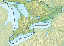
Coldwater River | |
---|---|
Etymology | From the Ojibwa gisinaa nibiish, "cold pool of water" |
Location | |
Country | Canada |
Province | Ontario |
Region | Central Ontario |
County | Simcoe |
Physical characteristics | |
Source | Unnamed lake |
• location | Martinville, Oro-Medonte township |
• coordinates | 44°34′30″N79°42′17″W / 44.57500°N 79.70472°W |
• elevation | 246 m (807 ft) |
Mouth | Matchedash Bay |
• location | Fesserton, Severn township |
• coordinates | 44°44′06″N79°39′03″W / 44.73500°N 79.65083°W Coordinates: 44°44′06″N79°39′03″W / 44.73500°N 79.65083°W |
• elevation | 176 m (577 ft) |
Basin features | |
River system | Great Lakes Basin |
Tributaries | |
• right | North River |
The Coldwater River is a river in Simcoe County in Central Ontario, Canada. [1] It is in the Great Lakes Basin and flows from the Oro moraine west of Lake Simcoe to Lake Huron. The river is believed to take its name from its Ojibwa name gisinaa nibiish, which means "cold pool of water".
The Coldwater River begins at the outflow from a small dammed lake, next to Ontario Highway 400, at Martinville in the municipality of Oro-Medonte and adjacent to the Oro Moraine. The lake was created as part of the Copeland Forest Resource Management Area by Ducks Unlimited. [2] It heads northeast to the community of Eady, then north north-west to the eponymous community of Coldwater in the incorporated township of Severn, where it is crossed by Ontario Highway 12, at this point part of the Trans-Canada Highway. It continues in the same direction, through the Matchedash Bay Provincial Wilderness Area, and takes in the right tributary North River just before turning west to its mouth, near the community of Fesserton, at Catfish Bay, a sub-bay of Matchedash Bay, itself a sub-bay of Georgian Bay on Lake Huron.
The river valley is used as a route by both Ontario Highway 400 and by the Canadian Pacific Railway transcontinental main line, Mactier Subdivision.
The valley sides are the location of several ski areas including Mount St. Louis Moonstone on the west slopes and the Horseshoe Resort on the east slopes.
The Niagara Escarpment is a long escarpment, or cuesta, in Canada and the United States that runs predominantly east–west from New York through Ontario, Michigan, Wisconsin, and Illinois. The escarpment is most famous as the cliff over which the Niagara River plunges at Niagara Falls, for which it is named.
The Humber River is a river in Southern Ontario, Canada. It is in the Great Lakes Basin, is a tributary of Lake Ontario and is one of two major rivers on either side of the city of Toronto, the other being the Don River to the east. It was designated a Canadian Heritage River on September 24, 1999.
Innisfil is a town in Ontario, Canada, located on the western shore of Lake Simcoe in Simcoe County, immediately south of Barrie and 80 kilometres (50 mi) north of Toronto. It has historically been a rural area, but due to being geographically sandwiched in between the high-growth areas of Barrie area and York Region has meant greater residential development in Innisfil.
Simcoe County is located in the central portion of Southern Ontario, Canada. The county is just north of the Greater Toronto Area, stretching from the shores of Lake Simcoe in the east to Georgian Bay in the west. Simcoe County forms part of the Greater Golden Horseshoe area, a densely populated and industrialized region, centred on the Greater Toronto Area.
Bradford is the primary country urban area of the Town of Bradford West Gwillimbury, Ontario, in Canada. It overlooks a farming community, known as The Holland Marsh, located on the Holland River that flows into Lake Simcoe.
The Nottawasaga River is a river in Simcoe County and Dufferin County in Central Ontario, Canada. It is part of the Great Lakes Basin, and is a tributary of Lake Huron. The river flows from the Orangeville Reservoir in the town of Orangeville, Dufferin County, through the Niagara Escarpment and the Minesing Wetlands, the latter a wetland of international significance, and empties into Nottawasaga Bay, an inlet of Georgian Bay on Lake Huron, at the town of Wasaga Beach, Simcoe County.
Oro-Medonte is a township in south-central Ontario, Canada, on the northwestern shores of Lake Simcoe in Simcoe County.
Springwater is a township in central Ontario, Canada, in Simcoe County, near Barrie. It is the county seat of Simcoe County.
King's Highway 400, commonly referred to as Highway 400, historically as the Toronto–Barrie Highway, and colloquially as the 400, is a 400-series highway in the Canadian province of Ontario linking the city of Toronto in the urban and agricultural south of the province with the scenic and sparsely populated central and northern regions. The portion of the highway between Toronto and Lake Simcoe roughly traces the route of the Toronto Carrying-Place Trail, a historic trail between the Lower and Upper Great Lakes. North of Highway 12, in combination with Highway 69, it forms a branch of the Trans-Canada Highway (TCH), the Georgian Bay Route, and is part of the highest-capacity route from southern Ontario to the Canadian West, via a connection with the mainline of the TCH in Sudbury. The highway also serves as the primary route from Toronto to southern Georgian Bay and Muskoka, areas collectively known as cottage country. The highway is patrolled by the Ontario Provincial Police and has a speed limit of 100 km/h (62 mph), except for the section south of the 401, where the speed limit is 80 km/h (50 mph).
Strange is an unincorporated community west of King City in King Township, Ontario, Canada. It is directly north of Laskay to the west of Highway 400, and is a sparsely populated agricultural area.
King's Highway 12, commonly referred to as Highway 12 and historically known as the Whitby and Sturgeon Bay Road, is a provincially maintained highway in the Canadian province of Ontario. The highway connects the eastern end of the Greater Toronto Area (GTA) with Kawartha Lakes, Orillia and Midland before ending at Highway 93. It forms the Central Ontario Route of the Trans-Canada Highway system from north of Sunderland to Coldwater. Highway 12 connects several small towns along its 146 km (91 mi) route, and bypasses a short distance from many others. It is signed as a north–south route between Whitby and Orillia, and as an east–west route from there to Midland. The rural portions of the highway feature a posted speed limit of 80 km/h (50 mph), often dropping to 50 km/h (31 mph) through built-up areas. The entire route is patrolled by the Ontario Provincial Police.
King's Highway 93, commonly referred to as Highway 93, is a provincially maintained highway in the Canadian province of Ontario. Located entirely within Simcoe County, the highway extends 23.9 kilometres (14.9 mi) from an interchange with Highway 400 in Springwater, just south of the community of Hillsdale, to an intersection with Highway 12 at the town limits of Midland. The route follows the historic Penetanguishene Road, an early colonization road which served to connect Lake Simcoe with Georgian Bay, thus providing an overland route from Lake Huron to Lake Ontario via Yonge Street.
Chippewas of Rama First Nation, also known as Chippewas of Mnjikaning and Chippewas of Rama Mnjikaning First Nation, is an Anishinaabe (Ojibway) First Nation located in the province of Ontario in Canada. The name Mnjikaning, or fully vocalized as Minjikaning, refers to the fishing weirs at Atherley Narrows between Lake Simcoe and Lake Couchiching and it means "in/on/at or near the fence".
Matchedash Bay is a bay and Ramsar wetland in Simcoe County in Central Ontario, Canada. It is the "final inland extension of Severn Sound" on Lake Huron's Georgian Bay, and is "situated at the interface between the Saint Lawrence Lowlands and the Canadian Shield ". It exhibits geologically unique features at the junction of the Canadian Shield and southern Ontario limestone. Wetland habitats in Matchedash Bay are varied, and include swamps, fens, cattail marshes, wet meadows and beaver ponds. Other features include "permanent freshwater lakes; upland hardwood forest, agricultural lands, native grass meadows and a unique, coniferous wetland forest".
King's Highway 103, commonly referred to as Highway 103, was a provincially maintained highway in the Canadian province of Ontario. Located in the District Municipality of Muskoka and Simcoe County, the highway extended from Highway 12 at Waubaushene to Highway 69 at Foot's Bay. Established in 1944, it was originally a short gravel highway connecting Waubaushene to Port Severn. In 1950 it was chosen as the future route of the Trans-Canada Highway and extended to Foot's Bay. It existed until 1976, when a series of renumberings eliminated the designation, replacing it with Highway 69; Highway 400 has since been built over the majority of the former route.
The Sturgeon River is a river in the Lake Huron drainage basin in the municipalities of Tay, Oro-Medonte and Springwater in Simcoe County, Central Ontario, Canada.
North River may refer to one of five rivers in Ontario, Canada:
The Oro Moraine is a glacial moraine in Simcoe County, Ontario, Canada. The moraine covers 141 square kilometres (54 sq mi) north of Barrie, Ontario. The moraine drains into Georgian Bay on Lake Huron, and the smaller Lake Simcoe.
The Beaver River is a river in Grey County and Simcoe County in Southern Ontario, Canada. It is part of the Great Lakes Basin, and is a tributary of Lake Huron. The river's drainage basin is under the auspices of Grey Sauble Conservation.
The Black River is a river in the Regional Municipality of York and the Regional Municipality of Durham in Central Ontario, Canada. It is part of the Great Lakes Basin, and is a tributary of Lake Simcoe; the entire watershed is under the auspices of the Lake Simcoe Region Conservation Authority.