North River may refer to one of five rivers in Ontario, Canada:

A river is a natural flowing watercourse, usually freshwater, flowing towards an ocean, sea, lake or another river. In some cases a river flows into the ground and becomes dry at the end of its course without reaching another body of water. Small rivers can be referred to using names such as stream, creek, brook, rivulet, and rill. There are no official definitions for the generic term river as applied to geographic features, although in some countries or communities a stream is defined by its size. Many names for small rivers are specific to geographic location; examples are "run" in some parts of the United States, "burn" in Scotland and northeast England, and "beck" in northern England. Sometimes a river is defined as being larger than a creek, but not always: the language is vague.

Ontario is one of the 13 provinces and territories of Canada and is located in east-central Canada. It is Canada's most populous province accounting for 38.3 percent of the country's population, and is the second-largest province in total area. Ontario is fourth-largest jurisdiction in total area when the territories of the Northwest Territories and Nunavut are included. It is home to the nation's capital city, Ottawa, and the nation's most populous city, Toronto, which is also Ontario's provincial capital.

Canada is a country in the northern part of North America. Its ten provinces and three territories extend from the Atlantic to the Pacific and northward into the Arctic Ocean, covering 9.98 million square kilometres, making it the world's second-largest country by total area. Canada's southern border with the United States, stretching some 8,891 kilometres (5,525 mi), is the world's longest bi-national land border. Its capital is Ottawa, and its three largest metropolitan areas are Toronto, Montreal, and Vancouver. As a whole, Canada is sparsely populated, the majority of its land area being dominated by forest and tundra. Consequently, its population is highly urbanized, with over 80 percent of its inhabitants concentrated in large and medium-sized cities, with 70% of citizens residing within 100 kilometres (62 mi) of the southern border. Canada's climate varies widely across its vast area, ranging from arctic weather in the north, to hot summers in the southern regions, with four distinct seasons.
- North River in Kenora District, in the Hudson Bay drainage basin, which flows into Marchington Lake on the Marchington River near the unincorporated place of Ghost River [1]
- In Nipissing District:
- North River, in the Ottawa River and Saint Lawrence River drainage basins, which flows to Radiant Lake on the Petawawa River, in Algonquin Provincial Park near the settlement of Radiant [2] [3]
- North River (French: Rivière du Nord), also in the Ottawa River and Saint Lawrence River drainage basins, which flows to the Mattawa River just upstream of Lake Talon [4]

The Ottawa River is a river in the Canadian provinces of Ontario and Quebec. For most of its length, it defines the border between these two provinces. It is a major tributary of the St. Lawrence River.

The Saint Lawrence River is a large river in the middle latitudes of North America. The Saint Lawrence River flows in a roughly north-easterly direction, connecting the Great Lakes with the Atlantic Ocean and forming the primary drainage outflow of the Great Lakes Basin. It traverses the Canadian provinces of Quebec and Ontario, and is part of the international boundary between Ontario, Canada, and the U.S. state of New York. This river provides the basis for the commercial Saint Lawrence Seaway.

The Petawawa River is a river in the Saint Lawrence River drainage basin in Nipissing District and Renfrew County in eastern and northeastern Ontario, Canada. The river flows from Algonquin Provincial Park to the Ottawa River at the town of Petawawa, and is only one of two major tributaries of the Ottawa River to flow completely free. The river's name comes from the Algonquian for "where one hears a noise like this", which refers to its many rapids.
- North River (Belmont Lake) in Peterborough County, in the Lake Ontario drainage basin, which flows into the North River Bay of Belmont Lake on the Crowe River [5]
- North River in Simcoe County, in the Lake Huron drainage basin, which flows from Bass Lake west of the city of Orillia to the Coldwater River, just upstream of that river's mouth at Matchedash Bay on Severn Sound on Georgian Bay [6] [7]
- North River in Thunder Bay District, in the Lake Superior drainage basin, a tributary of the Whitefish River [8]

Kenora District is a district and census division in Northwestern Ontario, Canada. It was created in 1907 from parts of Rainy River District. It is geographically the largest division in that province; at 407,213.01 square kilometres (157,225.82 sq mi), it comprises almost 38 percent of the province's land area, making it larger than Newfoundland and Labrador, and slightly smaller than Sweden.

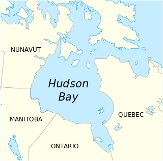
Hudson Bay is a large body of saltwater in northeastern Canada with a surface area of 1,230,000 km2 (470,000 sq mi). It drains a very large area, about 3,861,400 km2 (1,490,900 sq mi), that includes parts of southeastern Nunavut, Saskatchewan, most of Manitoba, Ontario, Quebec and indirectly through smaller passages of water to parts of North Dakota, South Dakota, Minnesota, and Montana. Hudson Bay's southern arm is called James Bay.

A drainage basin is any area of land where precipitation collects and drains off into a common outlet, such as into a river, bay, or other body of water. The drainage basin includes all the surface water from rain runoff, snowmelt, and nearby streams that run downslope towards the shared outlet, as well as the groundwater underneath the earth's surface. Drainage basins connect into other drainage basins at lower elevations in a hierarchical pattern, with smaller sub-drainage basins, which in turn drain into another common outlet.


