North River (Belmont Lake)

Last updated
North River
Canada Southern Ontario relief location map.jpg
Red pog.svg
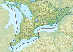
Location of the mouth of the North River in southern Ontario
Location
Country Canada
Province Ontario
Region Central Ontario
County Peterborough
Municipality Havelock-Belmont-Methuen
Physical characteristics
SourceImp lake
  coordinates 44°45′24″N77°54′42″W / 44.75667°N 77.91167°W / 44.75667; -77.91167
  elevation302 m (991 ft)
Mouth Belmont Lake, on the Crowe River
  coordinates
44°30′17″N77°50′03″W / 44.50472°N 77.83417°W / 44.50472; -77.83417 Coordinates: 44°30′17″N77°50′03″W / 44.50472°N 77.83417°W / 44.50472; -77.83417
  elevation
187 m (614 ft)
Basin features
River system Great Lakes Basin

The North River is a river in the municipality of Havelock-Belmont-Methuen, Peterborough County in Central Ontario, Canada. [1] It is part of the Great Lakes Basin, and is a right tributary of the Crowe River.

Contents

The river begins at Imp Lake in geographic Methuen Township [2] and flows south, past the Blue Mountain Mine at Devil's Lake, to Kasshabog Lake. It continues south to Long Lake, then turns east, then resumes a southward direction, and enters geographic Belmont Township. [3] The river passes through Round Lake, turns east, and reaches its mouth at Belmont Lake on the Crowe River, which flows via the Trent River to Lake Ontario.
Tributaries

See also

Related Research Articles

Restoule River

The Restoule River is a river in Parry Sound District in Central Ontario, Canada. It rises at Commanda Lake in geographic Patterson Township at the community of Restoule. It then flows north into Restoule Lake then north into Stormy Lake at Restoule Provincial Park, at the end of Ontario Highway 534. It then heads west into geographic Hardy Township to its mouth at the French River.

Crowe River

The Crowe River is a river in the counties of Haliburton, Hastings, Northumberland and Peterborough in southern Ontario, Canada. It is in the Lake Ontario drainage basin and is a tributary of the Trent River.

Riley Lake (Muskoka)

Riley Lake is a lake in geographic Ryde Township in the town of Gravenhurst, District Municipality of Muskoka in Central Ontario, Canada. It is part of the Great Lakes Basin.

Bobs Lake (South Frontenac)

Bobs Lake is a lake in Frontenac County and Lanark County in Eastern Ontario, Canada. It is in the St. Lawrence River drainage basin and is the source of the Tay River.

Riley Lake (Kenora District)

Riley Lake is a lake in geographic Code Township in the municipality of Sioux Narrows-Nestor Falls, Kenora District in Northwestern Ontario, Canada. It is part of the Hudson Bay drainage basin.

Koshlong Lake

Koshlong Lake is a lake in the municipalities of Highlands East and Dysart et al, Haliburton County in Central Ontario, Canada. It is part of the Great Lakes Basin.

Misema Lake

Misema Lake is a lake in geographic Katrine and geographic Arnold Township, Timiskaming District in Northeastern Ontario, Canada. It is in the Saint Lawrence River drainage basin and is in the Misema Caldera.

Black River (Kenora District)

The Black River is a river in the municipality of Sioux Narrows-Nestor Falls, Kenora District in Northwestern Ontario, Canada. It is part of the Hudson Bay drainage basin, and is a tributary of the Lake of the Woods.

Wolverine Lake (Cochrane District)

Wolverine Lake is a lake in geographic Hanlan Township and geographic Bannerman Township in Cochrane District in Northeastern Ontario, Canada. It is in the James Bay drainage basin and is in the Valentine River system.

Matawin River (Ontario)

The Matawin River is a river in Thunder Bay District in Northwestern Ontario, Canada. It is in the Great Lakes Basin and is a right tributary of the Kaministiquia River.

Kashabowie River

The Kashabowie River is a river in southwestern Thunder Bay District in Northwestern Ontario, Canada. It is in the Great Lakes Basin and is a tributary of the Shebandowan Lakes.

Gibson Lake (Monestime Township)

Gibson Lake is a lake mostly in geographic Monestime Township and partly in geographic Olynik Township in Algoma District in Northeastern Ontario, Canada. It is part of the Great Lakes Basin and lies about 4 kilometres (2.5 mi) east of the northern terminus of Ontario Highway 810.

Belmont Lake (Ontario)

Belmont Lake is a lake in geographic Belmont Township in the municipality of Havelock-Belmont-Methuen, Peterborough County in Central Ontario, Canada. It is part of the water system that feeds the Trent Severn Waterway Great Lakes Basin.

Corrigan Lake (Thunder Bay District)

Corrigan Lake is a lake in the municipality of Greenstone, Thunder Bay District in northwestern Ontario, Canada. It is in the Great Lakes Basin, lies in the geographic townships of Sandra and Irwin, and is the source of Corrigan Creek.

Borden River (Ontario)

The Borden River is a river in Sudbury District in northeastern Ontario, Canada. It is in the James Bay drainage basin, and is a left tributary of the Nemegosenda River.

Saganash River

The Saganash River is a river in Cochrane District in northeastern Ontario, Canada. It is in the James Bay drainage basin, and is a right tributary of the Kapuskasing River.

Fire River (Ontario)

The Fire River is a river in Algoma District in northeastern Ontario, Canada. It is in the James Bay drainage basin, and is a left tributary of the Missinaibi River.

Gould Lake (Van Hise Township)

Gould Lake is a lake in geographic Van Hise Township, Timiskaming District, in northeastern Ontario, Canada. It is in the Saint Lawrence River drainage basin.

Gould Lake (Lee Township, Ontario)

Gould Lake is a lake mostly in geographic Lee Township, with a small part in geographic Bompas Township and Timiskaming District, in northeastern Ontario, Canada. The south of the lake is in Bompas Township, and the north in Lee Township. The lake is also in the James Bay drainage basin.

Sucker Lake (Nipissing District)

Sucker Lake is a lake in geographic La Salle Township and geographic Osborne Township in the Unorganized North Part of Nipissing District in Northeastern Ontario, Canada, about 5.5 kilometres (3.4 mi) east of the railway point of Diver on the Ontario Northland Railway. It is in the Saint Lawrence River drainage basin and is the source of Sucker Creek.

References

  1. "North River". Geographical Names Data Base. Natural Resources Canada . Retrieved 2015-02-07.
  2. "Methuen" (PDF). Geology Ontario - Historic Claim Maps. Ontario Ministry of Northern Development, Mines and Forestry . Retrieved 2015-02-07.CS1 maint: discouraged parameter (link)
  3. "Belmont" (PDF). Geology Ontario - Historic Claim Maps. Ontario Ministry of Northern Development, Mines and Forestry. Archived from the original (PDF) on 2015-02-08. Retrieved 2015-02-07.CS1 maint: discouraged parameter (link)

Sources