Collier Mill, Virginia

Last updated

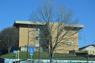
Collier Mill is an unincorporated community in Lee County, Virginia, in the United States. [1]
Lee County, Virginia County in the United States

Lee County is the westernmost county in the U.S. Commonwealth of Virginia. As of the 2015 census estimate, the population was 24,742. Its county seat is Jonesville.

United States federal republic in North America

The United States of America (USA), commonly known as the United States or America, is a country composed of 50 states, a federal district, five major self-governing territories, and various possessions. At 3.8 million square miles, the United States is the world's third or fourth largest country by total area and is slightly smaller than the entire continent of Europe's 3.9 million square miles. With a population of over 327 million people, the U.S. is the third most populous country. The capital is Washington, D.C., and the largest city by population is New York City. Forty-eight states and the capital's federal district are contiguous in North America between Canada and Mexico. The State of Alaska is in the northwest corner of North America, bordered by Canada to the east and across the Bering Strait from Russia to the west. The State of Hawaii is an archipelago in the mid-Pacific Ocean. The U.S. territories are scattered about the Pacific Ocean and the Caribbean Sea, stretching across nine official time zones. The extremely diverse geography, climate, and wildlife of the United States make it one of the world's 17 megadiverse countries.

History

Collier Mill was named in honor of Maston Collier, a pioneer settler. [2]

Related Research Articles

Attica Township, Michigan Township in Michigan, United States

Attica Township is a civil township of Lapeer County in the U.S. state of Michigan. The population was 4,678 at the 2000 census.

St. Charles, Virginia Town in Virginia, United States

St. Charles is a town in Lee County, Virginia, United States. It is one of three incorporated towns in Lee County. The population was 159 at the 2000 census.

The Panhandle Trail is a rail trail in southern Pennsylvania and the Northern Panhandle of West Virginia. It occupies an abandoned railroad corridor that had been known as the Panhandle route which has been converted to a bicycle and walking trail. The rail line covers a distance of 29 miles (47 km) and was abandoned in 1992. The original section of the trail is the West Virginia section, where the trail was called the Harmon Creek Trail, for the adjacent Harmon Creek. When Pennsylvania built its section, both states agreed to call it the Panhandle Trail. Although the Panhandle Trail occupies 29 miles of the Panhandle Route, the remaining portion of the route is owned by the Pittsburgh and Ohio Central Railroad, but it is no longer used.

Ben Hur, Virginia unincorporated community in Lee County, Virginia

Ben Hur is an unincorporated community in Lee County, Virginia, United States. It is located along U.S. Route 58 (Alternate) southwest of Pennington Gap and northeast of Jonesville.

Shady Lane is an unincorporated community in Nelson County, Virginia, United States.

Midway, Alameda County, California Unincorporated community in California, United States

Midway is an unincorporated community in Alameda County, California, 6 miles (9.7 km) south-southeast of Altamont. It lies at an elevation of 358 feet. A post office operated in Midway from 1870 to 1918.

McAdam is an unincorporated community in Pulaski County, in the U.S. state of Virginia.

Swansons Mill is an unincorporated community in Pittsylvania County, in the U.S. state of Virginia.

Janey is an unincorporated community in Buchanan County, Virginia, in the United States.

Cowan Mill is an unincorporated community in Lee County, Virginia, in the United States.

Fleenortown is an unincorporated community in Lee County, Virginia, in the United States.

Hagan is an unincorporated community in Lee County, Virginia, in the United States.

Hubbard Springs is an unincorporated community in Lee County, Virginia, in the United States.

Penn Lee is an unincorporated community in Lee County, Virginia, in the United States.

Turners Siding is an unincorporated community in Lee County, Virginia, in the United States.

Van is an unincorporated community in Lee County, Virginia, in the United States.

Holston is an unincorporated community in Washington County, Virginia, in the United States.

Fincastle is an unincorporated community in Brown County, in the U.S. state of Ohio.

Huddleston Branch is a stream in Oregon County in the Ozarks of southern Missouri.

References

Coordinates: 36°42′53″N83°01′49″W / 36.71472°N 83.03028°W / 36.71472; -83.03028

Geographic coordinate system Coordinate system

A geographic coordinate system is a coordinate system that enables every location on Earth to be specified by a set of numbers, letters or symbols. The coordinates are often chosen such that one of the numbers represents a vertical position and two or three of the numbers represent a horizontal position; alternatively, a geographic position may be expressed in a combined three-dimensional Cartesian vector. A common choice of coordinates is latitude, longitude and elevation. To specify a location on a plane requires a map projection.