Shorewood-Tower Hills-Harbert is a census-designated place (CDP) composed of several small unincorporated communities in Chikaming Township of Berrien County in the U.S. state of Michigan. The population was 1,344 at the 2010 census. The CDP is limited to Chikaming Township, although some of the communities extend into southern Lake Township. All of the communities are located either upon or just east of the dunes on the shore of Lake Michigan. Most of the communities lie west of Interstate 94, although the CDP includes a small area east of the freeway up to Sawyer.

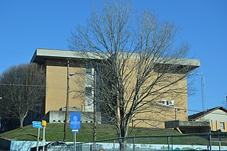
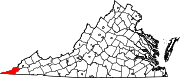
St. Charles is a town in Lee County, Virginia, United States. It is one of three incorporated towns in Lee County. The population was 159 at the 2000 census.

The Catawba River originates in Western North Carolina and the name of the river changes to the Wateree River in South Carolina. The river is approximately 220 miles (350 km) long. It rises in the Appalachian Mountains and drains into the Piedmont, where it has been impounded through a series of reservoirs for flood control and generation of hydroelectricity. The river is named after the Catawba tribe of Native Americans. In their Siouan language, they identified as the Kawahcatawbas, "the people of the river".

Ben Hur is an unincorporated community in Lee County, Virginia, United States. It is located along U.S. Route 58 (Alternate) southwest of Pennington Gap and northeast of Jonesville.

Wilderness Road State Park is a state park located in southwestern Virginia, near Cumberland Gap and Ewing, VA. It consists of about 310 acres (1.3 km2) around the former Wilderness Road. Within it stand the Karlan Mansion and a replica of the original Martin's Station fort.

Gangavaram is a suburban area in Visakhapatnam.
Phoenix Mill was part of Henry Ford's Village industries project and ran from 1922 to 1948 in Plymouth, Michigan. Generator cutouts, voltage regulators, gauges and light switches for Ford vehicles were produced at the plant.
Bennetts Mill is an unincorporated community in Montgomery County, Virginia, in the United States.
Shack Mills is an unincorporated community in Buchanan County, Virginia, in the United States.
Collier Mill is an unincorporated community in Lee County, Virginia, in the United States.
Fleenortown is an unincorporated community in Lee County, Virginia, in the United States.
Hagan is an unincorporated community in Lee County, Virginia, in the United States.
Hubbard Springs is an unincorporated community in Lee County, Virginia, in the United States.
Penn Lee is an unincorporated community in Lee County, Virginia, in the United States.
Shepherd Hill is an unincorporated community in Lee County, Virginia, in the United States.
Turners Siding is an unincorporated community in Lee County, Virginia, in the United States.
Van is an unincorporated community in Lee County, Virginia, in the United States.
Holston is an unincorporated community in Washington County, Virginia, in the United States.
Gladesville is an unincorporated community in Preston County, in the U.S. state of West Virginia.
English Creek is a stream in Oregon County of southern Missouri and Fulton County of northern Arkansas. It is a tributary of Spring River.