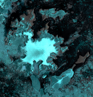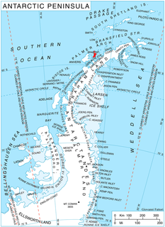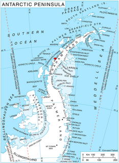
James Ross Island is a large island off the southeast side and near the northeastern extremity of the Antarctic Peninsula, from which it is separated by Prince Gustav Channel. Rising to 1,630 metres (5,350 ft), it is irregularly shaped and extends 64 km in a north–south direction. It was charted in October 1903 by the Swedish Antarctic Expedition under Otto Nordenskiöld, who named it for Sir James Clark Ross, the leader of a British expedition to this area in 1842 that discovered and roughly charted a number of points along the eastern side of the island. The style, "James" Ross Island is used to avoid confusion with the more widely known Ross Island in McMurdo Sound.
Shumskiy Cove is a cove in southern Hanusse Bay indenting the northwest side of Arrowsmith Peninsula in Graham Land. Mapped by Falkland Islands Dependencies Survey (FIDS) from surveys and air photos, 1956-59. Named by United Kingdom Antarctic Place-Names Committee (UK-APC) for Petr A. Shumskiy, Russian glaciologist, author in 1955 of an important publication on the petrology of ice.

Zinberg Glacier is a glacier in east Thurston Island; it flows east-northeast into Morgan Inlet between Tierney Peninsula and the promontory ending in Ryan Point. Named by Advisory Committee on Antarctic Names (US-ACAN) after Cpl. E. Zinberg, U.S. Army photographer in the Eastern Group of U.S. Navy Operation Highjump, which obtained aerial photographs of Thurston Island and adjacent coastal areas, 1946-47.

Ineson Glacier is a glacier flowing northwest into Gin Cove, James Ross Island, Antarctica. Following geological work by the British Antarctic Survey (BAS), 1981–83, it was named by the UK Antarctic Place-Names Committee after Jonathan R. Ineson, a BAS geologist in the area.
Brooklyn Island is an island 4 km (2.5 mi) long, lying 1.6 km (1 mi) south of Nansen Island in the eastern part of Wilhelmina Bay, off the west coast of Graham Land. It was discovered by the Belgian Antarctic Expedition under Gerlache, 1897–99, and named after Brooklyn, New York, the home of Dr. Frederick A. Cook, American member of the expedition who served as surgeon, anthropologist, and photographer.

Lawrie Glacier is a glacier flowing between Mount Genecand and Mezzo Buttress, and entering the head of Barilari Bay between Cherkovna Point and Prestoy Point on the west coast of Graham Land, Antarctica. It was charted by the British Graham Land Expedition under Rymill, 1934–37, and was named by the UK Antarctic Place-Names Committee in 1959 for Robert Lawrie, an English alpine and polar equipment specialist.

Birley Glacier is a glacier, at least 10 nautical miles (19 km) long, flowing west into the eastern extremity of Barilari Bay north of Vardun Point, on the west coast of Graham Land. First seen and roughly surveyed in 1909 by the French Antarctic Expedition under Jean-Baptiste Charcot, it was re-surveyed in 1935–36 by the British Graham Land Expedition (BGLE) under John Rymill, and later named for Kenneth P. Birley, who contributed toward the cost of the BGLE, 1934–37.
Port Charcot is a 3 km (1.9 mi) wide bay indenting the north shore of Booth Island, in the Wilhelm Archipelago of Antarctica. It was charted by the third French Antarctic expedition (1903–05), under Jean-Baptiste Charcot, and named by him for his father, Jean-Martin Charcot, French neurologist. Charcot established the expedition's winter base at Port Charcot in 1904.
Cholet Island is a small island immediately north of the narrow peninsula which forms the western extremity of Booth Island, in the Wilhelm Archipelago. It was discovered by the French Antarctic Expedition, 1903–05, under Jean-Baptiste Charcot, who named it for Ernest Cholet, skipper of the ship Français, and later, the Pourquoi-Pas?.
Walter Glacier is a glacier flowing east-northeast, merging with the south side of Moran Glacier to enter Schokalsky Bay, situated in the northeast portion of Alexander Island, Antarctica. The glacier was named by the Advisory Committee on Antarctic Names for Lieutenant Commander Howard J. Walter, U.S. Navy, LC-130 aircraft commander, Squadron VXE-6, Operation Deepfreeze, 1970 and 1971.

Pasteur Peninsula is a broad peninsula 9 km (5.6 mi) long in a north-south direction and ranging from 8–13 km (5.0–8.1 mi) wide between Guyou Bay and Bouquet Bay, forming the north end of Brabant Island in the Palmer Archipelago of Antarctica. Its interior is occupied by the northern part of Stribog Mountains drained by Oshane, Podayva, Burevestnik and Lister Glaciers.
Paumelle Point is a point marking the south side of the entrance to Libois Bay and the northwest end of the peninsula that forms the west extremity of Booth Island, in the Wilhelm Archipelago, Antarctica. First charted by the French Antarctic Expedition, 1903–05, and named by Charcot for R. Paumelle, steward of the ship Francais.
Flank Island is the southernmost of the Myriad Islands, lying 2 nautical miles (4 km) east-northeast of the Snag Rocks in the Wilhelm Archipelago. It was mapped by the Falkland Islands Dependencies Survey from photos taken by Hunting Aerosurveys Ltd in 1956–57 and from the helicopter of HMS Protector in March 1958, and was named by the UK Antarctic Place-Names Committee because of its position.

Hoek Glacier is a glacier flowing into Dimitrov Cove northeast of Veshka Point on the northwest coast of Velingrad Peninsula on Graham Coast in Graham Land, Antarctica, southward of the Llanquihue Islands. It was charted by the British Graham Land Expedition under John Rymill, 1934–37, and was named by the UK Antarctic Place-Names Committee in 1959 for Henry W. Hoek (1878–1951), a pioneer Swiss ski-mountaineer and author of one of the earliest skiing manuals.
Hervéou Point is a point forming the western extremity of the rocky peninsula between Port Charcot and Salpetriere Bay, on the west side of Booth Island in the Wilhelm Archipelago, Antarctica. It was first charted by the French Antarctic Expedition, 1903–05, under Jean-Baptiste Charcot, and named by him for F. Hervéou, a seaman on the Français.
Salpêtrière Bay is a bay, 1 nautical mile (1.9 km) wide, between Hervéou Point and Poste Point along the west side of Booth Island, in the Wilhelm Archipelago. First charted by the French Antarctic Expedition under Dr. Jean-Baptiste Charcot, 1903–05, and named by him after the Hôpital de la Salpêtrière, a Paris hospital where his father, Dr. Jean-Martin Charcot, founded a clinic for the treatment of nervous diseases.
Tofani Glacier is a glacier flowing northeast into the head of Solberg Inlet, Bowman Coast, to the north of Houser Peak. The feature was photographed from the air by United States Antarctic Service (USAS), 1940, U.S. Navy, 1966, and was surveyed by Falkland Islands Dependencies Survey (FIDS), 1946-48. Named by Advisory Committee on Antarctic Names (US-ACAN) in 1977 after Dr. Walter Tofani, M.D., station physician at Palmer Station, 1975.
Rallier Island is a small island with a small islet off its north side, lying 0.25 nautical miles (0.5 km) west of the northwest extremity of Booth Island, in the Wilhelm Archipelago. Discovered by the French Antarctic Expedition under Charcot, 1903–05, and named by him for Raymond Rallier du Baty, merchant marine cadet who signed on as seaman on the ship Francais.
Roland Bay is a cove, the south shore of which is Herveou Point, indenting the west end of the peninsula that forms the west extremity of Booth Island, in the Wilhelm Archipelago, off the west coast of the Antarctic Peninsula. Jean-Baptiste Charcot (1867-1936), an explorer and oceanographer, charted the area on one of the French Antarctic Expeditions. The bay was named F. Roland, a seaman on the ship Francais.
Libois Bay is a cove on the west side of Cholet Island which is entered between Rozo Point, the northwest end of Cholet Island, and Paumelle Point, the northwest end of Booth Island, in the Wilhelm Archipelago, Antarctica. It was first charted by the French Antarctic Expedition, 1903–05, and named by Jean-Baptiste Charcot for F. Libois, second mechanic and carpenter of the ship Français.


