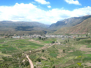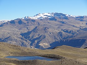
Caylloma Province is the largest of eight provinces in the Arequipa Region of Peru.

Chivay District is one of twenty districts of the province Caylloma in Peru.

Lari District is one of twenty districts of the province Caylloma in Peru.
Pukara means a ruin of the fortifications made by the natives of the central Andean cultures.

Quehuisha, Quehuicha, Queshihua, or Quihuisha is a mountain in the Chila mountain range in the Andes of Peru, about 5,514 metres (18,091 ft) high. It is located in the Arequipa Region, Caylloma Province, Lari District, west of the mountain Mismi.

Surihuiri, Sorehuire or Surihuire is a 5,506-metre-high (18,064 ft) mountain in the Chila mountain range in the Andes of Peru. It is located in the Arequipa Region, Caylloma Province, in the districts Lari, Madrigal and Tapay. Surihuiri lies north of the Colca River, northwest of the mountains Mismi, Quehuisha and Jatunpila and south of Minaspata. Some of the nearest villages are Tambomayo and Surihuire.

Huarancante is a mountain in the Andes of Peru, about 5,426 metres (17,802 ft) high. It is situated in the Arequipa Region, Caylloma Province, on the border of the districts Callalli, Chivay and Yanque, southeast of Chivay. Huarancante lies southwest of the mountain Jello Jello.
Paraccra is an archaeological site in the Andes of Peru on a mountain of the same name. It is situated in the Arequipa Region, Caylloma Province, Sibayo District, near the Colca River. The site contains towers, round houses and black walls.

Pucara is a mountain in the Chila mountain range in the Andes of Peru, about 5,000 metres (16,404 ft) high. It is situated in the Arequipa Region, Caylloma Province, on the border of the districts Caylloma, Lari and Tuti. Pucara lies north-east of the mountain Mismi and east of the mountain Chuaña.

Ananta is a mountain in the Arequipa Region in the Andes of Peru, about 5,240.1 metres (17,192 ft) high. It is situated in the Caylloma Province, on the border of the districts Achoma and Yanque. Ananta lies east of the dormant volcano Ampato and south-west of the mountain Warank'anthi.

Chila is a mountain in the Andes of Peru, about 5,111.2 metres (16,769 ft) high. It lies in the Arequipa Region, Castilla Province, Choco District, and in the Caylloma Province, Caylloma District. Chila is situated southeast of the lake Llocococha.

Chuaña is a mountain in the Chila mountain range in the Andes of Peru, about 5,108.1 metres (16,759 ft) high. It is situated in the Arequipa Region, Caylloma Province, Lari District. Chuaña lies north of Quehuisha and Mismi and west of Pucara. The lake Carhuacocha lies at its feet.

Minasnioc is a mountain in the north of the Chila mountain range in the Andes of Peru, about 5,000 metres (16,404 ft) high. It is situated in the Arequipa Region, Caylloma Province, on the border of the districts Caylloma and Tapay. It lies north of Surihuiri and Minaspata and northeast of the mountain named Huaillaccocha and Huallatane.
Jichu Qullu may refer to:

Ajo Colluna is a 5,255-metre-high (17,241 ft) mountain in the Chila mountain range in the Andes of Peru. It is located in the Arequipa Region, Caylloma Province, on the border of the districts of Lari and Tuti. It lies northeast of Quehuisha and Mismi.

Chungara is a mountain in the Chila mountain range in the Andes of Peru, about 5,000 m (16,404 ft) high. It is located in the Arequipa Region, Caylloma Province, on the border of the districts of Caylloma and Tuti. It lies south of Jatunchungara and Mesa Chungara and northeast of Ticlla.

Jatunchungara is a 5,287-metre-high (17,346 ft) mountain in the Chila mountain range in the Andes of Peru. It is located in the Arequipa Region, Caylloma Province, on the border of the districts of Caylloma and Sibayo. It lies north of Chungara and Mesa Chungara. There is a small lake north of the mountain named Chungara.
Tiklla or Tiqlla may refer to:


