Related Research Articles

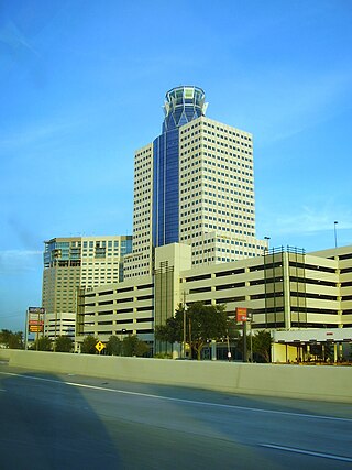
Harris County is a county located in the U.S. state of Texas; as of the 2020 census, the population was 4,731,145, making it the most populous county in Texas and the third-most populous county in the United States. Its county seat is Houston, the most populous city in Texas and fourth-most populous city in the United States. The county was founded in 1836 and organized in 1837. It is named for John Richardson Harris, who founded the town of Harrisburg on Buffalo Bayou in 1826. According to the July 2022 census estimate, Harris County's population has shifted to 4,780,913 comprising over 16% of Texas's population. Harris County is included in the nine-county Houston–The Woodlands–Sugar Land metropolitan statistical area, which is the fifth-most populous metropolitan area in the United States.

Crosby is a census-designated place in Harris County, Texas, United States. The population was 3,417 at the 2020 census.

Pasadena is a city in the U.S. state of Texas, located in Harris County. It is part of the Houston–The Woodlands–Sugar Land metropolitan area. As of the 2020 U.S. census, the city's population was 151,950, making it the twentieth most populous city in Texas and the second most populous in Harris County. The area was founded in 1893 by John H. Burnett of Galveston, who named the area after Pasadena, California, because of the perceived lush vegetation.
Harrisburg is a community that is now located within the city of Houston, Texas, United States.
The Memorial area of Houston, Texas is located west of Downtown, northwest of Uptown, and south of Spring Branch. The Memorial Super Neighborhood, as defined by the City of Houston, is bounded by Buffalo Bayou to the south, Barker Reservoir to the west, Westview to the north, and the Memorial Villages, a contiguous group of independent municipalities, to the east.

Greater Greenspoint, also referred to as the North Houston District, is a 7-square-mile (18 km2) business district and a suburban neighborhood in northern Harris County, Texas, United States, located mostly within the city limits of Houston. Centered around the junction of Interstate 45 and Texas State Highway Beltway 8 near George Bush Intercontinental Airport, the area is a classic example of a planned edge city. The initial 2,000-acre (8.1 km2) retail and office development centered around Greenspoint Mall was a project of the Friendswood Development Company during the 1970s and early 1980s.
Martin's Mill is an unincorporated community in south-central Van Zandt County, Texas, United States. According to the Handbook of Texas, the community had a population of 125 in 2000.
Hopewell is an unincorporated community in Houston County, Texas, United States. According to the Handbook of Texas, the community had a population of 22 in 2000.
Weeping Mary is an unincorporated community in Cherokee County, Texas, United States. It is significant as the community closest to the ancient Caddo Mounds State Historic Site.
Shady Grove is a ghost town in Houston County, Texas, United States.
Pleasant Hill, also known as Antrim, is a ghost town in Houston County, Texas, United States. It was located approximately at the intersection of County Roads 2295 and 2290.
Mound City, also known as Houston's Mound, is an unincorporated community in Houston and Anderson counties in the U.S. state of Texas. The Anderson County portion of the community is located within the Palestine, Texas micropolitan area.
Red Bank, or Redbank, is an unincorporated town in Bowie County, Texas, United States. According to the Handbook of Texas, the community had a population of 125 in 2000. It is part of the Texarkana metropolitan area.
Wheeler Springs is an unincorporated community in Houston County, Texas, United States.
Randolph, also known as Old Randolph, was an unincorporated area in Houston County, Texas, United States.
Stubblefield is an unincorporated community in Houston County, Texas, United States. According to the Handbook of Texas, the community had a population of 15 in 2000.
Goodwill is an unincorporated community in Washington County, Texas, United States. It is located on Farm to Market Road 1155, approximately 14 miles northeast of Brenham.
Waverly, known today as Old Waverly, is an unincorporated community in Walker County, Texas, United States. It is located at the intersection of Texas State Highway 150 and Farm to Market Road 1725. Its population was 200 as of 2000.
Beech Grove, also known as Beach Grove, is an unincorporated community in Jasper County, Texas, United States. It is located on U.S. Highway 190, approximately six miles from Jasper. Its most recent population estimate is 75.
Hazel Dell, also spelled Hazeldell, is an unincorporated community located in Comanche County, in the U.S. state of Texas.
References
- ↑ CHRISTOPHER, LONG (2010-06-12). "COCHINO BAYOU". tshaonline.org. Retrieved 2018-04-21.
- ↑ "Google Maps". Google Maps. Retrieved 2018-04-21.
- ↑ MIKE, SMALLEY (2010-06-12). "COLTHARP, TX". tshaonline.org. Retrieved 2018-04-21.
- ↑ MIKE, SMALLEY (2010-06-12). "COLTHARP, TX". tshaonline.org. Retrieved 2018-04-21.
- ↑ "Kennard ISD :: School District Map of the Kennard ISD :: MapTechnica". www.maptechnica.com. Archived from the original on 2018-04-22. Retrieved 2018-04-21.
Municipalities and communities of Houston County, Texas, United States | ||
|---|---|---|
| Cities |  | |
| Unincorporated communities |
| |
| Ghost towns | ||
| Footnotes | ‡This populated place also has portions in an adjacent county or counties | |