
Carrara is a town and comune in Tuscany, in central Italy, of the province of Massa and Carrara, and notable for the white or blue-grey marble quarried there. It is on the Carrione River, some 100 kilometres (62 mi) west-northwest of Florence. Its motto is Latin: "Fortitudo mea in rota", a reference firstly to the marble shipping industry from Roman times onwards.

The Lunigiana or Lunesana is a historical territory of Italy, which today falls within the provinces of Massa Carrara, Tuscany, and La Spezia, Liguria. Its borders derive from the ancient Roman settlement, later the medieval diocese of Luni, which no longer exists.
Fivizzano is a comune in the province of Massa and Carrara, Tuscany, central Italy.

Castiglione di Garfagnana is a medieval walled town and comune of 1,878 inhabitants in the province of Lucca. It sits on a hillside above the river Esarulo, a tributary of the Serchio.

Poggibonsi is a town in the province of Siena, Tuscany, central Italy. It is located on the River Elsa and is the main centre of the Valdelsa Valley.

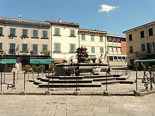
Pontremoli is a small city, comune former Latin Catholic bishopric in the province of Massa and Carrara, Tuscany region, central Italy.

Aulla is a comune in the province of Massa and Carrara, Tuscany, central Italy. It is located in the valley of the River Magra.
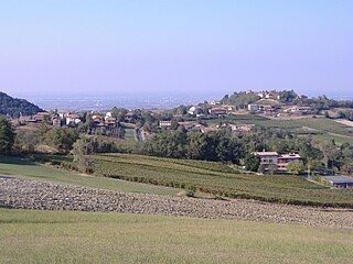
Pozzol Groppo is a comune (municipality) in the Province of Alessandria in the Italian region Piedmont, located about 110 kilometres (68 mi) east of Turin and about 35 kilometres (22 mi) east of Alessandria.

Pievepelago is a comune (municipality) in the Province of Modena in the Italian region of Emilia-Romagna in the heart of the northern Apennine Mountains. Situated on the Scoltenna River, in a mountain valley, it is a tourist resort crossed by the Via Vandelli.

Casola in Lunigiana is a comune (municipality) in the Province of Massa and Carrara in the Italian region Tuscany, located about 100 kilometres (62 mi) northwest of Florence and about 20 kilometres (12 mi) north of Massa.

Fosdinovo is a comune (municipality) in the Province of Massa and Carrara in the Italian region Tuscany, located about 110 kilometres (68 mi) northwest of Florence and about 15 kilometres (9 mi) northwest of Massa.

Montespertoli is a comune (municipality) in the Metropolitan City of Florence in the Italian region Tuscany, located about 20 kilometres (12 mi) southwest of Florence.

Città della Pieve is a comune (municipality) in the Province of Perugia in the Italian region Umbria, located in Valdichiana a few kilometres from the border between Umbria and Tuscany, and about 50 km (31 mi) southwest of Perugia and 11 km (7 mi) southeast of Chiusi in Tuscany.

Cantagallo is a comune (municipality) in the Province of Prato in the Italian region Tuscany, located about 30 kilometres (19 mi) northwest of Florence and about 15 kilometres (9 mi) north of Prato.
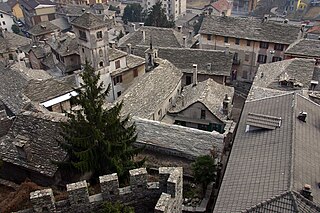
Vogogna is a comune (municipality) at the heart of the Val d’Ossola in the Province of Verbano Cusio Ossola, Piedmont, Italy, about 20 kilometres (12 mi) north-west of Verbania. The municipality is centred on the town of Vogogna and extends over an area of 15.28 square kilometres (5.90 sq mi), partly within the Val Grande National Park; the elevation varies between 211 and 2,018 metres above sea-level. Outlying settlements (frazioni) within the municipality include Prata, Dresio and Genestredo.
Il Castello of Bardine di San Terenzo a 12th-century structure and was the residence of the family Nobili.
Spinetta Malaspina (1282–1352), also known as Spinetta Malaspina the Great, a descendant of Obizzo Malaspina, was the Marquisse of Verrucola and the lord of Fosdinovo. He is the forefather of the marquisses of Fosdinovo and of its related imperial feud.
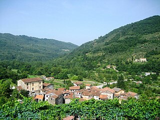
Codiponte is a village in the municipality of Casola in Lunigiana, Tuscany, Italy. It is located in the Province of Massa and Carrara and is about 20 minutes drive from the comune of Aulla. The population is about 200.
The 1920 Garfagnana earthquake occurred on 7 September in Garfagnana and Lunigiana, both agricultural areas in the Italian Tuscany region. The quake hypocenter was located 14 kilometres (8.7 mi) beneath Villa Collemandina. The maximum felt intensity was rated as X (Extreme) on the Mercalli intensity scale, and 6.6 on the Richter magnitude scale. It was one of the most destructive seismic events recorded in the Apenninic region in the twentieth century. Due to good news coverage, availability of official documents on the damage and abundance of recordings from surveillance stations throughout Europe, it was regarded as a first-rate case study to improve knowledge of tectonics and macroseismic analysis.

The House of Malaspina was a noble Italian family of Longobard origin that descended from Boniface I, through the Obertenghi line, that ruled Lunigiana from the 13th to the 14th centuries, and the marquisate of Massa and lordship of Carrara since the 14th century.


