
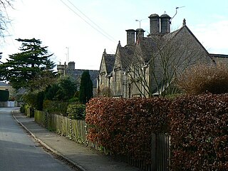
Northleach is a market town and former civil parish, now in parish Northleach with Eastington, in the Cotswold district, in Gloucestershire, England. The town is in the valley of the River Leach in the Cotswolds, about 10 miles (16 km) northeast of Cirencester and 11 miles (18 km) east-southeast of Cheltenham. The 2011 Census recorded the parish's population as 1,854, the same as Northleach built-up-area. The 2021 Census recorded the population as 1,931.

Stone is a village in the parish of Ham and Stone, Gloucestershire, England. It stands on the A38 road, just south-west of its crossing of the Little Avon River, halfway between Bristol and Gloucester, adjacent to the county boundary with South Gloucestershire. Woodford, immediately northeast in the Alkington parish, is part of the shared community.

Coln St Aldwyns is a village and civil parish in the Cotswold district of the English county of Gloucestershire.

Lower Oddington and Upper Oddington are a pair of adjoining villages in the English county of Gloucestershire. Together they form the civil parish of Oddington. In 2010 the parish had an estimated population of 477, decreasing at the 2011 census to 417.

Long Newnton is a small village and civil parish in Gloucestershire, England, lying on the B4014 road between Malmesbury and Tetbury. It is near the SW end of the Cotswolds. The population of the parish was 211 at the 2011 census.

The twin villages of Shipton Oliffe and Shipton Solars are situated 7 miles (11 km) from Cheltenham. The River Coln, a small stream at this point, flows through the village over two fords and innumerable little water splashes, creating ornamental lakes in private properties. The population of the parish at the 2011 census was 365.

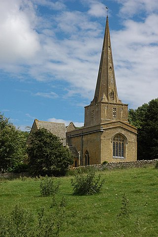
Sapperton is a village and civil parish in the Cotswold District of Gloucestershire in England, about 4.5 miles (7.2 km) west of Cirencester. It is most famous for Sapperton Canal Tunnel, and its connection with the Cotswold Arts and Crafts Movement in the early 20th century. It had a population of 424, which had reduced to 412 at the 2011 census.

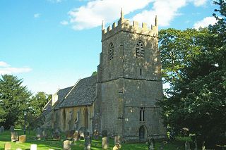
Frampton Mansell is a small English village 5 miles east-south-east of Stroud, Gloucestershire, in the parish of Sapperton. It lies off the A419 road between Stroud and Cirencester. It has a prominent mid-19th century, Grade II listed church with a set of five original stained-glass windows.

Birdlip is a village and civil parish, in the Cotswold district, in the county of Gloucestershire, England. It is in the Cotswolds Area of Outstanding Natural Beauty 6 miles (9.7 km) south of Cheltenham and 8 miles (13 km) south east of Gloucester.

Siddington is a village and civil parish in Gloucestershire, England. It is located immediately south of Cirencester. At the 2011 United Kingdom Census, the parish had a population of 1,249.

Oldbury-on-the-Hill is a small village and former civil parish, now in the parish of Didmarton, in the Cotswold district, in Gloucestershire, England, ninety-three miles west of London and less than one-mile (1.6 km) north of the village of Didmarton. In 1881 the parish had a population of 386.
Hatherop is a village and civil parish in the Cotswolds Area of Outstanding Natural Beauty, about 2.5 miles (4.0 km) north of Fairford in Gloucestershire, England. The River Coln forms part of the western boundary of the parish.

Daylesford is a small, privately owned village and former civil parish, now in the parish of Adlestrop, in the Cotswold district, in the county of Gloucestershire, England, on the border with Oxfordshire. It is situated just south of the A436 two miles east of Stow-on-the-Wold and 5 miles (8.0 km) west of Chipping Norton. The village is on the north bank of the small River Evenlode. This area falls within the Cotswold Hills Area of Outstanding Natural Beauty, so designated in 1966. In 1931 the parish had a population of 82.
Ebrington is a village and civil parish in Gloucestershire, England, about 2 miles (3.2 km) from Chipping Campden. It has narrow lanes and tiny streets of Cotswold stone houses and cottages, many of which are thatched.

Edgeworth is a small village and civil parish in the English county of Gloucestershire. It is located east of Stroud, west of Cirencester and south of Cheltenham.

Poulton is a village and civil parish in the English county of Gloucestershire, approximately 24 miles (39 km) to the south-east of Gloucester. It lies in the south of the Cotswolds, an Area of Outstanding Natural Beauty. In the 2001 United Kingdom census, the parish had a population of 398, increasing to 408 at the 2011 census.

Windrush is a village and civil parish in Gloucestershire, England, approximately five miles southeast of Northleach. It lies in the Cotswolds on the River Windrush, from which it derives its name. The village name is first attested in the Domesday Book of 1086, where it appears as Wenric.

Syde, often in the past spelt Side, is a small village and civil parish in Gloucestershire, England. It lies in the Cotswolds, near the source of the River Frome, some six miles north west of Cirencester and seven miles east of Painswick.
Saintbury is a village and civil parish in the Cotswold District of Gloucestershire, England. The population of the civil parish at the 2011 Census was 83. Saintbury was mentioned in the Domesday Book (1086) as Suineberie.

Sezincote or Seasoncote is a settlement and civil parish comprising Sezincote House and its estate, situated about 3 miles from Stow-on-the-Wold in the Cotswold district of Gloucestershire, England. In 2001 the parish had a population of 90. The parish touches Bourton-on-the-Hill, Condicote, Cutsdean, Longborough and Moreton-in-Marsh. Sezincote has a parish meeting.

