New Hampshire Route 10 is a 122.25-mile-long (196.74 km) north–south state highway in western New Hampshire, United States. Its southern terminus is in Winchester at the Massachusetts state line, where it continues south as Massachusetts Route 10. Administratively, the northern terminus is at a junction with U.S. Route 302 in Haverhill.

Route 225 is a state highway in the U.S. state of Massachusetts. The highway runs 31.100 miles (50.051 km) from Route 2A in Lunenburg in northeastern Worcester County east to Route 2 in Lexington. Route 225 serves the western Middlesex County towns of Shirley, Groton, Westford, and Carlisle. The highway also passes through Bedford along its concurrency with Route 4, which ends at the same junction with Route 2.

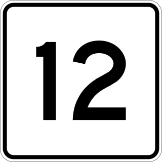
Massachusetts Route 12 is a 64.41-mile-long (103.66 km) north-south state highway that runs through central Massachusetts from the Connecticut state line in Dudley north to the New Hampshire state line in Winchendon, where it continues as New Hampshire Route 12.

Massachusetts Route 32 is a state highway in the U.S. state of Massachusetts. The highway runs 60.66 miles (97.62 km) from the Connecticut state line north to the New Hampshire state line, where it continues as NH 32. Route 32 connects several towns on the eastern edge of Western Massachusetts. The highway serves Palmer in eastern Hampden County, Ware in eastern Hampshire County, and Barre and Athol in northwestern Worcester County. Route 32 intersects major east–west routes including U.S. Route 20 and the Massachusetts Turnpike in Palmer, Route 9 in Ware, and US 202 and Route 2 in Athol. The highway has an alternate route, Route 32A, through Hardwick and Petersham.

Route 349 begins as a limited-access spur from I-95 leading to the city of Groton. It has full interchanges with I-95 and US 1. The limited-access portion is 1.9 miles (3.1 km) long and is known as the Clarence B. Sharp Highway.

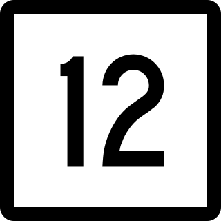
Connecticut Route 12 is a state highway that runs from Groton north to the Massachusetts state line in Thompson.

Route 27 is a north–south state highway in southeastern Connecticut running for 3.21 miles (5.17 km) from U.S. Route 1 in Mystic to Route 184 in Old Mystic.

Route 103 is a state highway in Connecticut running from the Quinnipiac Meadows neighborhood in New Haven, through the Montowese area of North Haven, ending at the town center of North Haven.

Route 45 is a Connecticut state highway from US 202 in Washington to US 7 in Cornwall, in the rural northwest of the state. It is 10.29 miles (16.56 km) long and runs north–south.

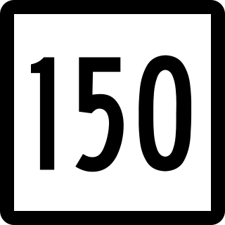
Route 150 is a state highway in southern Connecticut running for 9.04 miles (14.55 km) from the village of Northford, in the town of North Branford, through the center of Wallingford, to the village of Yalesville in Wallingford.

Route 47 is a Connecticut state highway from US 6 in Woodbury to US 202 in Washington, in the western south-central part of the state. It is 12.27 miles (19.75 km) long and runs roughly northwest-southeast, signed north–south.

Route 203 is a state highway in eastern Connecticut, running entirely within the town of Windham.

Route 214 is a state highway in southeastern Connecticut, running entirely within the town of Ledyard and servicing Foxwoods Casino. Route 214 runs east–west across the entire town.

Route 215 is a state highway in southeastern Connecticut, running entirely within the town of Groton in a loop off US 1 through the Noank and West Mystic sections of Groton and also serves the Groton Long Point community.

Route 148 is a state highway in southern and southeastern Connecticut running from Route 79 in Killingworth to Route 82 in the village of Hadlyme. Route 148 crosses the Connecticut River using the Chester–Hadlyme Ferry.

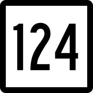
Route 124 is a state highway in southwestern Connecticut running from downtown Darien through the center of New Canaan to the state line in Scotts Corners, New York.

Route 187 is a 27.23-mile-long (43.82 km) secondary state route in the U.S. states of Connecticut and Massachusetts. It begins in the city of Hartford at Albany Avenue, travels north through the towns of Bloomfield, Windsor, East Granby and Suffield until the Connecticut-Massachusetts state line. Route 187 continues north across the state line through Agawam into Westfield, where the route ends at US 20 east of Westfield center. Route 187 crosses the Farmington River between the towns of Bloomfield and East Granby.

Route 184 is a state highway in southeastern Connecticut, running from Groton to North Stonington.

Route 254 is a state highway in northwestern Connecticut running from Thomaston to Litchfield.

The Norwich and Westerly Railway was an interurban trolley system that operated in Southeastern Connecticut during the early part of the 20th century. It operated a 21-mile line through rural territory in Norwich, Preston, Ledyard, North Stonington, and Pawcatuck, Connecticut to Westerly, Rhode Island between 1906 and 1922. For most of its length, the route paralleled what is now Connecticut Route 2.


