
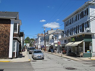
Mystic is a village and census-designated place (CDP) in Groton and Stonington, Connecticut, United States.
Stonington is a town located on Long Island Sound in New London County, Connecticut, United States. The municipal limits of the town include the borough of Stonington, the villages of Pawcatuck, Lords Point, and Wequetequock, and the eastern halves of the villages of Mystic and Old Mystic. Stonington is part of the Southeastern Connecticut Planning Region. The population of the town was 18,335 at the 2020 census.The town is home to many restored homes and preserves it's long nautical history.
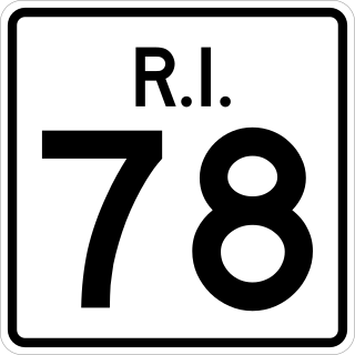
Route 78, also known as the Westerly Bypass, is a two-lane divided freeway between Stonington, Connecticut, to Westerly, Rhode Island. The route is about 4.6 miles (7.4 km) long and begins at Connecticut Route 2 in Stonington, crossing into Rhode Island at the Pawcatuck River, where it continues to U.S. Route 1 in Westerly. The route was constructed in 1979, after a sixteen-year delay. The designation was to become part of the Orient Point–Watch Hill Bridge, but this plan was later dropped. The route was given the memorial name of Veterans Way in 2004.

Route 9 is a 40.89-mile-long (65.81 km) expressway running from Interstate 95 (I-95) in Old Saybrook north to I-84 in Farmington. It connects the Eastern Coastline of the state along with the Lower Connecticut River Valley to Hartford and the Capital Region.

Route 2 is a 58.03-mile (93.39 km) state highway in Hartford and New London counties in Connecticut. It is a primary state route, with a freeway section connecting Hartford to Norwich and following surface roads to Stonington. The entire freeway section of Route 2 west of Route 169 is also known as the Veterans of Foreign Wars Memorial Highway Though it is labelled an east-west highway, it follows a northwest-southeast route, with large sections of the highway running north-south throughout its duration.

Interstate 95 (I-95) is the main north–south Interstate Highway on the East Coast of the United States, running in a general east–west compass direction for 111.57 miles (179.55 km) in Connecticut, from the New York state line to the Rhode Island state line. I-95 from Greenwich to East Lyme is part of the Connecticut Turnpike, during which it passes through the major cities of Stamford, Bridgeport, and New Haven. After leaving the turnpike in East Lyme, I-95 is known as the Jewish War Veterans Memorial Highway and passes through New London, Groton, and Mystic, before exiting the state through North Stonington at the Rhode Island border and goes on.
Interstate 95 (I-95) is the main north–south Interstate Highway on the East Coast of the United States, running generally southwest–northeast through the US state of Rhode Island. It runs from the border with Connecticut near Westerly, through Warwick and Providence, and to the Massachusetts state line in Pawtucket. It has two auxiliary routes, both of which enter Massachusetts—I-195, a spur from Providence east to Cape Cod, and I-295, a western bypass of the Providence metropolitan area.

Route 70 is a 10.92-mile-long (17.57 km) state highway in the U.S. state of Connecticut, connecting the towns of Cheshire and Meriden. The western half of the route is an important link between the Greater New Haven and the Greater Waterbury areas and is part of the state primary highway system. It runs in a “U” Shaped Pattern.

Connecticut Route 14 is one of several secondary routes from eastern Connecticut into Rhode Island. It runs from the Willimantic section of the town of Windham to the Rhode Island state line in Sterling.

Route 27 is a north–south state highway in southeastern Connecticut running for 3.21 miles (5.17 km) from U.S. Route 1 in Mystic to Route 184 in Old Mystic.
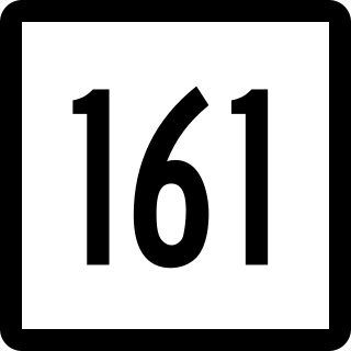
Route 161 is a state highway in southeastern Connecticut, running from the shoreline village of Niantic in East Lyme to the village of Chesterfield in Montville.

Route 142 is a state highway in Connecticut that serves as an alternate route of US 1, passing through the village of Short Beach on the Branford shoreline. It starts at US 1 in East Haven and ends at US 1 in Branford, running for 4.27 miles (6.87 km).

Route 49 is a Connecticut state highway from Route 2 in Stonington to Route 14A in Sterling, in the southeast part of the state. It is a scenic route that runs 21.74 miles (34.99 km) through the Pachaug State Forest.

Route 203 is a state highway in eastern Connecticut, running entirely within the town of Windham.

Route 214 is a state highway in southeastern Connecticut, running entirely within the town of Ledyard and servicing Foxwoods Casino. Route 214 runs east–west across the entire town.

Route 216 is a state highway in southeastern Connecticut, running entirely within the town of North Stonington. It connects Route 49 to the Rhode Island state line and serves the village of Clarks Falls.

Route 193 is a 9.40-mile-long (15.13 km) state highway in the U.S. states of Connecticut and Massachusetts. The route travels between the town centers of Thompson, Connecticut and Webster, Massachusetts. The road closely parallels Interstate 395 throughout its entire length. It is signed North-South, with the exception of one East-West Sign at the South end.

Route 184 is a state highway in southeastern Connecticut, running from Groton to North Stonington.

The Norwich and Westerly Railway was an interurban trolley system that operated in Southeastern Connecticut during the early part of the 20th century. It operated a 21-mile line through rural territory in Norwich, Preston, Ledyard, North Stonington, and Pawcatuck, Connecticut to Westerly, Rhode Island between 1906 and 1922. For most of its length, the route paralleled what is now Connecticut Route 2.

U.S. Route 44 (US 44) is an east–west United States Numbered Highway that runs for 237 miles (381 km) through four states in the Northeastern United States. The western terminus is at US 209 and New York State Route 55 (NY 55) in Kerhonkson, New York, a hamlet in the Hudson Valley region. The eastern terminus is at Route 3A in Plymouth, Massachusetts.

