
Barkhamsted is a town in Litchfield County, Connecticut, United States. It contains seven villages: West Hill, Mallory, Barkhamsted Center, Center Hill, Washington Hill, Pleasant Valley, and Riverton. The population was 3,647 at the 2020 census, down from 3,799 at the 2010 census. The town is part of the Northwest Hills Planning Region. Barkhamsted was first incorporated in 1779, and named after Berkhamsted, Hertfordshire, England.

Barkhamsted Hollow was a village in northwestern Connecticut. It was part of the town of Barkhamsted, Connecticut in Litchfield County, Connecticut, incorporated as part of Barkhamsted in 1779. It was flooded by the creation of the Barkhamsted Reservoir in 1940, splitting Barkhamsted and the nearby town of Hartland, Connecticut in half.

State Road 860 (SR 860), locally known as Miami Gardens Drive or North 183rd Street, is a 13-mile-long (21 km) east–west street serving bedroom communities in northern Miami-Dade County, Florida. Its western terminus is a diamond interchange with Interstate 75 in the Palm Springs North area near Miami Lakes, passing through Carol City, Miami Gardens, and North Miami Beach before ending at an intersection with Biscayne Boulevard in Aventura.

State Road 915 (SR 915), locally known as Northeast Sixth Avenue, is a 5.86-mile-long (9.43 km) north–south street through the residential and business areas of the northern Miami-Dade County municipalities of Miami Shores, Biscayne Park, North Miami, and North Miami Beach. It extends from an intersection with Biscayne Boulevard near Northeast 88th Terrace north to an interchange of Interstate 95 (I-95) and Miami Gardens Drive. It is often used by commuters as an alternative to the oft-congested Interstate and U.S. Highway between Miami and Hollywood.

State Route 14 (SR 14) is a 87.4-mile-long (140.7 km) state highway that travels southwest-to-northeast through portions of Troup, Coweta, and Fulton counties in the west-central and north-central parts of the U.S. state of Georgia. The highway connects the Alabama state line in West Point to Downtown Atlanta, via LaGrange, Fairburn, College Park, and East Point. Except for the northernmost segment, it is entirely concurrent with U.S. Route 29 (US 29).

Route 20 is a 31.56-mile (50.79 km) state highway in the U.S. state of Connecticut. It extends from Route 8 in rural Winchester to Interstate 91 (I-91) in Windsor Locks. Route 20 consists of two distinct sections: a long, winding, scenic rural road, and a section of the freeway linking I-91 to Bradley International Airport.

Route 142 is a state highway in Connecticut that serves as an alternate route of US 1, passing through the village of Short Beach on the Branford shoreline. It starts at US 1 in East Haven and ends at US 1 in Branford, running for 4.27 miles (6.87 km).

Route 110 is a state highway in Connecticut running for 15.95 miles (25.67 km) from Interstate 95 (I-95) in Stratford to Route 111 in Monroe.

State Route 304 is an east–west state highway in the northeastern portion of Ohio. The western terminus of SR 304 is at a signalized intersection with US 422 in Girard. Its eastern terminus is at the Pennsylvania State Line nearly 3 miles (4.8 km) east of Hubbard, where the highway continues east as Pennsylvania Route 318.
State Route 181 (SR 181) is a 4.46-mile long (7.18 km) east–west state highway in the northern portion of the U.S. state of Ohio. The western terminus of SR 181 is at a signalized intersection with SR 61 in downtown Crestline, and its eastern terminus is at a T-intersection with SR 309 approximately one mile (1.6 km) west of Ontario.
Route 97 is a north–south state highway in eastern Connecticut running for 29.14 miles (46.90 km) from Route 12 in Norwich to US 44 in Pomfret.
Route 319 is a state highway in northern Connecticut running entirely in Stafford.

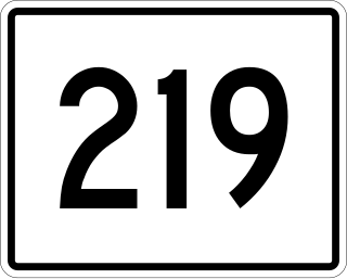
Route 219 is a state highway in northern Connecticut, running from New Hartford to Granby.
Route 181 is a rural state highway in northern Connecticut, running from Barkhamsted to Hartland.

Route 130 is a state highway in southwestern Connecticut, running from Fairfield to Stratford, generally parallel to I-95.

Route 179 is a state highway in northern Connecticut, running from Burlington to Hartland.

Route 275 is a state highway in northeastern Connecticut running from Coventry to the village of Storrs within the town of Mansfield, and serving as a western feeder to the main campus of the University of Connecticut.

Route 313 is a Connecticut state highway in the outer northwestern New Haven suburbs, running from Seymour to Woodbridge.

Saville Dam is an earthen embankment dam with masonry work on the eastern branch of the Farmington River in southwestern Barkhamsted, Connecticut and central Hartland, Connecticut, dividing the latter into two villages along its hilltops, East and West Hartland. The dam is 135 ft. tall and 1,950 ft. long and has an uncontrolled spillway on its western portion. It creates the Barkhamsted Reservoir which has a volume of 36.8 billion US gallons (139,000,000 m3) and is the primary water source for Hartford, Connecticut. Connecticut Route 318, also known as Saville Dam Road, crosses over the top of the dam.
State Route 219 is part of Maine's system of numbered state highways, located in the western central part of the state. It runs for 35.1 miles (56.5 km) from the town center of Greenwood to an intersection with State Route 133 in Wayne.

