Related Research Articles

The Central Valley is a broad, elongated, flat valley that dominates the interior of California, United States. It is 40–60 mi (60–100 km) wide and runs approximately 450 mi (720 km) from north-northwest to south-southeast, inland from and parallel to the Pacific coast of the state. It covers approximately 18,000 sq mi (47,000 km2), about 11% of California's land area. The valley is bounded by the Coast Ranges to the west and the Sierra Nevada to the east.

Tulare Lake or Tache Lake is a freshwater lake in the southern San Joaquin Valley, California, United States. Historically, Tulare Lake was once the largest freshwater lake west of the Mississippi River. For thousands of years, from the Paleolithic onward, Tulare Lake was a uniquely rich area, which supported perhaps the largest population of Native Americans north of present-day Mexico.

The San Joaquin River is the longest river of Central California. The 366-mile (589 km) long river starts in the high Sierra Nevada and flows through the rich agricultural region of the northern San Joaquin Valley before reaching Suisun Bay, San Francisco Bay, and the Pacific Ocean. An important source of irrigation water as well as a wildlife corridor, the San Joaquin is among the most heavily dammed and diverted of California's rivers.

The Governor Edmund G. Brown California Aqueduct is a system of canals, tunnels, and pipelines that conveys water collected from the Sierra Nevada and valleys of Northern and Central California to Southern California. Named after California Governor Edmund Gerald "Pat" Brown Sr., the over 400-mile (640 km) aqueduct is the principal feature of the California State Water Project.

The Kern River is an Endangered, Wild and Scenic river in the U.S. state of California, approximately 165 miles (270 km) long. It drains an area of the southern Sierra Nevada mountains northeast of Bakersfield. Fed by snowmelt near Mount Whitney, the river passes through scenic canyons in the mountains and is a popular destination for whitewater rafting and kayaking. It is the southernmost major river system in the Sierra Nevada, and is the only major river in the Sierra that drains in a southerly direction.
The Delta–Mendota Canal is a 117-mile-long (188 km) aqueduct in central California, United States. The canal was designed and completed in 1951 by the U.S. Bureau of Reclamation as part of the Central Valley Project. It carries freshwater to replace San Joaquin River water which is diverted into the Madera Canal and Friant-Kern Canal at Friant Dam.

The Yokuts are an ethnic group of Native Americans native to central California. Before European contact, the Yokuts consisted of up to 60 tribes speaking several related languages. Yokuts is both plural and singular; Yokut, while common, is erroneous. Yokut should only be used when referring specifically to the Tachi Yokut Tribe of Lemoore. Some of their descendants prefer to refer to themselves by their respective tribal names; they reject the term Yokuts,' saying that it is an exonym invented by English-speaking settlers and historians. Conventional subgroupings include the Foothill Yokuts, Northern Valley Yokuts, and Southern Valley Yokuts.

The Friant-Kern Canal is a 152 mi (245 km) aqueduct managed by the United States Bureau of Reclamation in Central California to convey water to augment irrigation capacity in Fresno, Tulare, and Kern counties. A part of the Central Valley Project, canal construction began in 1949 and was completed in 1951 at a cost of $60.8 million.
The Madera Canal is a 35.9 mi (57.8 km)-long aqueduct in the U.S. state of California. It is part of the Central Valley Project managed by the United States Bureau of Reclamation to convey water north to augment irrigation capacity in Madera County. It was also the subject of the United States Supreme Court's decision in Central Green Co. v. United States.
Kern River Slough Station was a stagecoach stop on the Butterfield Overland Mail 1st Division route from 1858 to 1861. The Butterfield Overland Mail (1857-1861) site is now registered California Historical Landmark #588. The site is 3 miles (4.8 km) west of Lamont.

Kern River Slough was the distributary of the Kern River running northwest from the vicinity of Bakersfield to Goose Lake near Tulare Lake in Kern County, California.
Fresno Slough is a distributary of the Kings River that connects the North Fork Kings River to the San Joaquin River in San Joaquin Valley, Kings County, California.
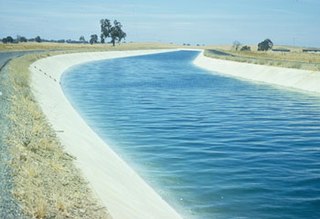
Beardsley Canal is an irrigation canal in Kern County, California. It originates at the Kern River, east of Gordon's Ferry and just west of the First Point of Measurement. It is the first diversion from the river in the San Joaquin Valley for agriculture irrigation. It terminates at reservoirs located in Famoso, just east of SR 99.
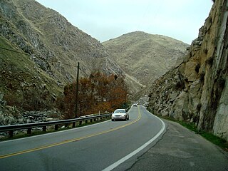
The Kern River Canyon is a canyon in Kern County, California. It is located in the Southern Sierra Nevada.

San Emigdio Creek, formerly Arroyo de San Emigdio, is a 33 kilometres (21 mi) northward-flowing stream in western Kern County, central California.

Buena Vista Lake was a fresh-water lake in Kern County, California, in the Tulare Lake Basin in the southern San Joaquin Valley, California.
Buena Vista Slough was the joint outlet of an overflowing Buena Vista Lake and a distributary of the Kern River into Tulare Lake. It is now diverted into a system of canals by the Outlet Canal of the Central Valley Project.
Watson's Ferry was a former settlement, river ferry and steamboat landing on Fresno Slough near its confluence with the San Joaquin River nearby to the northeast of modern Mendota in what is now Fresno County, California. Watson's Ferry was located 8 miles southeast of Firebaugh.
Sacramento–San Joaquin is a freshwater ecoregion in California. It includes the Sacramento and San Joaquin river systems of California's Central Valley, which converge in the inland Sacramento–San Joaquin Delta. It also includes the mostly-closed Tulare Lake basin in the southern Central Valley, the rivers and streams that empty into San Francisco Bay, and the Pajaro and Salinas river systems of Central California which empty into Monterey Bay.
References
35°09′46″N119°14′09″W / 35.16279°N 119.23573°W 35°09′50″N119°06′40″W / 35.16399°N 119.11111°W
| | This Kern County, California-related article is a stub. You can help Wikipedia by expanding it. |