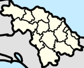
Constancia (Encrucijada) Last updated October 11, 2025 Education Schools in Constancia include: [ 5]
Boris Luis Santa Coloma Primary School CI Sueños de Abel Mariana Grajales Rural Primary School Augusto César Sandino Rural Primary School Roberto Rodríguez Rural Primary School Jesús Menéndez Rural Primary School Marcelo Salado Rural Primary School Transportation Constancia is on the Ingenio Constantia Railway to Cayo Hueso , and which links it to the railway that starts in Santa Clara, going to Crucero Margot, to Luis Arcos Bergnes , Vega Alta , Canoa, Tuinicu, Constancia, Encrucijada , Mata, El Vaquerito, Aguada la Piedra, Cifuentes , San Diego del Valle, Conyedo, and finally back to Santa Clara. [ 6] [ 7]
Arts Landmarks In Abel Santamaria there are monuments including: [ 8]
References ↑ "Celina Margarita Ruiz Rodríguez" . Archived from the original on 2022-09-10. Retrieved 2022-09-10 . 1 2 "Facultad De Ciencias Sociales Carrera De Estudios Socioculturales" . Docslib . Retrieved 2023-05-16 . 1 2 "Abel Santamaría (Encrucijada, Villa Clara Province, Cuba) - Population Statistics, Charts, Map, Location, Weather and Web Information" . www.citypopulation.de . Retrieved 2025-06-30 . 1 2 Lisbet Morales Martínez, Lisbet; Dr. Leonid, E. Hernández Sánchez; Pereira Leonard, Yainalis (2013). "LA INFLUENCIA DE LA INDUSTRIA AZUCARERA EN LAS CARACTERÍSTICAS SOCIOCULTURALES DE LA COMUNIDAD DE ENCRUCIJADA" (PDF) . Santa Clara, Cuba : dspace (Institutional Repository of the Central University "Marta Abreu" of Las Villas ). p. 46. ↑ "Portal del Ciudadano Somos Encrucijada - Educación" . www.somosencrucijada.gob.cu . Retrieved 2022-12-24 . ↑ lezumbalaberenjena (2017-11-09), Composed road map from a tour guide (1980's) , retrieved 2023-04-12 ↑ "Road guides of Cuba" (PDF) . 2019. ↑ Provincial, Equipo de Producción. "Portal del Ciudadano Somos Encrucijada - Monumentos" . www.somosencrucijada.gob.cu (in European Spanish). Retrieved 2022-07-19 . This page is based on this
Wikipedia article Text is available under the
CC BY-SA 4.0 license; additional terms may apply.
Images, videos and audio are available under their respective licenses.