Candlemas Island is a small uninhabited island of the Candlemas Islands in the South Sandwich Islands. It lies about 2 miles (3.2 km) from Vindication Island, separated by the Nelson Channel.
Boot Rock is a rock, 30 metres (100 ft) high, which lies 0.1 nautical miles (0.2 km) off the southeast side of Candlemas Island in the South Sandwich Islands. It was charted and named by Discovery Investigations personnel on the Discovery II in 1930.

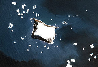
Borradaile Island is one of the Balleny Islands. It was the site of the first landing south of the Antarctic Circle, and features the "remarkable pinnacle" called Beale Pinnacle, near Cape Beale on its south-eastern coast, and Cape Scoresby on its north-western coast.
Buddha Rock is a rock, 35 metres (115 ft) high, lying 0.3 nautical miles (0.6 km) west of Vindication Island in the South Sandwich Islands. It was charted and named in 1930 by Discovery Investigations personnel on the RSS Discovery II.

Cove Rock is a low offshore rock 3 nautical miles (6 km) west of North Foreland, King George Island, in the South Shetland Islands. It was charted by Discovery Investigations in 1937 and called descriptively Cone Rock; the spelling Cove Rock, likely through error in transcription, appeared in a Hydrographic Office publication in 1942, and became established.
Crosscut Point is a series of jagged rocks forming the north end of Vindication Island in the South Sandwich Islands. It was charted in 1930 by Discovery Investigations personnel on the Discovery II, and so named because numerous crosscutting dikes have withstood weathering and produced this irregular formation.

Grey Island is 1 km (0.62 mi) south of Michelsen Island and 2 km (1.2 mi) west of the southern part of Fredriksen Island, in the South Orkney Islands of Antarctica. It was first charted and named Holmen Graa on a map by the Norwegian whaler Captain Petter Sorlle, who made a running survey of the South Orkney Islands in 1912–13. The anglicised form appears on the chart by Discovery Investigations personnel on the Discovery II who surveyed the islands in 1933.
Elephant Lagoon is a lagoon, 0.3 nautical miles (0.6 km) long, situated close south of Cook Bay to which it is connected by Carl Passage, on the north coast of South Georgia. It was probably named by Discovery Investigations personnel who charted the area during the period 1926–30.
Gorgon Pool is a lake, or perhaps lagoon, between the Chimaera Flats and Kraken Cove in Candlemas Island, South Sandwich Islands. It was named by the UK Antarctic Place-Names Committee in association with nearby Medusa Pool. The Gorgon is a mythical creature of Homer's Iliad, linked in other mythology with Medusa.
Harper Point is a point just north of Blackstone Plain forming the north end of Saunders Island in the South Sandwich Islands. It was charted in 1930 by Discovery Investigations personnel on the Discovery II and named for F.H. Harper, Secretary to the Discovery Committee.
Lucifer Hill is a reddish, cindery, sulphur-streaked hill forming the summit of the northern section of Candlemas Island in the South Sandwich Islands. It was one of the most active volcanic vents in this island chain at the time of HMS Protector's survey in 1964. The name applied by the UK Antarctic Place-Names Committee after Lucifer refers to the diabolical and infernal mythical association of active volcanoes.
Medusa Pool is a tidal lagoon which occupies the west side of the central lowlands of Candlemas Island in the South Sandwich Islands. The name, given by the UK Antarctic Place-Names Committee in 1971, is associated in classical mythology with the geomorphologically similar Gorgon Pool, nearby, Medusa being one of the gorgons.
Sarcophagus Point is a point at the southeast side of Sea Serpent Cove on the west coast of Candlemas Island, South Sandwich Islands. The point, with a spine of lava cliffs, almost cuts off Medusa Pool from the sea. It was referred to as "The Sarcophagus" on a sketch-survey of Sea Serpent Cove made by a boat party from RRS Discovery II in 1930.

Sölch Glacier is a glacier on the Pernik Peninsula of the Loubet Coast in Graham Land, flowing west to Salmon Cove just north of Kanchov Peak on the east side of Lallemand Fjord. It was mapped from air photos taken by the Falkland Islands and Dependencies Aerial Survey Expedition, 1956–57, and named by United Kingdom Antarctic Place-Names Committee for Johann Sölch (1883–1951), an Austrian glacial geologist and glaciologist.
Sombre Point is the northeast point of Saunders Island, South Sandwich Islands. The name applied by United Kingdom Antarctic Place-Names Committee (UK-APC) in 1971 refers to the dark and dull aspect of the basaltic rock and ash in this vicinity.
Hole Rock is the largest of several rocks lying close north of North Foreland, the northeastly cape of King George Island, in the South Shetland Islands. It was charted in 1937 by Discovery Investigations personnel on the Discovery II and so named because a conspicuous hole extends through it.
Holt Peak is a bare rock peak, 850 metres (2,800 ft) high, surmounting the northeast end of the Meyer Hills in the Heritage Range of Antarctica. It was mapped by the United States Geological Survey from surveys and U.S. Navy air photos from 1961 to 1966, and was named by the Advisory Committee on Antarctic Names for William C. Holt, a United States Antarctic Research Program auroral scientist at Ellsworth Station in 1961.
Limit Rock is a rock awash, lying 2 nautical miles (4 km) east of North Foreland, the northeast cape of King George Island, in the South Shetland Islands on the Southern Ocean. It was charted in 1937 by Discovery Investigations personnel on the Discovery II, and so named because it marks the eastern limit of foul ground surrounding North Foreland.
Knob Point is the southwesternmost point of Vindication Island in the South Sandwich Islands. It was charted in 1930 by Discovery Investigations personnel on the Discovery II, and probably so named because a conspicuous height of land overlooks the point.