
Central Nova is a federal electoral district in Nova Scotia, Canada that was represented in the House of Commons of Canada from 1968 until 1996. In 1996, Antigonish County and part of Guysborough County were placed with Pictou County in a new electoral boundaries configuration to form the electoral district of Pictou-Antigonish-Guysborough. A new version of Central Nova was established in 2003 and — in conjunction with the Pictou-Antigonish-Guysborough iteration — represented a significant electoral boundaries change with specific reference to Antigonish County. Between 1867 and 1997, Antigonish County was not in a riding that included Pictou County; rather, it comprised either its own electoral district (Antigonish), or part of other districts shared with Eastern Nova Scotia (Antigonish-Guysborough) and Cape Breton Island communities. In 2013, part of Antigonish County was "placed back" with communities in the electoral district of Cape Breton Canso, a riding which had emerged in part from the former Cape Breton Highlands Canso riding in 1996. The current version of Central Nova includes Pictou County, parts of Antigonish and Guysborough Counties and extends into Halifax Regional Municipality.

Canso is a community in Guysborough County, on the north-eastern tip of mainland Nova Scotia, Canada, next to Chedabucto Bay. In January 2012, it ceased to be a separate town and as of July 2012 was amalgamated into the Municipality of the District of Guysborough.
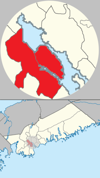
The community of Halifax, Nova Scotia was created on 1 April 1996, when the City of Dartmouth, the City of Halifax, the Town of Bedford, and the County of Halifax amalgamated and formed the Halifax Regional Municipality. The former City of Halifax was dissolved, and transformed into the Community of Halifax within the municipality.
The Marine Drive is a designated scenic route along Nova Scotia's Eastern Shore. It closely follows the coast of the Atlantic Ocean and the Strait of Canso from the Canso Causeway to the junction of Route 322 and Highway 111 in Dartmouth.

Guysborough is an unincorporated Canadian community in Guysborough County, Nova Scotia.
Dartmouth founded in 1750, is a Metropolitan Area and former city in the Canadian province of Nova Scotia.

Guysborough, officially named the Municipality of the District of Guysborough, is a district municipality in Guysborough County, Nova Scotia, Canada. Statistics Canada classifies the district municipality as a municipal district.

Jeddore is a Canadian rural community in Nova Scotia's Halifax Regional Municipality. The community itself comprises several smaller communities. Often the inner communities are referred to on their own but much of the time simply the encapsulating region of Jeddore is simply used. This is most likely due to the size of the communities, individually they are relatively unknown to residents outside of Nova Scotia's Eastern Shore.
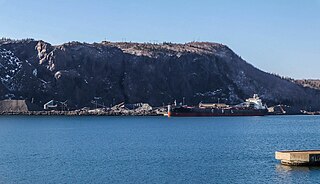
Aulds Cove is a community in the Canadian province of Nova Scotia, located in both Antigonish County and Guysborough County.
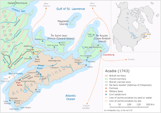
Father Le Loutre's War (1749–1755), also known as the Indian War, the Mi'kmaq War and the Anglo-Mi'kmaq War, took place between King George's War and the French and Indian War in Acadia and Nova Scotia. On one side of the conflict, the British and New England colonists were led by British officer Charles Lawrence and New England Ranger John Gorham. On the other side, Father Jean-Louis Le Loutre led the Mi'kmaq and the Acadia militia in guerrilla warfare against settlers and British forces. At the outbreak of the war there were an estimated 2500 Mi'kmaq and 12,000 Acadians in the region.

Jean Baptiste Cope was also known as Major Cope, a title he was probably given from the French military, the highest rank given to Mi’kmaq. Cope was the sakamaw (chief) of the Mi'kmaq people of Shubenacadie, Nova Scotia. He maintained close ties with the Acadians along the Bay of Fundy, speaking French and being Catholic. During Father Le Loutre’s War, Cope participated in both military efforts to resist the British and also efforts to create peace with the British. During the French and Indian War he was at Miramichi, New Brunswick, where he is presumed to have died during the war. Cope is perhaps best known for signing the Treaty of 1752 with the British, which was upheld in the Supreme Court of Canada in 1985 and is celebrated every year along with other treaties on Treaty Day.

The attack at Mocodome was a battle which occurred during Father Le Loutre's War in present-day Country Harbour, Nova Scotia on February 21, 1753 which saw two British mariners and six Mi'kmaq killed. The battle ended any hope for the survival of the Treaty of 1752 signed by Governor Peregrine Hopson and Mi'kmaq chief Jean-Baptiste Cope.

Nova Scotia is a Canadian province located in Canada's Maritimes. The region was initially occupied by Mi'kmaq. The colonial history of Nova Scotia includes the present-day Maritime Provinces and the northern part of Maine, all of which were at one time part of Nova Scotia. In 1763, Cape Breton Island and St. John's Island became part of Nova Scotia. In 1769, St. John's Island became a separate colony. Nova Scotia included present-day New Brunswick until that province was established in 1784. During the first 150 years of European settlement, the colony was primarily made up of Catholic Acadians, Maliseet, and Mi'kmaq. During the last 75 years of this time period, there were six colonial wars that took place in Nova Scotia. After agreeing to several peace treaties, the long period of warfare ended with the Halifax Treaties (1761) and two years later, when the British defeated the French in North America (1763). During those wars, the Acadians, Mi'kmaq and Maliseet from the region fought to protect the border of Acadia from New England. They fought the war on two fronts: the southern border of Acadia, which New France defined as the Kennebec River in southern Maine, and in Nova Scotia, which involved preventing New Englanders from taking the capital of Acadia, Port Royal and establishing themselves at Canso.
The Attack at Jeddore happened on May 19, 1753, off Jeddore, Nova Scotia, during Father Le Loutre's War. The Mi'kmaq killed nine of the British delegates and spared the life of the French-speaking translator Anthony Casteel, who wrote one of the few captivity narratives that exist from Acadia and Nova Scotia.
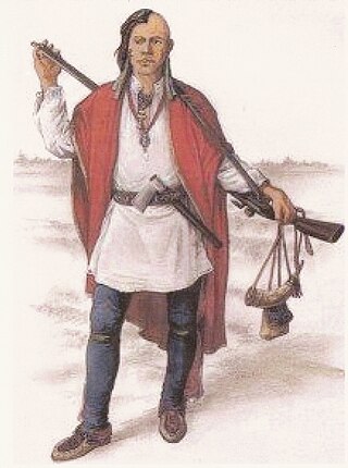
The military history of the Mi'kmaq consisted primarily of Mi'kmaq warriors (smáknisk) who participated in wars against the English independently as well as in coordination with the Acadian militia and French royal forces. The Mi'kmaq militias remained an effective force for over 75 years before the Halifax Treaties were signed (1760–1761). In the nineteenth century, the Mi'kmaq "boasted" that, in their contest with the British, the Mi'kmaq "killed more men than they lost". In 1753, Charles Morris stated that the Mi'kmaq have the advantage of "no settlement or place of abode, but wandering from place to place in unknown and, therefore, inaccessible woods, is so great that it has hitherto rendered all attempts to surprise them ineffectual". Leadership on both sides of the conflict employed standard colonial warfare, which included scalping non-combatants. After some engagements against the British during the American Revolutionary War, the militias were dormant throughout the nineteenth century, while the Mi'kmaq people used diplomatic efforts to have the local authorities honour the treaties. After confederation, Mi'kmaq warriors eventually joined Canada's war efforts in World War I and World War II. The most well-known colonial leaders of these militias were Chief (Sakamaw) Jean-Baptiste Cope and Chief Étienne Bâtard.

The military history of the Acadians consisted primarily of militias made up of Acadian settlers who participated in wars against the English in coordination with the Wabanaki Confederacy and French royal forces. A number of Acadians provided military intelligence, sanctuary, and logistical support to the various resistance movements against British rule in Acadia, while other Acadians remained neutral in the contest between the Franco–Wabanaki Confederacy forces and the British. The Acadian militias managed to maintain an effective resistance movement for more than 75 years and through six wars before their eventual demise. According to Acadian historian Maurice Basque, the story of Evangeline continues to influence historic accounts of the expulsion, emphasising Acadians who remained neutral and de-emphasising those who joined resistance movements. While Acadian militias were briefly active during the American Revolutionary War, the militias were dormant throughout the nineteenth century. After confederation, Acadians eventually joined the Canadian War efforts in World War I and World War II. The most well-known colonial leaders of these militias were Joseph Broussard and Joseph-Nicolas Gautier.
Fort St. Louis was a French fort built in Chedabucto, Acadia. The British attacked in 1720 as they built Fort William Augustus at Canso.
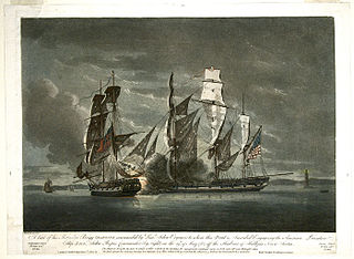
The Province of Nova Scotia was heavily involved in the American Revolutionary War (1776–1783). At that time, Nova Scotia also included present-day New Brunswick until that colony was created in 1784. The Revolution had a significant impact on shaping Nova Scotia, "almost the 14th American Colony". At the beginning, there was ambivalence in Nova Scotia over whether the colony should join the Americans in the war against Britain. Largely as a result of American privateer raids on Nova Scotia villages, as the war continued, the population of Nova Scotia solidified their support for the British. Nova Scotians were also influenced to remain loyal to Britain by the presence of British military units, judicial prosecution by the Nova Scotia Governors and the efforts of Reverend Henry Alline.

The Eastern Shore is a tourism region of the province of Nova Scotia, Canada. It provides two percent of the revenue for the province's tourism economy. One of its key features is an archipelago known as the 100 Wild Islands area.


