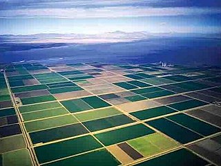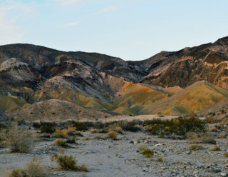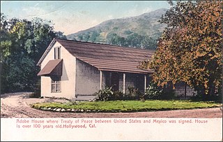
Imperial County is a county located on the southeast border of the U.S. state of California. As of the 2020 census, the population was 179,702, making it the least populous county in Southern California. The county seat and largest city is El Centro. Imperial is the most recent California county to be established, as it was created in 1907 out of portions of San Diego County.

The Mojave River is an intermittent river in the eastern San Bernardino Mountains and the Mojave Desert in San Bernardino County, California, United States. Most of its flow is underground, while its surface channels remain dry most of the time, except for the headwaters and several bedrock gorges in the lower reaches.

The Imperial Valley of Southern California lies in Imperial and Riverside counties, with an urban area centered on the city of El Centro. The Valley is bordered by the Colorado River to the east and, in part, the Salton Sea to the west. Farther west lies the San Diego and Imperial County border. To the north is the Coachella Valley region of Riverside County, which together with Imperial Valley form the Salton Trough, or the Cahuilla Basin, also the county line of Imperial and Riverside counties, and to the south the international boundary with Mexico.

The Old Spanish Trail is a historical trade route that connected the northern New Mexico settlements of Santa Fe, New Mexico with those of Los Angeles, California and southern California. Approximately 700 mi (1,100 km) long, the trail ran through areas of high mountains, arid deserts, and deep canyons. It is considered one of the most arduous of all trade routes ever established in the United States. Explored, in part, by Spanish explorers as early as the late 16th century, the trail was extensively used by traders with pack trains from about 1830 until the mid-1850s. The area was part of Mexico from Mexican independence in 1821 to the Mexican Cession to the United States in 1848.

Freeman Junction, a ghost town in Kern County, California, USA, was first homesteaded in the early 1870s. Freeman S. Raymond built a stage coach station here to accommodate travelers between the desert mines and Los Angeles. A group of Native Americans who were defending their homes and families in 1909 killed off the homesteaders and burned the stage station, after which the property lay dormant for several years. It was re-homesteaded in the 1920s by Clare C. Miley, who was born in 1900, and his wife. By the 1930s their small stone cabin became a gas station/car repair and later, a restaurant and some mining activities dominated the site. In 1953 a post office was planned, but never materialized and residents had to travel seven miles to Inyokern to collect their mail. By June, 1978, the town had died once again and the remains of the town have since been removed by passersby. Today, the site has reverted to its natural state and nothing remains.

The Mojave Road, also known as Old Government Road, is a historic route and present day dirt road across what is now the Mojave National Preserve in the Mojave Desert in the United States. This rough road stretched 147 miles (237 km) from Beale's Crossing, to Fork of the Road location along the north bank of the Mojave River where the old Mojave Road split off from the route of the Old Spanish Trail/Mormon Road.

Beaver Dam is an unincorporated community and census-designated place (CDP) in Mohave County, Arizona, United States, that is located in the Arizona Strip region and was settled on December 2, 1863. It is located along Interstate 15 approximately 10 miles (16 km) northeast of Mesquite, Nevada. It is located in the 86432 ZIP Code. It had a population of 1,552 as of the 2020 census, a decline from the figure of 1,962 tabulated in 2010.
Today's Bradshaw Trail is a historic overland stage route in the western Colorado Desert of Southern California. It is a remnant of the much longer Bradshaw Road, also known as the Road to La Paz, or Gold Road, established in 1862 by William D. Bradshaw. It was the first overland route to connect the gold fields near La Paz in the U.S. New Mexico Territory, later the Arizona Territory, to Southern California's more populated west coast. Once in La Paz, additional roads provided access to the mining districts of the central New Mexico/Arizona Territory, near Wickenburg and Prescott.

The Coyote Mountains are a small mountain range in San Diego and Imperial County in Southern California. The Coyotes form a narrow ESE trending 2 mi (3.2 km) wide range with a length of about 12 mi (19 km). The southeast end turns and forms a 2 mi (3.2 km) north trending "hook". The highest point is Carrizo Mountain on the northeast end with an elevation of 2,408 feet (734 m). Mine Peak at the northwest end of the range has an elevation of 1,850 ft (560 m). Coyote Wash along Interstate 8 along the southeast margin of the range is 100 to 300 feet in elevation. Plaster City lies in the Yuha Desert about 5.5 mi (8.9 km) east of the east end of the range.
Indian Wells is a former settlement in Imperial County, California. It was located 8 miles (13 km) south-southwest of Seeley.
Sackett's Wells is a former settlement in Imperial County, California. It was located 3 miles (4.8 km) west northwest of Plaster City, in or near Coyote Wash.

The Butterfield Overland Mail in California was created by the United States Congress on March 3, 1857, and operated until June 30, 1861. Subsequently, other stage lines operated along the Butterfield Overland Mail in route in Alta California until the Southern Pacific Railroad arrived in Yuma, Arizona in 1877.

The Southern Emigrant Trail, also known as the Gila Trail, the Kearny Trail, the Southern Trail and the Butterfield Stage Trail, was a major land route for immigration into California from the eastern United States that followed the Santa Fe Trail to New Mexico during the California Gold Rush. Unlike the more northern routes, pioneer wagons could travel year round, mountain passes not being blocked by snows; however, it had the disadvantage of summer heat and lack of water in the desert regions through which it passed in New Mexico Territory and the Colorado Desert of California. Subsequently, it was a route of travel and commerce between the eastern United States and California. Many herds of cattle and sheep were driven along this route and it was followed by the San Antonio-San Diego Mail Line in 1857–1858 and then the Butterfield Overland Mail from 1858 to 1861.

The Pacific Imperial Railroad was a company in possession of the SD&AE Desert Line right of way in Southern California, colloquially referred to as the Desert Line. The Desert Line starts at the border crossing at Division, near Campo at Milepost 59.94 in eastern San Diego County, California, where it connects with the Baja California Railroad in Mexico, and stretches 70.1 miles through the Jacumba Mountains to El Centro, California, where it connects to Union Pacific Railroad at Milepost 129.61. The significance of the Desert Line is that it provides an alternative rail route to and from the east for servicing the distribution, transportation, and supply chain needs of the Cali-Baja region.
The Butterfield Overland Mail route in Baja California was created as a result of an act by the United States Congress on March 3, 1857, and operated until June 30, 1861 as part of the Second Division of the route. Subsequently other stage lines operated along the route until the Southern Pacific Railroad arrived in Yuma, Arizona.

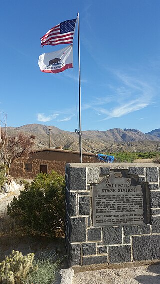
Vallecito, in San Diego County, California, is an oasis of cienegas and salt grass along Vallecito Creek and a former Kumeyaay settlement on the edge of the Colorado Desert in the Vallecito Valley. Its Spanish name is translated as "little valley". Vallecito was located at the apex of the gap in the Carrizo Badlands created by Carrizo Creek and its wash in its lower reach, to which Vallecito Creek is a tributary. The springs of Vallecito, like many in the vicinity, are a product of the faults that run along the base of the Peninsular Ranges to the west.
The Carrizo Creek and Carrizo Wash in California are a stream and an arroyo in San Diego County, California, and Imperial County, California.
San Felipe Creek is a stream in Imperial and San Diego Counties of California. It arises in the Volcan Mountains of San Diego County 33°11′57″N116°37′35″W, and runs eastward, gathering the waters of most of the eastern slope of the mountains and desert of the county in the San Sebastian Marsh before it empties into the Salton Sea. It is probably the last remaining perennial natural desert stream in the Colorado Desert region. In 1974, the San Felipe Creek Area was designated as a National Natural Landmark by the National Park Service.
Mormon Road, also known to the 49ers as the Southern Route, of the California Trail in the Western United States, was a seasonal wagon road pioneered by a Mormon party from Salt Lake City, Utah led by Jefferson Hunt, that followed the route of Spanish explorers and the Old Spanish Trail across southwestern Utah, northwestern Arizona, southern Nevada and the Mojave Desert of California to Los Angeles in 1847. From 1855, it became a military and commercial wagon route between California and Utah, called the Los Angeles – Salt Lake Road. In later decades this route was variously called the "Old Mormon Road", the "Old Southern Road", or the "Immigrant Road" in California. In Utah, Arizona and Nevada it was known as the "California Road".
Myer Creek is a tributary ephemeral stream running east through the In-Ko-Pah Gorge in the Jacumba Mountains, then as a wash in the Yuha Desert, to Coyote Wash in Imperial County, California. Its mouth is located at an elevation of 446 feet / 136 meters where it usually sinks into the sands before reaching Coyote Wash near Ocotillo, California. Its source is near Mountain Spring at 32°40′17″N116°06′05″W at an elevation of 2,240 feet at the head of In-Ko-Pah Gorge in the Jacumba Mountains.


