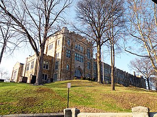
Sheraden is a neighborhood in the West End of Pittsburgh, Pennsylvania in the United States. Nearby neighborhoods include Windgap, Chartiers City, Crafton Heights, Esplen, and Elliott.
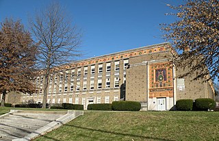
Lincoln–Lemington–Belmar is a neighborhood in Pittsburgh, Pennsylvania. It is located in the northeastern section of the city and spans the Allegheny River. Lincoln–Lemington–Belmar houses PBF 15 Engine, and is covered by PBP Zone 5 and the Bureau of EMS Medic 1.
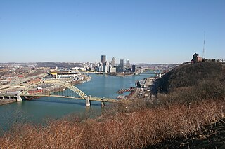
Elliott is a small, hilly neighborhood in Pittsburgh, Pennsylvania's West End Region. Elliott is represented on the Pittsburgh City Council by the council member for District 2, and uses the ZIP code 15220.

East Carnegie is a neighborhood located in the West End of Pittsburgh, Pennsylvania adjacent to the neighborhood of Oakwood. It is a "natural area" with large tracts of wooded land.

Brighton Heights is a neighborhood in Pittsburgh, Pennsylvania's northside area. It has a zip code of 15212, and has representation on Pittsburgh City Council by the council member for District 1. The Western gateway to the neighborhood, Brighton Heights Boulevard, is opposite the McKees Rocks Bridge and accessible via Route 65/Ohio River Boulevard. The Pittsburgh Bureau of Fire houses 35 Engine and 33 Truck in Brighton Heights.

Banksville is a neighborhood in Pittsburgh, Pennsylvania. The neighborhood of Banksville is located in the West End of the city and borders the South Hills region. Real estate agencies frequently refer to the Banksville area as Greentree City due to Banksville's shared border with the borough of Green Tree. It has two zip codes of both 15220 and 15216, and has representation in Pittsburgh City Council by the council member for District 2. Theresa Kail-Smith is the current Councilperson for district two. Banksville's primary corridor, Banksville Road, is frequently used as a gateway between the South Hills of Pittsburgh and downtown Pittsburgh via the Fort Pitt Tunnels. Banksville, formerly Union Township, joined the City of Pittsburgh around 1928.

Beechview is a neighborhood in Pittsburgh, Pennsylvania's southwestern side. It has a zip code of 15216, and has representation on Pittsburgh City Council by both the council member for District 4 and for District 2. Beechview was founded in 1905 after the introduction of a comprehensive light rail transit system. It is Pittsburgh Fire Bureau Zone 4-10 and houses Engine Company #28. It is located in Zone 6 for Pittsburgh Police. While Beechview took an economic downturn in the late 20th century, its proximity to downtown Pittsburgh, convenient access to light rail transit, sweeping vistas and new businesses have allowed Beechview to stabilize economically.

Central Lawrenceville is a neighborhood in the northeast of Pittsburgh, Pennsylvania in the United States. It has a zip code of 15201, and has representation on Pittsburgh City Council by the council member for District 7. It is home to Allegheny Cemetery. Central Lawrenceville is the home of the Pittsburgh Bureau of Fire's 6 Engine and 6 Truck.

Duquesne Heights is a neighborhood in Pittsburgh, Pennsylvania's south city area. It has a zip code of 15211, and has representation on Pittsburgh City Council by the council member for District 2.
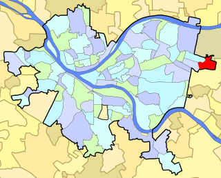
East Hills is a neighborhood in the east side of Pittsburgh, Pennsylvania, United States. Its ZIP Code is 15221. It has representation on Pittsburgh City Council by the council member for District 9.

Fairywood is a neighborhood on Pittsburgh, Pennsylvania's West End. It has a zip code of 15205, and has representation on Pittsburgh City Council by the council member for District 2. It is the westernmost neighborhood in the City of Pittsburgh.

Marshall-Shadeland is a neighborhood on Pittsburgh, Pennsylvania's North Side. It has a zip codes of both 15212 and 15214, and has representation on Pittsburgh City Council by the council member for District 1.
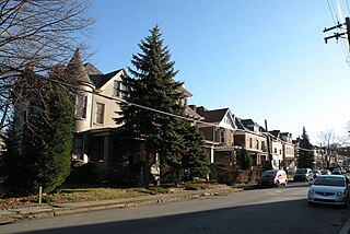
Morningside is a neighborhood in Pittsburgh, Pennsylvania's East End. It has two Zip Codes, 15201 and 15206.

Polish Hill is a neighborhood in Pittsburgh, Pennsylvania. Primarily a residential area, it is home to Pittsburgh's Immaculate Heart of Mary church.

Windgap is a neighborhood in the West End of Pittsburgh, Pennsylvania, United States. It has a zip code of 15204, and has representation on Pittsburgh City Council by the council member for District 2.

Oakwood is a neighborhood in Pittsburgh, Pennsylvania's West End. It has a zip code of 15205, and has representation on Pittsburgh City Council by the council member for District 2.

Stanton Heights is a neighborhood in Pittsburgh, Pennsylvania's East End. It has zip codes of both 15201 and 15206, and has representation on Pittsburgh City Council by the council member for District 7. Stanton Heights is the home of PBF 7 Engine and the city's Arson Investigation Units, and is covered by PBP Zone 5 and the Bureau of EMS Medic 6.
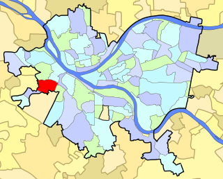
Westwood is a neighborhood in the West End Region of Pittsburgh, Pennsylvania. Beginning as a part of the now-defunct Township of Chartiers and existing for a short time as an independent borough, Westwood was annexed by the City of Pittsburgh in three pieces: the eastern third in 1872, and the remaining sectors progressing west in 1921 and 1927. Westwood is a quiet residential community inhabited by a large variety of residents, and exhibits an eclectic mix of architectural styles that span many periods. Among these is the John Frew House, one of the oldest surviving structures west of the Allegheny Mountains, which dates to 1790. Westwood also contains a public primary school bearing the community's name, as well as a public swimming pool, a playground, and ballfields. The neighborhood's main thoroughfare is Noblestown Road, and Noble Manor is its major commercial district. It has a zip codes of both 15205 and 15220, and has representation on Pittsburgh City Council by the council member for District 2. The Pittsburgh Bureau of Fire houses 29 Engine in Westwood.

West End Village is a neighborhood in Pittsburgh, Pennsylvania's west city area. It has a zip code of 15220, and has representation on Pittsburgh City Council by the council member for District 2.

Perry North is a neighborhood in Pittsburgh, Pennsylvania, USA's north city area. It lies within zip codes 15212 and 15214, and has representation on Pittsburgh City Council by the council member for District 1. The highest elevation in Pittsburgh is 1,370 feet at the Brashear Reservoir at the top of Observatory Hill. The Pittsburgh Bureau of fire houses 34 Engine in Perry North.


