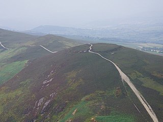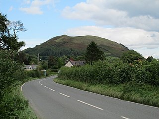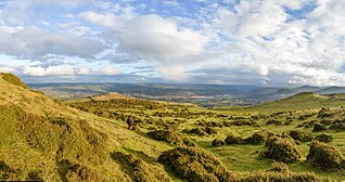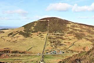
A hillfort is a type of earthwork used as a fortified refuge or defended settlement, located to exploit a rise in elevation for defensive advantage. They are typically European and of the Bronze Age or Iron Age. Some were used in the post-Roman period. The fortification usually follows the contours of a hill and consists of one or more lines of earthworks, with stockades or defensive walls, and external ditches. Hillforts developed in the Late Bronze and Early Iron Age, roughly the start of the first millennium BC, and were used in many Celtic areas of central and western Europe until the Roman conquest.

Llanymynech is a village straddling the border between Montgomeryshire/Powys, Wales, and Shropshire, England, about 9 miles (14 km) north of the Welsh town of Welshpool. The name is Welsh for "Church of the Monks". The village is on the banks of the River Vyrnwy, and the Montgomery Canal passes through it.

Breidden Hill is an extinct volcanic hill in Powys, Wales, near the town of Welshpool. It is immediately surrounded by the villages of Trewern, Middletown, Criggion, Crew Green and Llandrinio. The peak of the hill reaches to 367 metres (1,204 ft). Footpaths which lead up to the summit provide excellent 360 degree views over Powys and over the border with England to the Shropshire Plain.

Llangynog is a small rural community located in Carmarthenshire, Wales the main settlement of which was once called ‘Ebenezer’village. It is bordered by the communities of: Newchurch and Merthyr; Carmarthen; Llangain; Llansteffan; Laugharne Township; and St Clears, all being in Carmarthenshire. The population at the 2011 census was 492.

Moel y Gaer, also known as Moel-y-Gaer Camp or Moel y Gaer Hillfort, is an Iron Age hillfort located on a western spur of the Clwydian Range, near the village of Llanbedr, Denbighshire, Wales. The site is a scheduled monument, classified as a prehistoric defensive hillfort.

Moel y Gaer is an Iron Age hillfort on a summit of Llantysilio Mountain, northwest of the town of Llangollen, Denbighshire, Wales. The site is a scheduled monument classified as a prehistoric defensive hillfort.

Burfa Castle is an Iron Age hillfort near the tiny town of Old Radnor, Radnorshire in Powys, Wales. The site is a scheduled monument described as a prehistoric defensive hillfort, and was included in an inventory of monuments by 1913. The site is near Offa's Dyke which passes near the bottom of Burfa Bank.
Llandyssil is a village in Powys, Wales, about two miles from the town of Montgomery.

Caerau Hillfort is a large triangular multivallate Iron Age hillfort, built on a previously occupied Neolithic site, occupying the western tip of an extensive ridge-top plateau in the western suburbs of Caerau and Ely, Cardiff, Wales. It is the largest Iron Age site of its type in south Wales and also one of the largest in Great Britain. The old parish church, St Mary's, and a small ringwork, almost certainly a medieval castle site probably contemporary with the church, stand within the hillfort on the north-eastern side.

Ffridd Faldwyn is an Iron Age hillfort in northern Powys, in the former county of Montgomeryshire, It is sited on a prominent hill west of Montgomery, close to but higher than Montgomery Castle, overlooking the River Severn. It is one of the largest hill-forts in Wales.
Llwynda-Ddu Camp, also known as Llwynda-Ddu Hillfort, is a small Iron Age earthwork in Pentyrch, Cardiff in South Wales. The site is a scheduled monument, described as a prehistoric, defensive hillfort.

Bedd-y-Cawr Hillfort, or Bedd y Cawr Hillfort, is an Iron Age hillfort on a natural inland promontory in the community of Cefnmeiriadog in Denbighshire in North Wales. The name of the hillfort translates from the Welsh as Giant's Tomb.

Llwyn Bryn-Dinas is an Iron Age hillfort on the north side of the Tanat valley, about 1 mile (1.6 km) west of the village of Llangedwyn, in Powys, Wales.

Craig Gwrtheyrn, or Caer Gwrtheyrn, is an Iron Age hillfort on the south side of the River Teifi, about 1.2 miles (1.9 km) west of the village of Llanfihangel-ar-Arth, in Carmarthenshire, Wales.

Caer Bach is a Welsh hillfort of indeterminate age, on a rounded hillock situated near the village of Rowen; in Conwy County, North Wales. Its name in English translates as 'Small Fort'; or alternatively 'Little Fortress'. It is situated on the Eastern slopes of Tal-y-Fan, an outlying peak of the Carneddau mountain range in northeast Snowdonia; at an altitude of approximately 413 metres. Little information is known about the history of the fort, as to date, the site has undergone minimal investigation. The fort is classed as a scheduled ancient monument and is of national importance for its potential to enhance our knowledge of prehistoric settlement. It is said to retain significant archaeological potential, with a strong probability of the presence of associated archaeological features and deposits.

Hen Gaer is an Iron Age hillfort, on a hill adjacent to and east of Bow Street, Ceredigion, Wales.

Moel Arthur is an Iron Age hillfort in Flintshire, Wales, at the boundary with Denbighshire, about 5 miles (8.0 km) east of Denbigh [Grid reference SJ 14529 66034].
Caer Euni [Grid reference SJ 00027 41266] is an Iron Age hillfort, about 2.5 miles (4 km) north-east of the village of Llandderfel and about 5 miles (8 km) north-east of Bala Lake, in Gwynedd, Wales. It is a scheduled monument.

Pentre Camp is an Iron Age hillfort, near the hamlet of Llangynyw and about 2.5 miles (4 km) north-east of Llanfair Caereinion, in Powys, Wales. It is a scheduled monument.
Cefn Carnedd is an Iron Age hillfort, about 1.5 miles (2 km) south-west of Caersws, in Powys, Wales. It is a scheduled monument.


