
Malham Cove is a large curved limestone formation 0.6 miles (1 km) north of the village of Malham, North Yorkshire, England. It was formed by a waterfall carrying meltwater from glaciers at the end of the last Ice Age more than 12,000 years ago. Today it is a well-known beauty spot and rock climbing crag within the Yorkshire Dales National Park. A large limestone pavement lies above the cove.

Pillar is a mountain in the western part of the English Lake District. Situated between the valleys of Ennerdale to the north and Wasdale to the south, it is the highest point of the Pillar group. At 892 metres (2,927 ft) it is the eighth-highest mountain in the Lake District. The fell takes its name from Pillar Rock, a prominent feature on the Ennerdale side, regarded as the birthplace of rock climbing in the district.

Fair Head or Benmore is a 5-kilometre (3.1 mi) long, 200-metre (660 ft) high, mountain cliff, close to the sea, at the north-eastern corner of County Antrim, Northern Ireland. The cliff's sheer and vertical 100-metre (330 ft) high dolerite rock face is shaped into distinctive vertical columns like organ pipes, which formed 60 million years ago when a sill of igneous rock was injected between horizontal Carboniferous sediments.
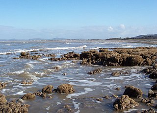
Ogmore-by-Sea is a seaside village in St Brides Major community in the Vale of Glamorgan, Wales. It lies on the western limit of the Glamorgan Heritage Coast of south Wales. The population in 2011 was 878.

Smith Rock State Park is a state park located in central Oregon's High Desert near the communities of Redmond and Terrebonne. The day-use area of the park is open daily from dawn to dusk. The park also has a camping area as well that accommodates tent camping only. Its sheer cliffs of tuff and basalt are ideal for rock climbing of all difficulty levels. Smith Rock is generally considered the birthplace of modern American sport climbing, and is host to cutting-edge climbing routes. It is popular for sport climbing, traditional climbing, multi-pitch climbing, and bouldering.
Dinas Rock is a high promontory of Carboniferous Limestone which rises between the Afon Mellte and its left-bank tributary, the Afon Sychryd on the border between the county of Powys and the county borough of Neath Port Talbot in south Wales. It can be found near the village of Pontneddfechan near Glyn Neath at the head of the Vale of Neath. It derives its name from the presence of Iron Age earthworks on its summit, dinas in Welsh signifying a defensive site or "city".

The Llanberis Pass in Snowdonia carries the main road (A4086) from the south-east to Llanberis, over Pen-y-Pass, between the mountain ranges of the Glyderau and the Snowdon massif. At the bottom of the pass is the small village of Nant Peris.

Carboniferous Limestone is a collective term for the succession of limestones occurring widely throughout Great Britain and Ireland that were deposited during the Dinantian Epoch of the Carboniferous Period. These rocks formed between 363 and 325 million years ago. Within England and Wales, the entire limestone succession, which includes subordinate mudstones and some thin sandstones, is known as the Carboniferous Limestone Supergroup.
Dulas Bay is a small bay on the north east coast of Anglesey, north Wales, forming the boundary between Llaneilian and Moelfre communities. The bay is bordered by three beaches.

The Eglwyseg valley is an area to the north east of Llangollen in Denbighshire, Wales; it is within the boundaries of Llantysilio Community. The name also refers to a widely scattered hamlet in the valley.

Ailladie, is an 800-metre-long (2,600 ft) west-facing limestone sea cliff, that varies in height from 8 metres (26 ft) to 35 metres (115 ft), situated on the coast of The Burren in County Clare, Ireland. Ailladie is one of Ireland's most highly regarded rock-climbing locations, particularly for high technical grade single pitch traditional climbing routes and deep-water soloing routes. It is also a location for shore-angling competitions, and, with its cliffs and view of the Aran Islands, is a popular photography stop for tourists.

Cribarth is a hill in the Brecon Beacons National Park, Powys, Wales, in the traditional county of Brecknockshire. The summit lies on the broken ridge at an elevation of 428 m (1,404 ft) at OS grid reference SN 831143. To its west is a 426-metre-high (1,398 ft) rounded top at SN 829144 which lies just to the northwest of a mile-long ridge that forms the main bulk of the hill. The ridge attains a height of 423 m (1,388 ft) at its southwest end and this spot is marked by a trig point. Both of these latter high points are adorned by Bronze Age burial cairns.

Craig y Forwyn is a crag that encloses the northern side of World's End, near the town of Llangollen in Denbighshire, Wales. It is part of the limestone escarpment that separates the Eglwyseg Valley from the higher Ruabon Moors and, along with nearby Craig Arthur, is a popular site for rock climbing. Evidence of lead and silver mining is found just to the west. The Offa's Dyke Path runs along its foot.
Llanddulas and Rhyd-y-foel is a community in Conwy County Borough, in Wales. It is located on the coast of Liverpool Bay, at the mouth of the Afon Dulas, 2.7 miles (4.3 km) west of Abergele, 3.6 miles (5.8 km) east of Colwyn Bay and 9.0 miles (14.5 km) east of Conwy. As the name suggests, it consists of the villages of Llanddulas and Rhyd-y-foel. At the 2001 census the community had a population of 1,572, reducing slightly to 1,542 at the 2011 census.

Aill na Cronain is an inland west-facing limestone crag in The Burren in County Clare, Ireland. It is popular with novice rock climbers due to the number of short single-pitch 10–20 metre rock climbing routes in the S to HS rock climbing grades. It is beside the Aillwee Caves.

Ballyryan or Ballyreen is a small inland mostly west-facing limestone crag in The Burren in County Clare, Ireland. It is popular with rock climbers due to its easy access, the range of short easy-to-intermediate rock climbs, and its close proximity to the much larger and highly regarded, Ailladie rock-climbing sea-cliff; Ailladie is also locally known as the Ballyreen Cliffs or Ballyreen Point.

Chee Dale is a steep-sided gorge on the River Wye near Buxton, Derbyshire, in the Peak District of England.

Cressbrook Dale is a dry carboniferous limestone gorge near Bakewell, Derbyshire, in the Peak District of England. The dale is cut into a plateau of farmland and lies to the south east of the village of Litton. Cressbrook village is at the foot of the valley to the south.

Middleton Dale is a steep-sided, carboniferous limestone valley in the Derbyshire Peak District of England. The village of Stoney Middleton lies at the eastern foot of the dale and the village of Eyam lies about 600 metres (660 yd) to the north, through the side valley of Eyam Dale. The dale is cut into the surrounding gritstone uplands of Middleton Moor and Eyam Moor. Dale Brook stream runs down the dale into Stoke Brook and on into the River Derwent 1.5 kilometres (1 mi) beyond Stoney Middleton. The Delf is a secluded, wooded side gorge with a stream between Eyam and Middleton Dale. Opposite The Delf, water gushes from Hawkenedge Well and flows into Dale Brook.

The Wye Valley is the limestone valley of the River Wye in the White Peak of Derbyshire, England. The source of the River Wye is west of Buxton on Axe Edge Moor. One main channel runs underground through Poole's Cavern. The river flows though Buxton Pavilion Gardens and then along a culvert under the town centre. After leaving the flat area of central Buxton, the Wye Valley becomes distinct as a gorge running east for 10 miles (16 km) before the valley broadens at Ashford-in-the Water.
