Craigowl Hill

Last updated

Craigowl Hill
Craigowl hill.jpg
Road leading to masts on Craigowl Hill
Highest point
Elevation 455 m (1,493 ft)
Prominence 393 m (1,289 ft)
Parent peak Lochnagar
Listing Marilyn, Hardy
Geography
Angus UK location map.svg
Red triangle with thick white border.svg
Craigowl Hill in Angus.
Scotland relief location map.jpg
Red triangle with thick white border.svg
Craigowl Hill
Craigowl Hill in Scotland
Location Sidlaw Hills, Scotland
OS grid NO376400
Topo map OS Landranger 53

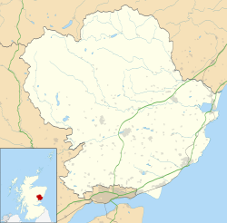
Craigowl Hill is a summit towards the eastern end of the Sidlaw Hills in Angus, Scotland. Northeast of Kirkton of Auchterhouse and approximately eight kilometres north of Dundee, Craigowl Hill represents the highest point in the range. It also known for being one of the hardest cycling climbs in Scotland, as a 3.36-kilometre (2 mi 155 yd) climb at 9.4% gradient.

Contents

Geodesy

Craigowl Hill was the origin (meridian) of the six-inch-to-the-mile and 1:2500 Ordnance Survey maps of Angus (Forfarshire). [1]

See also

Related Research Articles

<span class="mw-page-title-main">Sidlaws</span>

The Sidlaws are a range of hills in the counties of Perthshire and Angus in Scotland that extend for 30 miles (45 km) from Kinnoull Hill, near Perth, northeast to Forfar. A continuation of the Ochils, they separate Strathmore to the north from the Carse of Gowrie on the shore of the Tay.

<span class="mw-page-title-main">Glas Maol</span>

Glas Maol is a mountain in the Mounth, in the southeastern part of the Highlands of Scotland. The broad, flat summit is divided between the council area of Aberdeenshire, Angus and Perth and Kinross, though the highest point lies wholly within Angus; indeed Glas Maol is the highest point in that council area. Glas Maol is both a Munro and a Marilyn. The western slopes of Glas Maol form part of the Glenshee Ski Centre ski area. The most common route of ascent goes through the slopes, starting from the highest point of the A93 road, the Cairnwell pass. This is the highest public road in Scotland; hence only around 400 m of ascent is involved. Glas Maol is often climbed in conjunction with Creag Leacach to the south or Cairn of Claise to the north. The broad ridge linking these peaks is topped by a dry-stone dyke, which approximately corresponds to the border of the Angus council area.

Baldragon Academy is a six-year comprehensive in the Kirkton area of the city of Dundee, Scotland. It was originally named Kirkton High School until merging with Rockwell High School in August 1997. The school is set in over 20 acres (8.1 ha) of its own grounds.

<span class="mw-page-title-main">Ben Alder</span> Mountain in Scotland

Ben Alder is the highest mountain in the remote area of the Scottish Highlands between Loch Ericht and Glen Spean. It rises to 1,148 metres (3,766 ft), making it the 25th highest Munro. The vast summit plateau is home of one of Britain's highest bodies of standing water, Lochan a' Garbh Coire.

<span class="mw-page-title-main">Canisp</span> Mountain in Scotland

Canisp is a mountain in the far north west of Scotland. It is situated in the parish of Assynt, in the county of Sutherland, 25 kilometres (16 mi) north of the town of Ullapool. Canisp reaches a height of 847 metres (2,779 ft) and qualifies as a Corbett and Marilyn hill. The mountain's name translates from the Old Norse kambsnípa or point of the comb/ridge.

<span class="mw-page-title-main">West Lomond</span>

West Lomond is the highest point in the county of Fife, Scotland and the highest peak in the Lomond Hills. Its cone-shaped summit, which is the remains of a volcanic plug, rises above an escarpment of Carboniferous sandstone and limestone layers, capped with a quartz-microgabbro sill. The conspicuous peaks of West Lomond, and its neighbour East Lomond, are visible for many miles around, which explains one suggested origin of their name, the 'Lomond' or 'beacon' hills. On the summit are the remains of an Iron Age hill fort.

<span class="mw-page-title-main">Coupar Angus F.C.</span> Association football club in Perth and Kinross, Scotland, UK

Coupar Angus Junior Football Club are a Scottish Junior football club based in Coupar Angus, Perth and Kinross. Their home ground is Foxhall Park.

<span class="mw-page-title-main">Kinrossie</span> Village in Scotland

Kinrossie is a linear village in the Perth and Kinross area of Scotland. It is less than a mile south off the A94 road, 8 miles from Perth and 6 miles from Coupar Angus.

<span class="mw-page-title-main">Glen Doll</span>

Glen Doll, also sometimes spelt Glendoll, lies within the Cairngorms National Park, Scotland, at the top of Glen Clova, in an area of steep hills, corries and Munros. It includes the Corrie Fee National Nature Reserve, which has many endangered plants.

<span class="mw-page-title-main">Beinn a' Chroin</span> Scottish mountain located six kilometres south of Crianlarich in the Stirling Council area

Beinn a' Chroin is a mountain in the Breadalbane region of the Scottish Highlands, six kilometres south of Crianlarich. With a height of 941 metres (3,087 ft) it qualifies as a Munro.

<span class="mw-page-title-main">Eassie Stone</span>

The Eassie Stone is a Class II Pictish stone of about the mid 8th century AD in the village of Eassie, Angus, Scotland. The stone was found in Eassie burn in the late 18th century and now resides in a purpose-built perspex building in the ruined Eassie church.

<span class="mw-page-title-main">Càrn Gorm</span> Mountain in Perth and Kinross, Scotland, UK

Càrn Gorm is a mountain in the Breadalbane region of the Scottish Highlands, with a height of 1,029 metres (3,376 ft). It stands in a group of four Munro mountains known as the Càrn Mairg group or the Glen Lyon Horseshoe, on the north side of Glen Lyon, Perthshire.

<span class="mw-page-title-main">Ark Hill</span>

Ark Hill is a mountainous landform within the Sidlaw Hills in Angus, Scotland. This location has been proposed as a windfarm for generating renewable electrical power. Approximately two kilometres to the north is the village of Eassie noted for the presence of the Eassie Stone; this carved Pictish stone is dated prior to the Early Middle Ages.

<span class="mw-page-title-main">Glamis Manse Stone</span>

The Glamis Manse Stone, also known as Glamis 2, is a Class II Pictish stone at the village of Glamis, Angus, Scotland. Dating from the 9th century, it is located outside the Manse, close to the parish church. It is inscribed on one side with a Celtic cross and on the other with a variety of Pictish symbols. It is a scheduled monument.

<span class="mw-page-title-main">Càrn Mòr</span> Mountain in Scotland

Càrn Mòr is a mountain on the edge of the Rough Bounds of Knoydart in the Northwest Highlands of Scotland. At a height of 829 metres (2,720 ft) it is classified as a Corbett whilst its prominence of 613 metres (2,011 ft) means it is also classified as a Marilyn. It is located in the Glen Dessary area approximately 26 kilometres (16 mi) from Fort William.

The Downie Hills are a small range of hills in Angus, Scotland, approximately 4 kilometres (2.5 mi) to the North of Carnoustie. At their highest point is the summit of Camustane Hill, where lies the Panmure Testimonial. To the east of this is a tree-lined avenue that leads via the Camus Cross to the former site of Panmure House.

<span class="mw-page-title-main">Hunter's Hill Stone</span>

The Hunter's Hill Stone, otherwise known as the Glamis 1 Stone, is a Class II Pictish standing stone at Hunter's Hill to the south east of Glamis village, Angus, Scotland.

<span class="mw-page-title-main">Gallow Hill</span>

Gallow Hill is one of the hills of the Sidlaw range in South East Perthshire, Scotland. At 378 metres (1,240 ft). Gallow Hill is located near Newbigging and is smaller than Craigowl Hill.

<span class="mw-page-title-main">Kinpurnie Castle</span>

Kinpurnie Castle is a stately home located 12 miles (19 km) west of Dundee, close to Newtyle, near Blairgowrie, Angus in Scotland.

References

  1. "198 years and 153 meridians, 152 defunct" (PDF). Charlesclosesociety.org. Archived from the original (PDF) on 26 October 2016. Retrieved 10 September 2016.

56°32′52″N3°00′59″W / 56.54783°N 3.01652°W / 56.54783; -3.01652