Beinn Ìme is the highest mountain in the Arrochar Alps of Argyll, in the Southern Highlands of Scotland. It reaches 1,011 metres (3,317 ft), making it a Munro.
Ben Vorlich is a mountain in the Arrochar Alps of Argyll, in the Southern Highlands of Scotland. It reaches 943 metres (3,094 ft), making it a Munro. It lies between Loch Lomond and Loch Sloy. Ben Vorlich is the highest point of the historic county of Dunbartonshire.
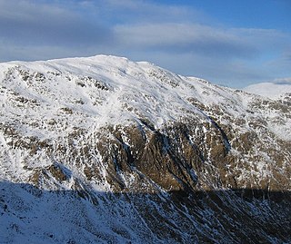
Creag Meagaidh is a mountain on the northern side of Glen Spean in the Highlands of Scotland. It is a complex mountain, made up of a flat summit plateau, with five ridges spreading out from it, overlooking five deep corries; it is most famed for the cliffs surrounding the corrie of Coire Ardair on the north-eastern face. These crags are a renowned venue for ice climbing. Creag Meagaidh rises to 1,130 metres (3,710 ft).
Càrn nan Gobhar is a mountain rising to 993 metres (3,258 ft) in the Northwest Highlands of Scotland. It stands on the northern side of Loch Mullardoch in the upper part of Glen Cannich, in a remote group of four Munros informally known as "The Mullardochs" which form the high ground between Loch Mullardoch and Loch Monar.
Creag Mhòr is a mountain in the Breadalbane region of the Scottish Highlands. It is in the Forest of Mamlorn, ten kilometres northeast of Tyndrum, and is one of the remotest of the southern Highlands Creag Mhòr reaches a height of 1047 metres (3435 ft) and qualifies as a Munro and a Marilyn. It is often climbed with the neighbouring Munro of Beinn Heasgarnich; the two mountains form the high ground between Glen Lochay and Loch Lyon.

Beinn Sgritheall or Beinn an Sgrithill, also anglicized Ben Sgriol, is the highest mountain on the Glenelg peninsula in the Northwest Highlands of Scotland. It is a Munro with a height of 974 metres (3,196 ft). The main approach is via Arnisdale on the shores of Loch Hourn or via Gleann Beag to the north, with its well-known brochs. The view from the summit was described by Sir Hugh Munro, a founder member of the Scottish Mountaineering Club, as "perhaps the most beautiful I have seen in Scotland".

Chno Dearg is a mountain in the Lochaber area of the Scottish Highlands. It overlooks Glen Spean to the north and Loch Treig to the west. With a height of 1,046 metres (3,432 ft), it is classed as a Munro.

Beinn a' Chreachain is a Scottish mountain, with a conical top, to the north-west of Loch Lyon.

Meall nan Tarmachan is a mountain in the Southern Highlands of Scotland near Killin just west of Ben Lawers. It is often climbed as part of the Tarmachan ridge, the other peaks of which are Meall Garbh, Beinn nan Eachan and Creag na Caillich ; these three peaks are Tops rather than Munros, and lie to the south-west of Meall nan Tarmachan.

Meall Ghaordaidh is a mountain in the Southern Highlands of Scotland, approximately 10 km north-west of Killin. It is a Munro, recorded as Meall Ghaordie.

Beinn a' Chaorainn is a Scottish mountain situated on the northern side of Glen Spean in the Lochaber region of the Highland Council area. The mountain which is located 30 km east-northeast of Fort William is one of several of the same name in the Scottish Highlands and should not be confused with another well known Beinn a' Chaorainn in the Cairngorms.

Seana Bhràigh is a mountain east of Ullapool, in the Highlands of Scotland.

Beinn Each is a mountain in the southern Grampian Mountains of Scotland. It is located in Stirlingshire, north of the town of Callander.

Beinn na h-Uamha is a mountain in the Northwest Highlands of Scotland. It lies in the Ardgour area of Lochaber, west of the village of Corran.

Meall Mor is a mountain in the Grampian Mountains of Scotland. It lies in the Stirling region, on the northern side of Loch Katrine in the Trossachs.
Beinn a' Mhanaich is a hill in the southern Grampian Mountains of Scotland. It is located in Argyll and Bute, in the southern Luss Hills north of the town of Helensburgh.

Binnein Shuas is a mountain in the Grampian Mountains of Scotland. It lies between Loch Laggan and Lochan na h-Earba in Inverness-shire.

Creag Dhubh is a mountain in the Grampian Mountains of Scotland. It is located in the Strathspey area of the central Highlands, above the village of Newtonmore.

Creag Dhubh is a hill in the Grampian Mountains of Scotland. It is located in the Lochaber region, east of Roybridge.

Glas Bheinn (792 m) is a mountain in the Grampian Mountains of Scotland, northeast of the village of Kinlochleven in Lochaber.