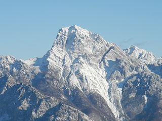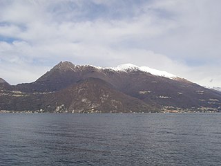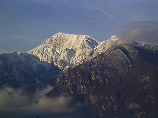
Monte Civetta is a prominent and major mountain of the Dolomites, in the Province of Belluno in northern Italy. Its north-west face can be viewed from the Taibon Agordino valley, and is classed as one of the symbols of the Dolomites.

Monte Sernio is a remote mountain of the Carnic Alps, in Udine, northeast Italy, with an elevation of 2,187 m. It is located, together with the nearby Creta Grauzaria, in the mountain chain between the Incarojo Valley, near the village of Paularo, and the Aupa Valley. It was first climbed in 1879 by sisters Minetta and Annina Grassi.

Monte di Tremezzo is a mountain of the Lugano Prealps in Lombardy, Italy. It is the highest summit of a ridge just south of Porlezza commune, lying between Lake Lugano and Lake Como. Due to its modest height it is a relatively easy mountain to climb, but due to its great prominence it provides a good view across the lakes, and over to the High Alps; mountains as far away as Finsteraarhorn, Dom and Monte Leone can be seen on a clear day.

Monte Legnone is a mountain of the Bergamo Alps in Lombardy, northern Italy. It is located between the valleys of Valsassina and Valtellina near Lake Como and Colico. It has a height of 2609 mt.

Monte Stivo is a 2,059 m mountain near Lake Garda, close to the cities of Arco and Riva del Garda in Italy.

Monte Bondone is a mountain of Trentino, northern Italy, located west of the provincial capital of Trento. It has an elevation of 2,180 metres (7,152 ft) and includes a ski resort on one side. It is the highest mountain of the Garda Prealps and with a prominence of 1,685 metres (5,528 ft) qualifies as an Ultra. It lies between the Etschtal valley in the east and the Sarca valley in the west. Due to its location high above the city, it is often called the mountain of Trento.

Aiguille de Chambeyron (3,412m) is a mountain of the Cottian Alps and is the highest mountain of Alpes-de-Haute-Provence in southeast France. Together with its neighbour Brec de Chambeyron, it is the dominant peak of the upper Ubaye Valley. The mountain is located near the border with Italy, just west of the Main chain of the Alps. It is the culminating point of the Massif du Chambeyron and is also the highest peak in the Alps south of Monte Viso.

Monte Terza Grande is a mountain of the Carnic Alps in Belluno, Veneto in north-eastern Italy. It is the highest mountain of the Southern Carnics and is part of a small Dolomitic group known as the "Dolomiti Pesarine". It resembles a pyramid from the north and south and a rocky massif from the east or west, and boasts a northwest face that is one kilometre high. It was first climbed in 1820.

Averau (2,649m) is the highest mountain of the Nuvolau Group in the Dolomites, located in the Province of Belluno, northern Italy. It lies between the Falzarego Pass and the Giau Pass. The mountain is usually climbed from its northern face, which is less steep than its other faces, by the Averau ferrata. The view from the summit takes in many of the Dolomitic giants, including Monte Civetta, Monte Pelmo, Antelao and Sorapiss.

Testa Grigia (3,315m) is a mountain on the Italian side of the Monte Rosa Massif in the Pennine Alps. It is the highest mountain of the ridge that separates the Lys valley (Gressoney-La-Trinité) from the Ayas Valley, in Aosta Valley.

Monte Agnèr is a mountain of the Dolomites located near the village of Taibon Agordino in Belluno, northeast Italy. It lies in the Pala group and is known locally as Il Pizzòn, meaning Great Peak. The mountain has several sub-peaks, Lastei d'Agnèr at 2,861m, Spiz d'Agnèr Sud at 2,652m, Torre Armena at 2,652m and Spiz d'Agnèr Nord at 2,545m. It was first climbed in 1875 by Cesare Tomé, accompanied by guides Tomaso Dal Col and Martino Gnech.

Rognosa di Sestriere is a mountain of the Cottian Alps in Piedmont, Italy.

Trogkofel is a mountain of the Carnic Alps lying on the border of Friuli, Italy and Carinthia, Austria. It is located on the main ridge of the Carnics between the Aip Valley to the south and the Gail Valley in the north, and is the second highest mountain on the eastern ridge after Gailtaler Polinik. The mountain is known as Crete Rosse, meaning Red Rocky Mountain in Friuli.

Hochiss or Hochriss is a mountain in Tyrol, Austria. Rising some 2,299 metres (7,543 ft), it is the highest mountain of the Brandenberg Alps and is located near the tourist hot spot Achensee. Its steep north face is popular with rock climbers and its other slopes are a popular destination for hiking and paragliding as well as snowshoeing and ski touring in the winter.

Monte Bìvera is a mountain of the Carnic Alps in Friuli, northeast Italy. It lies south of the main chain of the Carnics, north of the Tagliamento River and above the resort of Forni di Sopra. It is a twin peaked mountain, with the slightly lower Clapsavon just to the west, and it is formed of Limestone. A popular mountain to climb, from its summit many of the giants of the Dolomites can be seen to the West, the mighty Großvenediger to the north and the Julian Alps in the east.

Pizzo Diei is a mountain of the Lepontine Alps in Piedmont, northern Italy. It is located in the Alpe Veglia Nature Park in the commune of Varzo, and has a slightly lower sister peak, the pyramidal shaped Monte Cistella. The mountain is a popular ski mountaineering peak and its summit offers fine views of the Monte Rosa Massif.

Stuhleck is a mountain in Steiermark, Austria. It is the highest mountain of the Fischbach Alps and of the Prealps east of the Mur.

Monte d'Oro is a mountain in the department of Haute-Corse on the island of Corsica, France, one of the highest on the island. It is in the south of the Monte Rotondo massif, but is sometimes considered the summit of its own massif, the Monte d'Oro massif.

Monte Renoso is a mountain in the departments of Haute-Corse and Corse-du-Sud on the island of Corsica, France. It is the highest peak in the Monte Renoso massif.

Punta Minuta is a 2,556 metres (8,386 ft) mountain in the department of Haute-Corse on the island of Corsica, France. It is in the Monte Cinto massif.


