
Cheshire is a ceremonial county in northwest England. It is bordered by the counties of Merseyside and Greater Manchester to the north, Derbyshire to the east, and Staffordshire and Shropshire to the south, while the west is bordered by the country of Wales. Cheshire's county town is the cathedral city of Chester, while its most populated town is Warrington. Other towns include Crewe, Ellesmere Port, Frodsham, Knutsford, Macclesfield, Nantwich, Runcorn, Widnes, Wilmslow, and Winsford. The county is split into four administrative districts: the Borough of Halton, the Borough of Warrington, Cheshire West and Chester, and Cheshire East.
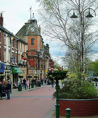
Crewe is a railway town and civil parish in the unitary authority of Cheshire East in Cheshire, England. The civil parish of Crewe had a population of 55,318 in the 2021 census. The larger Crewe built-up area, which also covers parts of the adjacent civil parishes of Willaston, Shavington cum Gresty and Wistaston, had a total population of 76,437 in 2021.

Nantwich is a market town and civil parish in the unitary authority of Cheshire East in Cheshire, England. It has among the highest concentrations of listed buildings in England, with notably good examples of Tudor and Georgian architecture. It had a population of 14,045 in 2021.

Woore is a village and civil parish in the north east of Shropshire, England, of about 3,950 acres. It had a population of 1,004 in the 2001 Census, rising to 1,069 at the 2011 Census.

The English county of Shropshire has a fairly large railway network, with 19 National Rail stations on various national lines; there are also a small number of heritage and freight lines, including the famous heritage Severn Valley Railway running along its eastern border with Worcestershire.
Barthomley is a village and ancient parish, and is now a civil parish in the unitary authority of Cheshire East and the ceremonial county of Cheshire, England. According to the 2001 and the 2011 census' the parish had a population of 202. The village is situated near junction 16 of the M6 motorway and by the border with Staffordshire. It is about three miles south-west of Alsager.

Wrenbury-cum-Frith is a village and civil parish in the unitary authority of Cheshire East, and the ceremonial county of Cheshire, England. It lies on the River Weaver, around 8.5 miles south-west of Crewe.

Bridgemere is a village and civil parish in the unitary authority of Cheshire East and the ceremonial county of Cheshire, England. It is around 7 miles (11 km) south east of Nantwich and 12 miles (19 km) west of Stoke-on-Trent. The southern boundary of the parish is on the border with Shropshire. The civil parish also includes the small settlements of Admiral's Gorse, Parrah Green, Prince Hill, Seven Stars and Wheel Green. The total population is a little under 150. Nearby towns include Crewe in Cheshire, Market Drayton and Whitchurch in Shropshire, and villages include Blakenhall, Buerton and Hankelow in Cheshire, Madeley, Staffordshire and Woore, Shropshire.
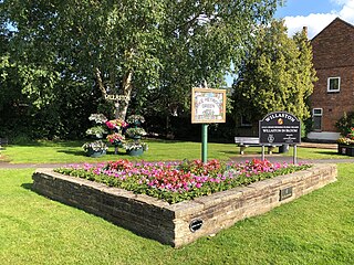
Willaston is a civil parish and village in the unitary authority of Cheshire East and the ceremonial county of Cheshire, in north-west England. It had a population of 3,104 at the time of the 2011 census, up from 2,973 in 2001.

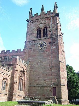
Calveley is a village and civil parish in the unitary authority of Cheshire East and the ceremonial county of Cheshire, England. The village lies 5½ miles to the north west of Nantwich. The parish also includes parts of the settlements of Barrets Green and Wardle Bank. The total population is 280 people. The area is largely agricultural and includes a short stretch of the Shropshire Union Canal. There is an Anglican parish church, a primary school and a public house. Nearby villages include Alpraham, Bunbury, Haughton and Wardle.

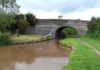
Cholmondeston is a village and civil parish in the unitary authority of Cheshire East and the ceremonial county of Cheshire, England. The village lies 5 miles (8 km) to the northwest of Nantwich. Nearby villages include Aston juxta Mondrum, Barbridge, Calveley and Wettenhall. The Middlewich Branch of the Shropshire Union Canal and the Crewe–Chester railway line run through the civil parish. The area is predominantly rural, with a total population of around 150 in 2001, increasing to 175 at the 2011 Census.

Crewe Green is a small village and civil parish in the unitary authority of Cheshire East and the ceremonial county of Cheshire, England. The village lies 1½ miles to the east of the centre of Crewe. The parish also includes a dispersed settlement of houses and farms called Slaughter Hill, the Jacobean mansion of Crewe Hall, and the industrial estates of Crewe Hall Enterprise Park and Crewe Hall Farm. Nearby villages include Haslington and Stowford.

Minshull Vernon is a hamlet and civil parish in the unitary authority of Cheshire East and the ceremonial county of Cheshire, England. The hamlet lies 3 miles (5 km) to the north west of Crewe, south east of Winsford and south west of Middlewich. The parish also includes the small settlements of Bradfield Green, Eardswick, Hoolgrave, Minshull Hill, Walley's Green and Weaver Bank. The total population of the civil parish is somewhat over 200, measured at 391 in the Census 2011. Nearby villages include Church Minshull, Warmingham and Wimboldsley.

Stapeley is a hamlet and civil parish in the unitary authority of Cheshire East and the ceremonial county of Cheshire, England. The hamlet lies 2¼ miles to the south east of Nantwich. The parish also includes the small settlements of Broad Lane and Butt Green, and parts of Artle Brook, Haymoor Green and Howbeck Bank, as well as a recent residential development north of the A5301 adjacent to Nantwich. In 2008, the total population was estimated to be a little under 3000, increasing to 3,336 at the 2011 Census. Nearby villages include Shavington, Willaston and Wybunbury.

Checkley cum Wrinehill is a civil parish in the unitary authority of Cheshire East and the ceremonial county of Cheshire, England, which lies adjacent to the boundaries with Shropshire and Staffordshire. The hamlet of Checkley lies to the south east of Crewe and to the west of Newcastle-under-Lyme. The parish is largely rural but also includes the small settlements of Bunkers Hill and Randilow. Wrinehill was formerly included in the parish, becoming part of Staffordshire in 1965. Nearby villages include Blakenhall, Bridgemere, Madeley and Woore.

Coole Pilate is a civil parish in the unitary authority of Cheshire East and the ceremonial county of Cheshire, England, which lies to the north of Audlem and to the south of Nantwich. The area is predominantly rural with scattered farms, and a total population of 60 people. At the 2011 Census the population remained less than 100. Details are included in the civil parish of Austerson. Nearby villages include Broomhall Green, Hankelow, Hatherton and Newhall.
Edleston is a civil parish in the unitary authority of Cheshire East and the ceremonial county of Cheshire, England, which lies immediately to the south west of Nantwich. For administrative purposes, it is combined with adjacent civil parishes of Acton and Henhull to form a total area of 765 hectares. The parish is predominantly rural with scattered farms and houses, with the exception of a new housing estate at the eastern end of the parish east of the canal. Nearby villages include Acton and Ravensmoor.
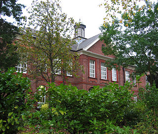
Malbank School is a comprehensive secondary school and sixth form in Nantwich, Cheshire with pupils of both sexes aged from 11 to 18.

Market Drayton railway station served the town of Market Drayton in Shropshire, England, between 1863 and 1963. It was at the junction where three railway lines met: two of them, forming the Great Western Railway route between Wellington (Shropshire) and Crewe, were met by a line from Stoke-on-Trent on the North Staffordshire Railway.

County Hall is a former municipal building on Castle Drive in Chester, Cheshire, England. It was the headquarters of Cheshire County Council and is now the Wheeler building campus of the University of Chester.

