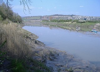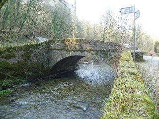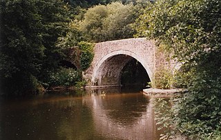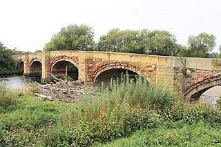
Llansantffraed (Llansantffraed-juxta-Usk) is a parish in the community of Talybont-on-Usk in Powys, Wales, near Brecon. The benefice of Llansantffraed with Llanrhystud and Llanddeiniol falls within the Diocese of St Davids in the Church in Wales.

The River Usk rises on the northern slopes of the Black Mountain, Wales, in the westernmost part of the Brecon Beacons National Park. Initially forming the boundary between Carmarthenshire and Powys, it flows north into Usk Reservoir, then east by Sennybridge to Brecon before turning southeast to flow by Talybont-on-Usk, Crickhowell and Abergavenny after which it takes a more southerly course.

Crickhowell is a town and community in southeastern Powys, Wales, near Abergavenny, and is in the historic county of Brecknockshire.

The River Taff is a river in Wales. It rises as two rivers in the Brecon Beacons; the Taf Fechan and the Taf Fawr before becoming one just north of Merthyr Tydfil. Its confluence with the River Severn estuary is in Cardiff.

Bwlch is a small village and an electoral ward in the community of Cwmdu and District, Powys, south Wales. The settlement is strung out along the A40 road which crosses a low col above the Usk Valley at this point on its route between Brecon and Crickhowell.

Raglan (; is a village and community in Monmouthshire, south east Wales, United Kingdom. It is located some 9 miles south-west of Monmouth, midway between Monmouth and Abergavenny on the A40 road very near to the junction with the A449 road. The fame of the village derives from Raglan Castle, built for William ap Thomas and now maintained by Cadw. The community includes the villages of Llandenny and Pen-y-clawdd. Raglan itself has a population of 1,183.

Glanusk Park is a country estate in Wales, United Kingdom, situated near the town of Crickhowell, Powys and was established in 1826 by ironmaster Sir Joseph Bailey. The park features in the hereditary title Baron Glanusk which was given to Sir Joseph's grandson, Sir Joseph Bailey in 1899 who at that time was the Lord Lieutenant of Brecknockshire. The park and estate contains 20,000 acres (8,100 ha) of common land, 3,500 acres (1,400 ha) of farmland, 29 let residential properties, 7 let farms and a five-mile (8 km) stretch of the River Usk. There are 400 acres (160 ha) of private parkland and 800 acres (320 ha) of forest which also includes a collection of over 200 different species of oak trees.

Llangattock is a village, community and electoral ward in the Brecon Beacons National Park in Powys, Wales. It lies in the Usk Valley just across the river from the town of Crickhowell. The Monmouthshire and Brecon Canal passes through the village en route between Brecon and Pontypool. It is in the historic county of Breconshire.

St Mary's Church, Cilcain, is in the village of Cilcain, Flintshire, Wales. It is an active Anglican church in the Bro Famau group of parishes, in the Mold Mission Area, in the archdeaconry of Wrexham and the diocese of St Asaph. The church is designated by Cadw as a Grade I listed building.

The Old Wye Bridge or Town Bridge at Chepstow, also known historically as Chepstow Bridge, crosses the River Wye between Monmouthshire in Wales and Gloucestershire in England, close to Chepstow Castle. Although there had been earlier wooden bridges on the site since Norman times, the current road bridge was constructed of cast iron in 1816 during the Regency period, by John Rastrick of Bridgnorth, who greatly modified earlier plans by John Rennie.

In the United Kingdom, the term listed building refers to a building or other structure officially designated as being of special architectural, historical, or cultural significance; Grade I structures are those considered to be "buildings of exceptional interest". Listing was begun by a provision in the Town and Country Planning Act 1947. Once listed, strict limitations are imposed on the modifications allowed to a building's structure or fittings. In Wales, the authority for listing under the Planning Act 1990 rests with Cadw.

The Usk Bridge in Brecon, Powys, Wales is the town's oldest route over the River Usk. It carries the B4601 road, formerly the A40, between Brecon and Llanfaes.

Llangynidr Bridge, also known as "Coed-yr-Ynys Bridge", is an early 18th-century bridge that crosses the River Usk to the north of Llangynidr, Powys, Wales. It carries the B4560 road towards Bwlch.

Pont Cych is a single-arch, Grade II-listed bridge over Afon Cych at Cwmcych in the Cych Valley, bordering Carmarthenshire and Pembrokeshire, Wales.

Llawhaden Bridge is a Grade II* listed medieval stone arch bridge spanning the Eastern Cleddau river near Llawhaden village in Pembrokeshire, Wales, in the community of Llawhaden and about 1 mile (1.6 km) upstream of the river's tidal limit at Canaston Bridge. It is a scheduled ancient monument.
Abercamlais is a Grade I listed country house in the Usk valley between Brecon and Sennybridge in Powys, Wales. Possibly dating back to the Middle Ages, it underwent various alterations and additions during the nineteenth century accounting for all or most of what may be seen today. Also of note is an early eighteenth century octagonal dovecote. The gardens attached to the house extend on both sides of the Usk and are connected by both a grade II* listed Elizabethan three arch stone bridge and a wrought iron suspension bridge constructed by Crawshay Bailey in the middle of the nineteenth century. It is considered a fine piece of Victorian engineering and listed by Cadw accordingly.

Penpont is a seventeenth-century Grade I listed manor house in the Usk valley between Brecon and Sennybridge in Powys, Wales. It was built by Daniel Williams on the site of, and perhaps incorporating, an earlier house, Abercamlais-isaf. The frontage dates from 1815. Penpont Bridge, a grade II* listed structure, spans the Usk by means of four segmented stone arches. The gardens at Penpont are influenced by Repton but have a long history from the seventeenth century with the addition of a celebrated Green Man maze in recent years. They are listed Grade II* on the Cadw/ICOMOS Register of Parks and Gardens of Special Historic Interest in Wales.

The Bear Hotel, formerly the White Bear, stands on Beaufort Street, Crickhowell, Powys, Wales. A coaching inn from the mid 18th century, the building has older origins from the 17th and 15th centuries. It is a Grade II* listed building.

Bangor Bridge is a Grade I listed bridge crossing the River Dee in Bangor-on-Dee, Wrexham County Borough, Wales. It is situated on the community boundary between Bangor-is-y-Coed and Sesswick. Located to the west of Bangor-on-Dee, it connects the village's high street and the A525 road bypass. The narrow bridge is a one-way traffic bridge, west to east, and is downstream (north) of the Bangor by-pass bridge.

Hampton in Arden packhorse bridge crosses the River Blythe near Hampton in Arden in the West Midlands of England, between Birmingham and Coventry. Dating from the 15th century, it is the only bridge of its kind in the area now covered by the West Midlands, and is a grade II* listed building and a scheduled monument.


