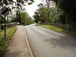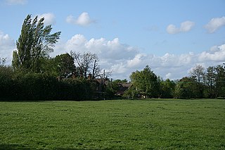
The Battle of Cropredy Bridge was fought on 29 June 1644 near Banbury, Oxfordshire during the First English Civil War. In the engagement, Sir William Waller and the Parliamentarian army failed to capture King Charles.
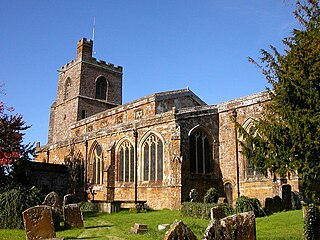
Cropredy is a village and civil parish on the River Cherwell, 4 miles (6.4 km) north of Banbury in Oxfordshire.

Edge Hill is an escarpment and Edgehill a hamlet in the civil parish of Ratley and Upton, Stratford-on-Avon District, southern Warwickshire, England. At Ratley, the escarpment rises to 219 m (719 ft) above sea level and 112 m (367 ft) above nearby Radway, within 300 metres of the Warwickshire border with Oxfordshire.

A pier, in architecture, is an upright support for a structure or superstructure such as an arch or bridge. Sections of structural walls between openings (bays) can function as piers. External or free-standing walls may have piers at the ends or on corners.

Taşköprü, historically known as Ponte Sarus, is a Roman bridge spanning the Seyhan River in Adana that was probably built in the first half of the second century AD. The bridge was a key link in ancient trade routes from the Mediterranean Sea to Anatolia and Persia. Until its closure in 2007, it was one of the oldest bridges in the world open to motorized vehicles. Since 2007 it has only carried foot traffic, and now hosts social and cultural events.

The Old Dee Bridge in Chester, Cheshire, England, is the oldest bridge in the city. It crosses the River Dee carrying the road that leads from the bottom of Lower Bridge Street and the Bridgegate to Handbridge. A bridge on this site was first built in the Roman era, and the present bridge is largely the result of a major rebuilding in 1387. It is recorded in the National Heritage List for England as a designated Grade I listed building, and is a scheduled monument.
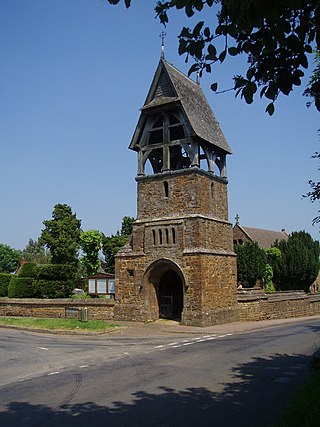
Great Bourton is a village about 3 miles (5 km) north of Banbury in Oxfordshire, England. It is the largest settlement in the civil parish of Bourton. The 2011 Census recorded the parish's population as 614.
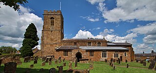
Wardington is a village and civil parish in Oxfordshire, about 4 miles (6.4 km) northeast of Banbury. The village consists of two parts: Wardington and Upper Wardington. The village is on a stream that rises in Upper Wardington and flows north to join the River Cherwell.

Chiselhampton is a village in the civil parish of Stadhampton on the River Thame, about 6 miles (10 km) southeast of Oxford in Oxfordshire, England.

Abingdon Bridge crosses the River Thames at the town of Abingdon, Oxfordshire, England. It carries the A415 road from Abingdon to Dorchester, Oxfordshire, over the reach of the Thames between Culham Lock and Abingdon Lock.
John Joseph Leeming,, BSc, ACGI, FICE, MI Struct E, MI Mun E, F Inst HE, was a British civil engineer and traffic engineer. He forwarded controversial ideas for the causes of, and remedies for, road traffic accidents (RTAs), including the notion that drivers should not always be assumed to be at fault.
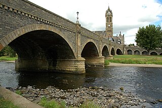
The Tweed Bridge is a stone-built road bridge of five spans over the River Tweed in Peebles, in the Scottish Borders.

The Aesepus Bridge was a late antique Roman bridge over the Aesepus River in the ancient region of Mysia in modern-day Turkey. It is notable for its advanced hollow chamber system which has also been employed in other Roman bridges in the region, such as the Makestos Bridge. In a field examination carried out in the early 20th century, the four main vaults of the bridge were found in ruins, while nearly all piers and the seven minor arches had still remained intact. Today, the two remaining pier stubs in the riverbed are still extant, while the condition of the rest of the structure is difficult to determine.
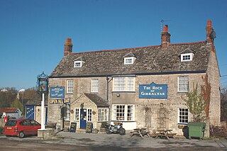
Enslow is a hamlet on the banks of both the River Cherwell and the Oxford Canal in Bletchingdon civil parish, Oxfordshire. The medieval main road linking London with Chipping Norton and Worcester crosses the Cherwell at Enslow. There was a bridge here by the time that John Leland toured England in 1538–43. John Ogilby's Britannia Atlas of 1675 records a timber bridge here that he called "Emley Bridg". In 1718 the road was made into a turnpike and at some stage the timber bridge was replaced by one with pointed stone arches. In 1814 the stone bridge was widened on its downstream side. to almost double its former width. In contrast with the older upstream side of the bridge, the 1814 arches are semicircular. The road is now the A4095.

Crickhowell Bridge is an 18th-century bridge that spans the River Usk in Crickhowell, Powys, Wales. The main A4077 road to Gilwern crosses it. The bridge is claimed to be the longest stone bridge in Wales at over 128 metres (420 ft).
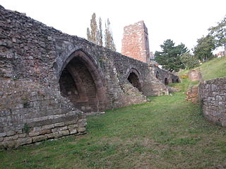
The Old Exe Bridge is a ruined medieval arch bridge in Exeter in south west England. Construction of the bridge began in 1190, and was completed by 1214. The bridge is the oldest surviving bridge of its size in England and the oldest bridge in Britain with a chapel still on it. It replaced several rudimentary crossings which had been in use sporadically since Roman times. The project was the idea of Nicholas and Walter Gervase, father and son and influential local merchants, who travelled the country to raise funds. No known records survive of the bridge's builders. The result was a bridge at least 590 feet long, which probably had 17 or 18 arches, carrying the road diagonally from the west gate of the city wall across the River Exe and its wide, marshy flood plain.

The Mill Street–South Branch Raisin River Bridge is a bridge carrying Mill Street over the South Branch of the River Raisin in Brooklyn, Michigan. It was listed on the National Register of Historic Places in 2000.
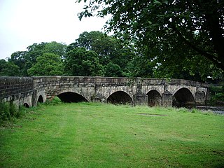
Edisford Bridge is a toll-free, nine-span bridge over the River Ribble near Clitheroe, Lancashire, England. A Grade II listed structure and a Scheduled monument, located about a mile WSW of the centre of town, it crosses the river to the civil parish of Great Mitton. The bridge carries the two-lane traffic of the B6243 Edisford Road.

Wolverton Viaduct is a railway bridge carrying the West Coast Main Line over the River Great Ouse to the north of Wolverton, part of the City of Milton Keynes, in south-eastern England. Built in 1837 for the London and Birmingham Railway under the supervision of Robert Stephenson, it is one of the largest and most notable structures on the route and is a grade II listed building.

Hampton in Arden packhorse bridge crosses the River Blythe near Hampton in Arden in the West Midlands of England, between Birmingham and Coventry. Dating from the 15th century, it is the only bridge of its kind in the area now covered by the West Midlands, and is a grade II* listed building and a scheduled monument.
