U.S. Route 42 is an east–west United States highway that runs southwest–northeast for 350 miles (560 km) from Louisville, Kentucky to Cleveland, Ohio. The route has several names including Pearl Road from Cleveland to Medina in Northeast Ohio, Reading Road in Cincinnati, Cincinnati and Lebanon Pike in southwestern Ohio and Brownsboro Road in Louisville. Traveling northeast, the highway ends in downtown Cleveland and traveling southwest ends in Louisville.

The Wilderness Road was one of two principal routes used by colonial and early national era settlers to reach Kentucky from the East. Although this road goes through the Cumberland Gap into southern Kentucky and northern Tennessee, the other is sometimes called the "Cumberland Road" because it started in Fort Cumberland in Maryland. Despite Kentucky Senator Henry Clay's advocacy of this route, early in the 19th century, the northern route was selected for the National Road, connecting near Washington, Pennsylvania into the Ohio Valley of northern Kentucky and Ohio.
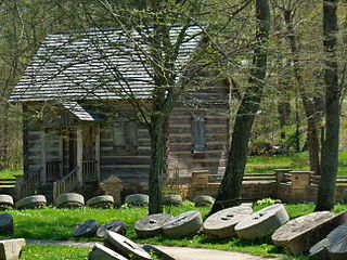
Levi Jackson Wilderness Road Park is a former state park located just south of London, Kentucky in Laurel County. It is now a city park under the auspices of the city of London, KY. The park encompasses 896 acres (363 ha) and includes a section of the Wilderness Road that early settlers used to reach Kentucky. The park is named for Levi Jackson, an early Kentucky pioneer. It serves as both a recreational and historic park.
Kentucky Route 70 (KY 70) is a long east-east state highway that originates at a junction with U.S. Route 60 (US 60) in Smithland in Livingston County, just east of the Ohio River. The route continues through the counties of Crittenden, Caldwell, Hopkins, Muhlenberg, Butler, Edmonson, Barren, Barren, Metcalfe, Green, Taylor, Casey, Pulaski, Lincoln and back into Pulaski again to terminate at a junction with US 150 near Maretburg in Rockcastle.
U.S. Route 25 (US 25) runs for 178.9 miles (287.9 km) across the state of Kentucky from the split between US 25E and US 25W in North Corbin to US 42/US 127 at the Ohio state line in Covington.
U.S. Route 27 (US 27) in Kentucky runs 190.785 miles (307.039 km) from the Tennessee border to the Ohio border at Cincinnati. It crosses into the state in the Lake Cumberland area, passing near or through many small towns, including Somerset, Stanford, and Nicholasville. The road then passes straight through the heart of Lexington, including past the University of Kentucky (UK) and Transylvania University. North of Lexington it passes through Cynthiana and Falmouth before entering Campbell County and passing through many Northern Kentucky suburbs before ending at the Ohio state line on the Taylor Southgate Bridge in Cincinnati.
U.S. Route 62 (US 62) in Kentucky runs for a total of 391.207 miles (629.587 km) across 20 counties in western, north-central, and northeastern Kentucky. It enters the state by crossing the Ohio River near Wickliffe, then begins heading eastward at Bardwell, and traversing several cities and towns across the state up to Maysville, where it crosses the Ohio River a second time to enter the state of Ohio.
U.S. Route 231 in Kentucky runs 86.465 miles (139.152 km) from the Tennessee state line near Adolphus to the William H. Natcher Bridge on the Ohio River near Rockport, Indiana. It crosses the state mainly in the west-central region, traversing Allen, Warren, Butler, Ohio, and Daviess Counties.
U.S. Route 431 in Kentucky runs 86.93 miles (139.90 km) from the Tennessee state line south of Adairville to US 60 at Owensboro. It crosses the state in mainly west-central portions of the state, passing through or near towns such as Russellville, Lewisburg, Central City and Livermore. The route goes through Logan, Muhlenberg, McLean County, and Daviess counties.
U.S. Route 421 (US 421) in the U.S. state of Kentucky is a 250.536-mile-long (403.199 km) north–south United States highway that traverses twelve counties in the central and eastern parts of the state. It travels in a southeast-to-northwest path from the Virginia state line near Pennington Gap to the Indiana state line, on the Ohio River at Milton, Kentucky and Madison, Indiana.


