
Tipton County is a county in the U.S. state of Indiana, located north of the state capital of Indianapolis. According to the 2020 census, it had a population of 15,359. Its county seat is Tipton. The county has four incorporated towns with a total population of about 7,000, as well as many small unincorporated communities. It is divided into six townships which provide local services. Three Indiana state roads and one U.S. Route cross the county, as do two railroad lines. Before the arrival of non-indigenous settlers in the early 19th century, the area was inhabited by several Native American tribes. The county was officially established in 1844, one of the last Indiana counties to be settled. Tipton and Howard Counties were established by the same legislative action on January 15.

Ripley County is a county located at the southeastern corner of the U.S. state of Indiana. According to the 2020 Census, the population was 28,995. The county seat is Versailles.

Porter County is a county in the U.S. state of Indiana. As of 2020, the population was 173,215, making it the 10th most populous county in Indiana. The county seat is Valparaiso. The county is part of Northwest Indiana, as well as the Chicago metropolitan area. Porter County is the site of much of the Indiana Dunes, an area of ecological significance. The Hour Glass Museum in Ogden Dunes documents the region's ecological significance.

Morgan County is a county located in the U.S. state of Indiana. As of the 2020 United States Census, the population was 71,780. The county seat is Martinsville.

Madison County is a county in the U.S. state of Indiana. The 2020 census states the population is standing at 130,129. The county seat since 1836 has been Anderson, one of three incorporated cities within the county.

Hancock County is a county in the U.S. state of Indiana. The 2020 United States Census recorded a population of 79,840. The county seat is Greenfield.

Hamilton County is a county in the U.S. state of Indiana. The 2020 United States Census recorded a population of 347,467. The county seat is Noblesville.

Delaware County is a county in the east central portion of the U.S. state of Indiana. As of 2020, the population was 111,903. The county seat is Muncie.

Boone County is a county in the U.S. state of Indiana. As of 2020, the population was 70,812. The county seat is Lebanon.

Blackford County is located in the east central portion of the U.S. state of Indiana. The county is named for Judge Isaac Blackford, who was the first speaker of the Indiana General Assembly and a long-time chief justice of the Indiana Supreme Court. Created in 1838, Blackford County is divided into four townships, and its county seat is Hartford City. Two incorporated cities and one incorporated town are located within the county. The county is also the site of numerous unincorporated communities and ghost towns. Occupying only 165.58 square miles (428.9 km2), Blackford County is the fourth smallest county in Indiana. As of the 2020 census, the county's population was 12,112. Based on population, the county is the 8th smallest county of the 92 in Indiana. Although no interstate highways are located in Blackford County, three Indiana state roads cross the county, and an additional state road is located along the county's southeast border. The county has two railroad lines. A north–south route crosses the county, and intersects with a second railroad line that connects Hartford City with communities to the west.
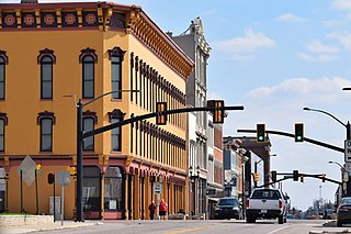
Muncie is an incorporated city and the seat of Delaware County, Indiana, United States. Previously known as Buckongahelas Town, named after the prominent Delaware Chief, it is located in East Central Indiana, about 50 miles (80 km) northeast of Indianapolis. At the 2020 United States Census, the city's population was 65,195, down from 70,085 in the 2010 Census. It is the principal city of the Muncie Metropolitan Statistical Area, which encompasses all of Delaware County. The city is also included in the Indianapolis–Carmel–Muncie, IN Combined Statistical Area.
Strawtown is an unincorporated community in White River Township, Hamilton County, Indiana.
Anthony is an unincorporated community in Hamilton Township, Delaware County, Indiana.
Cammack is an unincorporated community in Mount Pleasant Township, Delaware County, Indiana.
Oakville is an unincorporated community in Monroe Township, Delaware County, Indiana.
Progress is an unincorporated community in Monroe Township, Delaware County, Indiana.
Reed Station is an unincorporated community in Mount Pleasant Township, Delaware County, Indiana.
Stockport is an unincorporated community in Washington Township, Delaware County, Indiana.
West Muncie is an unincorporated community in Mount Pleasant Township, Delaware County, Indiana.

Wheeling is an unincorporated community in Washington Township, Delaware County, Indiana.


