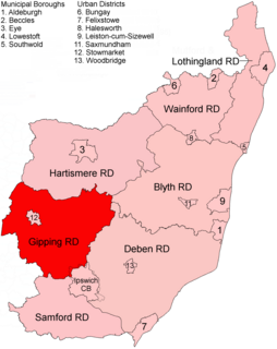
Gipping Rural District was a rural district in the county of East Suffolk, England. It was created in 1934 by the merger of the disbanded Bosmere and Claydon Rural District and the disbanded East Stow Rural District, under a County Review Order. It was named after the River Gipping and administered from Needham Market.
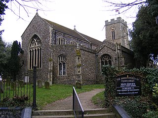
Halesworth is a market town, civil parish and electoral ward in north-eastern Suffolk, England. The population stood at 4,726 in the 2011 Census. It lies 15 miles (24 km) south-west of Lowestoft, on a tributary of the River Blyth, nine miles upstream from Southwold. The town is served by Halesworth railway station on the Ipswich–Lowestoft East Suffolk Line. It is twinned with Bouchain in France and Eitorf in Germany. Nearby villages include Cratfield, Wissett, Chediston, Walpole, Blyford, Linstead Parva, Wenhaston, Thorington, Spexhall, Bramfield, Huntingfield, Cookley and Holton.

Royal Air ForceWoodbridge or RAF Woodbridge, is a former Royal Air Force station located east of Woodbridge in the county of Suffolk, England.

Royal Air Force Metfield or more simply RAF Metfield is a former Royal Air Force station located just to the southeast of the village of Metfield, Suffolk, England.

Covehithe is a village and civil parish in the East Suffolk district of the English county of Suffolk. It lies on the North Sea coast around 4 miles (6.4 km) north of Southwold and 7 miles (11 km) south of Lowestoft. Neighbouring settlements include Benacre, South Cove and Frostenden.
Roger A. Freeman was an English farmer who also became a noted military aviation historian specialising in US Eighth Air Force operations during World War II.

Royal Air Force Martlesham Heath or more simply RAF Martlesham Heath is a former Royal Air Force station located 1.5 miles (2.4 km) southwest of Woodbridge, Suffolk, England. It was active between 1917 and 1963, and played an important role in the development of Airborne Interception radar.

Exning is a village and civil parish in the West Suffolk district of Suffolk in eastern England.

Royal Air Force Station Wormingford is a former Royal Air Force station located 6 miles (9.7 km) northwest of Colchester, Essex, England.

Royal Air Force Mendlesham, or more simply RAF Mendlesham, is a former Royal Air Force station located 5.5 miles (8.9 km) east of Stowmarket, Suffolk, England.

Royal Air Force Great Ashfield or more simply RAF Great Ashfield is a former Royal Air Force station located 10 miles (16 km) east of Bury St. Edmunds and 2 miles (3.2 km) south of Great Ashfield, Suffolk, England.
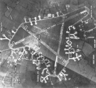
Royal Air Force Framlingham or more simply RAF Framlingham is a former Royal Air Force station located 3 miles (4.8 km) southeast of Framlingham, Suffolk, England.
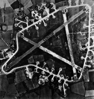
Royal Air Force Station Rattlesden or more simply RAF Rattlesden is a former Royal Air Force station located 9 miles (14 km) south east of Bury St Edmunds, Suffolk, England.
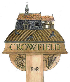
Crowfield is a village in Suffolk, England. It is in Helmingham and Coddenham ward in the Mid Suffolk local authority, in the East of England region.
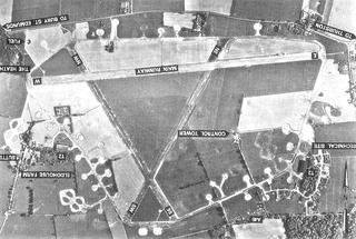
Rougham Airfield, formerly Royal Air Force Station Bury St Edmunds or more simply RAF Bury St Edmunds is a former Royal Air Force station located 3 miles (4.8 km) east of Bury St Edmunds, Suffolk, England. It is not to be confused with the RAF grass strip on the western side of Bury St Edmunds known as RAF Westley, an area now part of the town itself. The airfield, now in private ownership and much reduced in size, is still active and is known as Rougham Airfield.

Crowfield Windmill is a smock mill at Crowfield, Suffolk, England which has been conserved.

Shipmeadow is a village and civil parish located in the north of the English county of Suffolk. It is in the East Suffolk district, 2.5 miles (4.0 km) east of Bungay and the same distance west of Beccles on the B1062 road. Norwich is 15 miles (24 km) to the north-west.
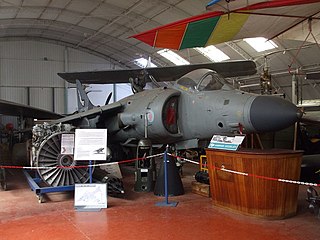
The Norfolk and Suffolk Aviation Museum is a museum collection of aircraft and aviation-related artefacts, located near the former RAF Bungay airfield in Flixton in the north of the English county of Suffolk.

Richard Wingfield, of Wantisden and Crowfield, Suffolk, was an English politician.


