Crymlyn Burrows

Last updated

Crymlyn Burrows (Welsh : Twyni Crymlyn) is an area of land in Wales, UK to the east of Swansea city centre, and south of Crymlyn Bog. It is bounded by Jersey Marine Beach to the south and the River Neath to the east. The land west of Baldwin's Crescent falls within the City and County of Swansea and from Baldwin's Crescent eastwards falls within Neath Port Talbot.

Contents

The area northwest of the Fabian Way contains a small settlement at Elba Crescent and Baldwins Crescent and areas of industry and commerce. The 1940s Swansea Bay Museum is located in Elba Crescent. The museum contains exhibits showing what life was like in the Swansea Bay area during and just after World War II. [1]

Nature reserve

View of Crymlyn Burrows salt marsh looking towards the River Neath estuary Crymlyn Burrows - geograph.org.uk - 117768.jpg
View of Crymlyn Burrows salt marsh looking towards the River Neath estuary

The undeveloped salt marsh area south of the Fabian Way and north Jersey Marine Beach is a designated biological Site of Special Scientific Interest and is one of the last remaining places of the Swansea Bay coastline that has remained unmodified by industrial development. The area contains sand dunes, a salt marsh and carr woodland. The burrows also contain a rare orchid [2] - the Fen Orchid, Liparis loeselii . [3] The 1,000-acre (400 ha) site was acquired by St. Modwen from BP in November 2009 and will be kept as a protected leisure destination. [4]

Industry and commerce

View along the Fabian Way outside the former Linamar transmission components factory offices Linamar.jpg
View along the Fabian Way outside the former Linamar transmission components factory offices

Industrial sites in the northeastern part of the area include the Linamar Elba Works site, the Gower Chemicals site, and Network Rail's Swansea Burrows yard.

Part of the Visteon industrial site was acquired by RT Properties in 2007 with Visteon consolidating their operations in the Elba Works plant. The part of the site which was sold includes factory premises and the offices and Canteen buildings fronting the Fabian Way. The plant was originally built in 1959 for the Prestcold fridge company and was later acquired by Ford who manufactured car axle and transmission components there. Ford later transferred the site to Visteon. The 30-acre (12 ha) site acquired by RT properties has been re-developed as a business park branded Swansea Gate Business Park. [5] [6] The 24,600-square-metre (265,000 sq ft) car parts factory was later closed and is now used as a film studio. [7] [8]

BP has a storage site south east of the Fabian Way adjacent to Swansea Docks. Amazon.co.uk has a 33-acre (13 ha) distribution centre just west of the Jersey Marine roundabout on the Fabian Way. [9]

Leisure

Jersey Marine beach Jersey Marine Beach - geograph.org.uk - 461077.jpg
Jersey Marine beach

The 18 hole links golf course of the Swansea Bay Golf Club lies to the east of Jersey Marine village. It is the oldest golf club in the Swansea area. [10] The marina of the Monkstone Sailing and Cruising Club is located at Earlswood in the east of the area, under the M4 Motorway viaduct, with access to the estuary of the River Neath. [11] [12]

Fabian Way

Fabian Way is an arterial road which connects Swansea city centre with the M4 Motorway at junction 42. It forms a stretch of the A483 road. It is about 4.7 miles (7.6 km) long and cuts through the centre of Crymlyn Burrows in the unitary authorities of Swansea and Neath Port Talbot. Fabian Way is a dual carriageway for its whole length. The speed limit of Fabian Way is 30 mph (48 km/h) between Swansea city centre and Port Tennant, after which the speed limit rises to 40 mph (64 km/h) until the Jersey Marine traffic lights. The road is a standard national speed limit dual carriageway between Jersey Marine and the junction with the M4. It is considered to be the main entrance to Swansea City Centre.

Plans

A new residential development was approved in 2009 for the area north of Elba Crescent, consisting of 33 houses with a planned total of 100 and a new business area. [13]

Swansea University

Swansea University has built a 100-acre (40 ha) site close to Fabian Way as a second campus and innovation park. The development is on land previously used by BP as a petrochemicals transit site which BP gifted to the university. The site stretches from Swansea Docks to Crymlyn Bog. [14] Funding for the project was made available in September 2012 from the Welsh Government and the European Investment Bank. Construction work started on the site in 2013 and the main phase completed in 2015, with accommodation blocks still being added. Companies which intend to establish research facilities at the site include Rolls-Royce, Hewlett-Packard, Tata, Bell Labs and BAE. [15] [16] [17]

Buildings

The buildings were designed by Porphyrios Associates.

BuildingArchitectsYearImage
Active Classroom
Bay Library Porphyrios Associates 2019
Centre For Integrative Semiconductor Materials2023
Computational Foundry Porphyrios Associates 2018
Engineering Central
Engineering East
Engineering North - IMPACT Porphyrios Associates
Energy Safety Research Institute (ESRI) Porphyrios Associates
School of Management Porphyrios Associates
The Great Hall Porphyrios Associates
The College Porphyrios Associates 2018

Student Residences

The student residences at the Bay Campus have been designed so that the internal space is modern and the external build stands the test of time in both design and the elements. [18]

Nearest places

Related Research Articles

<span class="mw-page-title-main">Swansea</span> City and county in Wales

Swansea is a coastal city and the second-largest city of Wales. It forms a principal area, officially known as the City and County of Swansea.

<span class="mw-page-title-main">Port Talbot</span> Town and community in Wales

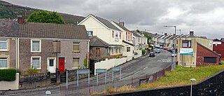
Port Talbot is a town and community in the county borough of Neath Port Talbot, Wales, situated on the east side of Swansea Bay, approximately eight miles from Swansea. The Port Talbot Steelworks covers a large area of land which dominates the south east of the town. It is one of the biggest steelworks in the world, but has been under threat of closure since the 1980s. The population was 31,550 in 2021, comprising about a fifth of the 141,931 population of Neath Port Talbot.

<span class="mw-page-title-main">Neath Port Talbot</span> County borough in Wales

Neath Port Talbot is a county borough in the south-west of Wales. Its principal towns are Neath, Port Talbot, Briton Ferry and Pontardawe. The county borough borders Bridgend County Borough and Rhondda Cynon Taf to the east, Powys and Carmarthenshire to the north; and Swansea to the west.

<span class="mw-page-title-main">Swansea Bay</span> Bay on the southern coast of Wales

Swansea Bay is a bay on the southern coast of Wales. The River Neath, River Tawe, River Afan, River Kenfig and Clyne River flow into the bay. Swansea Bay and the upper reaches of the Bristol Channel experience a large tidal range. The shipping ports in Swansea Bay are Swansea Docks, Port Talbot Docks and Briton Ferry wharfs.

<span class="mw-page-title-main">Briton Ferry</span> Human settlement in Wales

Briton Ferry is a town and community in the county borough of Neath Port Talbot, Wales. The Welsh name may indicate that the church, llan, is protected from the wind, awel. Alternatively, Sawel may be a derivative of Saul, St Paul's earlier name. He once landed at Briton Ferry. An alternative Welsh name unused today is Rhyd y Brython, a direct translation of Briton Ferry. The Normans referred to the River crossing as La Brittonne and Leland in 1540 as Britanne Fery.

<span class="mw-page-title-main">Aberavon</span> Human settlement in Wales

Aberavon is a town and community in Neath Port Talbot county borough, Wales. The town derived its name from being near the mouth of the river Afan, which also gave its name to a medieval lordship. Today it is essentially a district of Port Talbot, covering the central and south western part of the town. Aberavon is also the name of the nearby Blue Flag beach and the parish covering the same area.

<span class="mw-page-title-main">River Neath</span> River in United Kingdom, Wales

River Neath is a river in south Wales running south west from the point at which its headwaters arising in the Brecon Beacons National Park converge to its mouth at Baglan Bay below Briton Ferry on the east side of Swansea Bay.

<span class="mw-page-title-main">Neath and Tennant Canal</span> Canals in South Wales

The Neath and Tennant Canals are two independent but linked canals in South Wales that are usually regarded as a single canal. The Neath Canal was opened from Glynneath to Melincryddan, to the south of Neath, in 1795 and extended to Giant's Grave in 1799, in order to provide better shipping facilities. With several small later extensions it reached its final destination at Briton Ferry. No traffic figures are available, but it was successful, as dividends of 16 per cent were paid on the shares. The canal was 13.5 miles (21.7 km) long and included 19 locks.

The M4 corridor is an area in the United Kingdom adjacent to the M4 motorway, which runs from London to South Wales. It is a major hi-tech hub. Important cities and towns linked by the M4 include London, Slough, Bracknell, Maidenhead, Reading, Newbury, Swindon, Bath, Bristol, Newport, Cardiff, Port Talbot and Swansea. The area is also served by the Great Western Main Line, the South Wales Main Line, and London Heathrow Airport. Technology companies with major operations in the area include Adobe, Amazon, Citrix Systems, Dell, Huawei, Lexmark, LG, Microsoft, Novell, Nvidia, O2, Oracle, Panasonic, SAP, and Symantec.

<span class="mw-page-title-main">Port Tennant</span>

Port Tennant is a suburban district of Swansea, Wales, falling within the St. Thomas ward. Port Tennant lies at the southern foot of Kilvey Hill just east of St. Thomas and is bounded by the Fabian Way to the south. It is a mostly residential area and is the location of one of Swansea's largest public cemeteries - Danygraig Cemetery.

<span class="mw-page-title-main">Coedffranc West</span> Human settlement in Wales

Coedffranc West is an electoral ward of Neath Port Talbot county borough, Wales. As of May 2022, it is represented by two councillors from the Welsh Liberal Democrats.

<span class="mw-page-title-main">Llandarcy</span>

Llandarcy is a village near Neath in the Neath Port Talbot county borough, Wales, and was the site of the first oil refinery in the United Kingdom. It was originally designed as a garden village to house the workers for the BP refinery built between 1918 and 1922. The village is near junction 43 of the M4 motorway.

Swansea Docks is the collective name for several docks in Swansea, Wales. The Swansea docks are located immediately south-east of Swansea city centre. In the mid-19th century, the port was exporting 60% of the world's copper from factories situated in the Tawe Valley. The working docks area today is owned and operated by Associated British Ports as the Port of Swansea and the northern part around the Prince of Wales Dock is undergoing re-development into a new urban area branded the SA1 Swansea Waterfront.

<span class="mw-page-title-main">Crymlyn Bog</span> Site of Special Scientific Interest in Wales

Crymlyn Bog is a nature reserve and a designated Site of Special Scientific Interest of international significance, near Swansea, south Wales.

<span class="mw-page-title-main">Baglan Bay</span>

Baglan Bay(Welsh: Bae Baglan) is a part of the Swansea Bay coastline and a district of Neath Port Talbot county borough, Wales. Baglan Bay is also the name of a local government community. Baglan Bay is served by the M4 Motorway and the A48 road which traverse the northeastern edge of the area.

Jersey Marine is a village in Neath Port Talbot county borough, Wales, UK located about 3 miles (4.8 km) east of Swansea. It falls within the Coedffranc West ward.

<span class="mw-page-title-main">Llandarcy Oil Refinery</span>

The Llandarcy Oil Refinery, also known as the National Oil Refinery, BP Llandarcy and Skewen refinery, was the United Kingdom's first oil refinery, initially opened by the Anglo-Persian Oil Company on 29 June 1922, although operations had begun on 1 July 1921. Before this, the only oil refined in the UK came from Scottish shale.

The Rhondda and Swansea Bay Railway was a Welsh railway company formed to connect the upper end of the Rhondda Fawr with Swansea, with the chief objective of transporting coal and other minerals to Swansea docks. It was incorporated in 1882, but at first the connection to Swansea from Briton Ferry was refused.

Coed Darcy is a new village currently being developed adjacent to Llandarcy in Neath Port Talbot county borough, Wales.

<span class="mw-page-title-main">Swansea Bay and West Wales Metro</span> Transport project in Wales

The Swansea Bay and West Wales Metro, or simply the Swansea Bay Metro is a proposed enhancement of railways, buses and active travel around the Swansea Bay and South West Wales areas of South Wales.The project could take up to 10 years to complete.

References

  1. 1940's Swansea Bay (official site) www.1940sswanseabay.co.uk
  2. Local Biodiversity Action Plan for Neath Port Talbot 2001 - 2006 www.neath-porttalbot.gov.uk[ permanent dead link ]
  3. NPT CBC - County Flower www.neath-porttalbot.gov.uk
  4. St Modwen unveil £3bn former BP site schemes for South Wales www.walesonline.co.uk
  5. Welcome to RT Properties – Affordable Properties in Swansea and Cardiff www.rtproperties.co.uk Archived 2008-02-21 at the Wayback Machine
  6. Property tycoon snaps up Visteon complex icwales.icnetwork.co.uk
  7. Job losses at car parts factory BBC News - news.bbc.co.uk
  8. Former Doctor Who Art Director Ed Thomas Helps Bring Hollywood To Swansea www.combom.co.uk
  9. Amazon to create 1,200 Swansea jobs itn.co.uk/news Archived 2008-02-04 at the Wayback Machine
  10. Swansea Bay www.welshgolfcourses.com
  11. River Bridge Briton Ferry www.britonferry2007.com Archived 2009-01-14 at the Wayback Machine
  12. The Motorway Archive: M4 in Wales. Baglan to Lon Las (J41 to J44) www.iht.org
  13. "South Wales Evening Post, 22 September 2009". Archived from the original on 12 September 2012. Retrieved 30 September 2009.
  14. New Campus Plan Unveiled by University www.thisissouthwales.co.uk
  15. Go-ahead for Swansea University’s £90m expansion www.theconstructionindex.co.uk
  16. £90 million boost for Swansea University campus www.thisissouthwales.co.uk
  17. Swansea University's £90m secures new science campus www.bbc.co.uk
  18. "Bay Campus Key Projects - Swansea University". www.swansea.ac.uk. Retrieved 17 July 2023.

51°37′17.00″N3°53′24.00″W / 51.6213889°N 3.8900000°W / 51.6213889; -3.8900000