
Garrett County (gərɛt) is the westernmost county of the U.S. state of Maryland. As of the 2010 census, the population was 30,097, making it the third-least populous county in Maryland. Its county seat is Oakland. The county was named for John Work Garrett (1820–1884), president of the Baltimore and Ohio Railroad. Created from Allegany County, Maryland in 1872, it was the last Maryland county to be formed.

Clatsop County is a county in the U.S. state of Oregon. As of the 2010 census, the population was 37,039. The county seat is Astoria. The county is named for the Clatsop tribe of Native Americans, who lived along the coast of the Pacific Ocean prior to European settlement.

The Cohansey River is a 30.6-mile-long (49.2 km) river in southern New Jersey in the United States. The river drains approximately 108 square miles (280 km2) of rural agricultural and forested lowlands on the north shore of Delaware Bay.

The Alsea River flows 48.5 miles (78.1 km) from Alsea, an unincorporated community in the coastal mountains of the U.S. state of Oregon, to the Pacific Ocean near the city of Waldport. It begins at the confluence of the North Fork Alsea River and the South Fork Alsea River and ends in Alsea Bay, a wide estuary at Waldport. The river flows generally west-northwest in a winding course through the mountains of southern Benton and Lincoln counties, passing near the unincorporated community of Tidewater and through the Siuslaw National Forest. Its drainage basin extends into Lane County, along the headwaters of the South Fork Alsea River.

The Kankakee River is a tributary of the Illinois River, approximately 133 miles (214 km) long, in the Central Corn Belt Plains of northwestern Indiana and northeastern Illinois in the United States. At one time, the river drained one of the largest wetlands in North America and furnished a significant portage between the Great Lakes and the Mississippi River. Significantly altered from its original channel, it flows through a primarily rural farming region of reclaimed cropland, south of Lake Michigan.

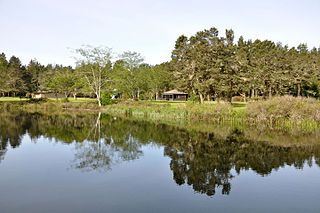
The Skipanon River is a tributary of the Columbia River, approximately 7 miles (11 km) long, on the Pacific coast of northwest Oregon in the United States. It is the last tributary of the Columbia on the Oregon side, draining an area of coastal bottom land bordered by sand dunes and entering the river from the south at its mouth west of Astoria.
The Wallooskee River is a tributary of the Youngs River, about 10 miles (16 km) long, in northwest Oregon in the United States. It drains a small area of the foothills of the Coast Range near the mouth of the Columbia River. The Youngs River is a tributary of the Columbia River.

The Necanicum River is a river on the Pacific coast of northwest Oregon in the United States, approximately 21 miles (34 km) long. It drains a timber-producing area of the Northern Oregon Coast Range northwest of Portland. It forms the first estuary south of the mouth of the Columbia River along the Oregon Coast, reaching the Pacific Ocean at Seaside in Clatsop County.

The Clatsop Plains are an area of wetlands and sand dunes between the Northern Oregon Coast Range and Pacific Ocean in northwestern Oregon in the United States. They stretch from near the mouth of the Columbia River south to the vicinity of Tillamook Head near Seaside. The plains are drained by several coastal rivers include the Skipanon River and the Necanicum River, which flow parallel to the coast and empty into the Columbia at Youngs Bay near Astoria and into the Pacific Ocean near Seaside respectively. At the time, the Lewis and Clark expedition recorded a different river draining the plains which entered the Pacific near the current day Camp Rilea Armed Forces Training Center. Research, 200 years later in 2005, seems to have confirmed this by locating an old river channel.

The John Day River is a tributary of the Columbia River, approximately 6 miles (10 km) long, in northwestern Oregon in the United States. The river rises in the Northern Oregon Coast Range in Clatsop County at 46.138889°N 123.704722°W.

Seneca Creek is a 5.8-mile-long (9.3 km) stream in Montgomery County, Maryland, USA, roughly 16 miles (26 km) northwest of Washington, D.C. It drains into the Potomac River.

Perry Lake is a US Army Corps of Engineers operated reservoir in northeast Kansas. Its primary purposes are flood control, water reserve for nearby areas and regional recreation. The lake is approximately 11,150 acres (45 km²) in size, with over 160 miles (260 km) of shoreline. Perry Lake's full multi-purpose pool elevation is 891.5 feet (271.7 m) above sea level. Perry Lake is located about 40 miles (64 km) west of Kansas City, just northwest of Lawrence, Kansas. Its close proximity to Kansas City, Lawrence, and the state capitol, Topeka, make it a very popular destination, with the nickname "Paradise on the Plains".

The Withlacoochee River originates in central Florida's Green Swamp, east of Polk City. It flows west, then north, and then turns northwest and finally west again before it empties into the Gulf of Mexico near Yankeetown. The river is 141 miles (227 km) long and has a drainage basin of 1,170 square miles (3,000 km2). It is believed to have been named after the Withlacoochee River to the north.
Lamoka Lake, previously known as Mud Lake, is a small crescent-shaped lake in the western part of New York state. The lake is located at the border of Schuyler County and Steuben County. Most of the lake is in Schuyler County with only a small part, called "Mill Pond," at the southwest corner in Steuben County.

The Little River is a 29.3-mile-long (47.2 km) tributary of the Etowah River in the U.S. state of Georgia in the United States.
Blue Cypress Lake, originally called Lake Wilmington, is a lake in Indian River County of the Treasure Coast in Florida. It is the largest lake in the Treasure Coast and Indian River County. It is the headwaters lake of the St. Johns River. The sources of water are several creeks from the south, two from the west, and Moonshine Bay from the North that flow into the lake. All the water flows out of the lake to the northwest into M Canal and Zigzag Canal. The lake is over 6,500 acres (26 km²) in size, 21 mi (34 km) in circumference, and has an average depth of 8 feet. The lake is 2,100 acres (8.7 km²) larger than Lake Washington, 27 mi (43 km) north of this lake. The lake's name comes from the blue appearance of the cypress trees as the morning sun's rays reflect off the water. A fishing camp called Middletons Fish Camp is 4 mi (6 km) off State Road 60. The Blue Cypress Village is south of the small boat canal from the fish camp.

Clatsop Spit is a giant sand spit on the Pacific coast along U.S. Route 101 between Astoria and the north end of Tillamook Head in Clatsop County, northwest Oregon at the mouth of the Columbia River. The Clatsop Spit was formed by Columbia River sediment brought to the coast by the river flow after the last ice age ended approximately 8500 years ago and the ocean level rose. Here it was worked over and shaped by the wind and the waves until a vast and sandy plain was formed. In regular conversation, referring to Clatsop Spit usually refers to the northern end of the spit: the area that is bound by the Pacific to the west and the Columbia River to the northeast. In the past, the spit was known as Clatsop Sands.

Olney is an unincorporated community and former company town in Clatsop County, Oregon, United States, on Oregon Route 202 approximately eight miles south of Astoria. Olney is located at 46.100109°N 123.757637°W. Its post office is assigned ZIP code 97325.
Eel Lake is large, deep lake in a chain of water bodies along the Oregon Coast south of the Umpqua River in the United States. The chain includes other large lakes—Clear, North Tenmile, and Tenmile—as well as smaller lakes, which drain into the Pacific Ocean via Tenmile Creek.

