Related Research Articles

The Mount Hood Corridor is a part of Oregon between Sandy and Government Camp, in Clackamas County. It is named after Mount Hood and has served travelers going in both directions since the days of Native Americans and Oregon Trail migrants. The area between Alder Creek and Government Camp is sometimes known as Hoodland.

The Pudding River is a 62-mile (100 km) tributary of the Molalla River in the U.S. state of Oregon. Its drainage basin covers 528 square miles (1,368 km2). Among its tributaries are Silver Creek, Butte Creek, Abiqua Creek, and the Little Pudding River.
The Big River is a tributary of the Coast Fork Willamette River, approximately 12 miles (19 km) long, in western Oregon in the United States. It drains an area of the Calapooya Mountains south of Eugene.

The South Santiam River is a tributary of the Santiam River, about 69 miles (111 km) long, in western Oregon in the United States. It drains an area of the Cascade Range into the Willamette Valley east of Corvallis.
Steamboat Creek is a short tributary of the North Umpqua River in southwestern Oregon in the United States. Approximately 35 kilometres (22 mi) long, the creek is located on a remote part of the upper North Umpqua in the Calapooia Mountains west of the Cascade Range. It rises in southeastern Lane County at 43.5601214°N 122.5519948°W and flows southwest to join the North Umpqua from the north at Steamboat.

Toketee Falls is a waterfall in Douglas County, Oregon, United States, on the North Umpqua River at its confluence with the Clearwater River. It is located approximately 58 miles (93 km) east of Roseburg near Oregon Route 138.

Watson Falls is a 272-foot (83 m) waterfall on Watson Creek, a tributary of the Clearwater River, in Douglas County in the U.S. state of Oregon. It is located at an elevation of 3,353 feet (1,022 m).

Bull Run is an unincorporated community in Clackamas County, Oregon, United States. It is located about 5 miles (8.0 km) northeast of Sandy, near the Bull Run River and the powerhouse of the defunct Mount Hood Railway and Power Company.

Fall Creek is an unincorporated community in Lane County, Oregon, United States, southeast of Eugene/Springfield. Nearby communities include Dexter to the south, Lowell to the southeast, and Jasper to the northwest.

The Row River is a river, approximately 20 miles (32 km) long, in Lane County, Oregon, United States. It rises in the Cascade Range and flows into the Coast Fork Willamette River near Cottage Grove. The stream was originally known as the "East Fork Coast Fork", but was later renamed after a dispute between neighbors and brothers-in-law George Clark and Joseph Southwell over "trespassing" livestock. Clark was killed as a result of the row. The name rhymes with "cow" rather than with "slow". A post office named Row River operated from 1911 to 1914 a little north of the present site of Dorena at 43.740123°N 122.880347°W.

Stewart Bridge is a Howe truss covered bridge built in 1930 near Walden, Oregon, United States, in Lane County. It was listed on the National Register of Historic Places in 1979. It is 60 feet (18 m) long and crosses Mosby Creek, a tributary of the Row River.
Culp Creek is an unincorporated community in Lane County, Oregon, United States, southeast of Cottage Grove on the Row River. It lies on Row River Road between Dorena and Disston.
Steamboat is an unincorporated community in Douglas County, Oregon, United States. It is located about 39 miles east of Roseburg on Oregon Route 138, near the confluence of the North Umpqua River with Steamboat Creek within the Umpqua National Forest.
Swagger Creek is a stream in Clackamas County, Oregon, in the United States. It is a tributary of Clear Creek.
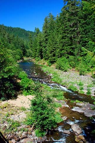
Sharps Creek is a tributary of the Row River in Lane County, in the U.S. state of Oregon. It begins near Bohemia Mountain and the Calapooia Divide of the Cascade Range and flows generally northwest to meet the river. Much of its course lies within the Umpqua National Forest. Sharps Creek enters the Row River at the unincorporated community of Culp Creek, about 12 miles (19 km) southeast of Cottage Grove.
Bernhardt Creek is a stream in Lane County, Oregon, in the United States. The creek was named for the Bernhardt family of early settlers. It flows mostly west-northwest to its mouth at the Siuslaw River about 4.5 miles (7.2 km) east of Florence.
Wildwood is an unincorporated community in Lane County, Oregon, United States. It is located between Culp Creek and Disston on the former line of the Oregon, Pacific and Eastern Railway (OP&E), about 16 miles southeast of Cottage Grove.
Myrtle Creek is a short tributary of the South Umpqua River in Douglas County in the U.S. state of Oregon. Its main stem, formed by the confluence of two forks just south of the city of Myrtle Creek, is only about 1 mile (1.6 km) long. Its only named tributaries are the two forks, North Myrtle Creek and South Myrtle Creek, each of which is much longer than the main stem.
Culp Branch is a stream in Oregon County in the U.S. state of Missouri. It is a tributary to Piney Creek.
References
- 1 2 "Culp Creek". Geographic Names Information System . United States Geological Survey, United States Department of the Interior. 28 November 1980. Retrieved 5 September 2015.
- ↑ "Indians, Surveyors, Incidents Gave Names to Streams, Lakes and Mountains". Eugene Register-Guard . 4 January 1942. p. 5. Retrieved 23 April 2015.
43°42′02″N122°50′57″W / 43.70056°N 122.84917°W
| | This Lane County, Oregon state location article is a stub. You can help Wikipedia by expanding it. |