Curry Canyon (Utah)

Last updated

Curry Canyon is a canyon on the eastern edge of Emery County, Utah, United States. [1]

Emery County, Utah County in the United States

Emery County is a county located in east-central Utah, United States. As of the 2010 census, the population was 10,976. Its county seat is Castle Dale, and the largest city is Huntington. The county was named for George W. Emery, governor of the Utah Territory in 1875.
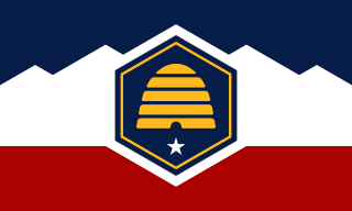
Utah A state of the United States of America

Utah is a state in the western United States. It became the 45th state admitted to the U.S. on January 4, 1896. Utah is the 13th-largest by area, 31st-most-populous, and 10th-least-densely populated of the 50 United States. Utah has a population of more than 3 million according to the Census estimate for July 1, 2016. Urban development is mostly concentrated in two areas: the Wasatch Front in the north-central part of the state, which contains approximately 2.5 million people; and Washington County in Southern Utah, with over 160,000 residents. Utah is bordered by Colorado to the east, Wyoming to the northeast, Idaho to the north, Arizona to the south, and Nevada to the west. It also touches a corner of New Mexico in the southeast.

United States federal republic in North America

The United States of America (USA), commonly known as the United States or America, is a country composed of 50 states, a federal district, five major self-governing territories, and various possessions. At 3.8 million square miles, the United States is the world's third or fourth largest country by total area and is slightly smaller than the entire continent of Europe's 3.9 million square miles. With a population of over 327 million people, the U.S. is the third most populous country. The capital is Washington, D.C., and the largest city by population is New York City. Forty-eight states and the capital's federal district are contiguous in North America between Canada and Mexico. The State of Alaska is in the northwest corner of North America, bordered by Canada to the east and across the Bering Strait from Russia to the west. The State of Hawaii is an archipelago in the mid-Pacific Ocean. The U.S. territories are scattered about the Pacific Ocean and the Caribbean Sea, stretching across nine official time zones. The extremely diverse geography, climate, and wildlife of the United States make it one of the world's 17 megadiverse countries.

Contents

Description

The canyon is a side canyon of Gray Canyon, on the north side of Big Horn Mountain. The mouth of Curry Canyon is on the west bank of the Green River and extends southwest from the Gray Canyon toward Big Horn Mountain. [2]

Bank (geography) in geography, area between high and low tide marks

In geography, the word bank generally refers to the land alongside a body of water. Different structures are referred to as banks in different fields of geography, as follows.

Green River (Colorado River tributary) tributary of the Colorado River in the western United States

The Green River, located in the western United States, is the chief tributary of the Colorado River. The watershed of the river, known as the Green River Basin, covers parts of Wyoming, Utah, and Colorado. The Green River is 730 miles (1,170 km) long, beginning in the Wind River Mountains of Wyoming and flowing through Wyoming and Utah for most of its course, except for 40 miles (64 km) into western Colorado. Much of the route is through the Colorado Plateau and through some of the most spectacular canyons in the United States. It is only slightly smaller than the Colorado when the two rivers merge, but typically carries a larger load of silt. The average yearly mean flow of the river at Green River, Utah is 6,121 cubic feet (173.3 m3) per second.

Curry Canyon was named for a family of criminals who lived and died near that point. [3]

See also

Related Research Articles

Wasatch Range mountain range in northern Utah, Untied States

The Wasatch Range is a mountain range that stretches approximately 160 miles (260 km) from the Utah-Idaho border, south through central Utah in the western United States. It is the western edge of the greater Rocky Mountains, and the eastern edge of the Great Basin region. The northern extension of the Wasatch Range, the Bear River Mountains, extends just into Idaho, constituting all of the Wasatch Range in that state.

Little Bighorn River river in the United States of America

The Little Bighorn River is a 138-mile-long (222 km) tributary of the Bighorn River in the United States in the states of Montana and Wyoming. The Battle of the Little Bighorn, also known as the Battle of the Greasy Grass, was fought on its banks on June 25, in 1876, as well as the Battle of Crow Agency in 1887.

Keetley, Utah ghost town in Wasatch County, Utah, United States

Keetley is a ghost town located in northeastern Wasatch County, Utah, United States.

The Roan Cliffs are a series of desert mountains and cliffs in eastern Utah and western Colorado, in the western United States that are distinct from the Book Cliffs.

Price River river in the United States of America

The Price River is a river in eastern Utah, United States.

White Canyon (San Juan County, Utah) canyon in San Juan County, Utah, United States

White Canyon is a canyon in San Juan County, Utah, United States.

Harker Canyon (Tooele County, Utah)

Harker Canyon is located 10 km (6.2 mi) south of the town of Vernon, in Tooele County, Utah, USA. The canyon is oriented east-west on the southern side of the Sheeprock Mountains, a small mountain group in the larger Wasatch Range. The canyon is entirely encompassed by the boundaries of the Wasatch-Cache National Forest, and is accessible from Harker Road by a forest road designated NF 586. There are many abandoned mines in the canyon. Bird watching and horseback riding are popular recreational activities in the canyon.

Minnie Maud river in the United States of America

Minnie Maud is the name of a creek and canyon in eastern Utah that is noted as the western starting point of the Nine Mile Canyon petroglyphs section. Minnie Maud Creek is a stream whose headwaters begin where the Western Tavaputs and Wasatch Plateau meet the Uinta Mountains.

Trout Creek, Utah Unincorporated community in Utah, United States

Trout Creek is a small farming unincorporated community, in far western Juab County, Utah, United States.

Temescal Mountains, formerly the Sierra Temescal, are one of the northernmost mountain ranges of the Peninsular Ranges in western Riverside County, in Southern California in the United States. They extend for approximately 25 mi (40 km) southeast of the Santa Ana River east of the Elsinore Fault Zone to the Temecula Basin and form the western edge of the Perris Block.

Peteetneet Creek river in the United States of America

Peteetneet Creek is a stream in Payson Canyon, south of Payson, Utah, United States.

Crouse Creek is a stream in the Uinta Mountains near the eastern edge of Daggett County, Utah, United States.

Crystal Canyon is a canyon on the northeastern edge of Juab County, Utah, United States.

Cunningham Wash is a wash in eastern Beaver County, Utah, United States.

Davis Lakes is a group of lakes near the northern edge of Duchesne County, Utah, United States.

Days Canyon is a canyon in the Wasatch Range in eastern Utah County, Utah, United States.

Dead Ox Canyon is a canyon in southern Morgan County, Utah, United States.

Diamond Gulch is a gulch in eastern Juab County, Utah, United States.

Currant Creek (Juab and Utah counties, Utah)

Currant Creek is a stream in eastern Juab County and southern Utah County in northern Utah, United States.

References

  1. "Curry Canyon". Geographic Names Information System . United States Geological Survey.
  2. "MyTopo Maps - Curry Canyon, Utah, USA" (Map). mytopo.com. Trimble Navigation, Ltd. Retrieved 16 Feb 2018.
  3. Van Cott, John W. (1990). Utah Place Names: A Comprehensive Guide to the Origins of Geographic Names: A Compilation. Salt Lake City: University of Utah Press. p. 99. ISBN   978-0-87480-345-7. OCLC   797284427 . Retrieved 16 Feb 2018.

Coordinates: 39°16′25″N110°04′44″W / 39.2735777°N 110.0787581°W / 39.2735777; -110.0787581

Geographic coordinate system Coordinate system

A geographic coordinate system is a coordinate system that enables every location on Earth to be specified by a set of numbers, letters or symbols. The coordinates are often chosen such that one of the numbers represents a vertical position and two or three of the numbers represent a horizontal position; alternatively, a geographic position may be expressed in a combined three-dimensional Cartesian vector. A common choice of coordinates is latitude, longitude and elevation. To specify a location on a plane requires a map projection.