
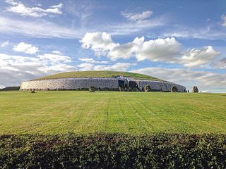
The Hill of Tara is a hill and ancient ceremonial and burial site near Skryne in County Meath, Ireland. Tradition identifies the hill as the inauguration place and seat of the High Kings of Ireland; it also appears in Irish mythology. Tara consists of numerous monuments and earthworks—dating from the Neolithic to the Iron Age—including a passage tomb, burial mounds, round enclosures, a standing stone, and a ceremonial avenue. There is also a church and graveyard on the hill. Tara forms part of a larger ancient landscape and Tara itself is a protected national monument under the care of the Office of Public Works, an agency of the Irish Government.

Rathcroghan is a complex of archaeological sites near Tulsk in County Roscommon, Ireland. It is identified as the site of Cruachan, the traditional capital of the Connachta, the prehistoric and early historic rulers of the western territory. The Rathcroghan Complex is a unique archaeological landscape with many references found in early Irish medieval manuscripts.

Ringforts, ring forts or ring fortresses are circular fortified settlements that were mostly built during the Bronze Age up to about the year 1000. They are found in Northern Europe, especially in Ireland. There are also many in South Wales and in Cornwall, where they are called rounds. Ringforts come in many sizes and may be made of stone or earth. Earthen ringforts would have been marked by a circular rampart, often with a stakewall. Both stone and earthen ringforts would generally have had at least one building inside.
The prehistory of Ireland has been pieced together from archaeological evidence, which has grown at an increasing rate over the last decades. It begins with the first evidence of permanent human residence in Ireland around 10,500 BC and finishes with the start of the historical record around 400 AD. Both the beginning and end dates of the period are later than for much of Europe and all of the Near East. The prehistoric period covers the Palaeolithic, Mesolithic, Neolithic, Bronze Age and Iron Age societies of Ireland. For much of Europe, the historical record begins when the Romans invaded; as Ireland was not invaded by the Romans its historical record starts later, with the coming of Christianity.

The Turoe stone is a granite stone decorated in a Celtic style located in the village of Bullaun, County Galway, Ireland, 6 km north of Loughrea off the R350 regional road. It probably dates to about the period 100 BC to 100 AD. The stone is positioned in a covered protective structure on the lawn in front of Turoe House, set in a concrete base surrounded by a metal cattle grill. The Turoe stone is National Monument of Ireland Nr. 327 (NM#327)

Thomas Johnson Westropp was an Irish antiquarian, folklorist and archaeologist.
Edward Martyn Jope was an English archaeologist and chemist. He worked temporarily during the Second World War as a biochemist. Following the war, he returned to working in archaeology, first as a medievalist and later as a prehistorian.

Rathgall, or the Ring of the Rath is a large multivallate hill fort near the town of Shillelagh. Dating from the Bronze Age, it consists of three roughly concentric stone ramparts with a fourth masonry wall dating from the Medieval period at its centre. Rathgall is a National Monument which is in state care.
Mullaghreelan Rath is a ringfort (rath) and National Monument located in County Kildare, Ireland.
Aghaderrard Court Tomb is a court cairn and National Monument located in County Leitrim, Ireland.

Altar Wedge Tomb is a wedge-shaped gallery grave and National Monument located outside the village of Schull, in County Cork, Ireland.
Carntierna is a ringfort and National Monument located in County Cork, Ireland.
The Coolcoulaghta Standing Stones are a pair of standing stones forming a stone row and National Monument located in County Cork, Ireland.

Ardagh Fort is a ringfort (rath) and National Monument in County Limerick, Ireland, famous as the discovery site of the Ardagh Hoard.
Breeny More Stone Circle is an axial stone circle and National Monument located in County Cork, Ireland.

Loher Cashel is a stone ringfort (cashel) and National Monument located on the Iveragh Peninsula, Ireland.

Annagh Church is a medieval church and National Monument in County Kerry, Ireland.
Maughanasilly Stone Row is a stone row and National Monument located in County Cork, Ireland.

Rahinnane Castle is a tower house and National Monument located in County Kerry, Ireland.

Dísert Óengusa is a medieval hermitage and National Monument located in County Limerick, Ireland.
