
Tohickon Creek is a 29.5-mile-long (47.5 km) tributary of the Delaware River. Located entirely in Bucks County, in southeastern Pennsylvania, it rises in Springfield Township and has its confluence with the Delaware at Point Pleasant. It is dammed to form Lake Nockamixon.
Neshaminy Creek is a 40.7-mile-long (65.5 km) stream that runs entirely through Bucks County, Pennsylvania, rising south of the borough of Chalfont, where its north and west branches join. Neshaminy Creek flows southeast toward Bristol Township and Bensalem Township to its confluence with the Delaware River.

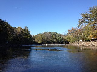
Pleasant Valley is an unincorporated community in Springfield Township, Bucks County, Pennsylvania, United States.
Mill Creek is a tributary of Neshaminy Creek, one of three tributaries of the Neshaminy which all share the same name, and one of six in Bucks County, Pennsylvania which share the name. The Geographic Name Information System I.D. is 1181118, U.S. Department of the Interior Geological Survey I.D. is 02596.
Robin Run is a dammed headwater major tributary of the Delaware River with a drainage area of 22.69 square miles that is 1.69 miles north 1.69 miles north of Mill Creek's Confluence with the Neshaminy Creek on the border of Buckingham and Wrightstown Townships), The headwaters originate in Buckingham Township, Bucks County, Pennsylvania and the stream flows generally southeast to its confluence with Mill Creek in Wrightstown Township.
Lahaska Creek is a tributary of Mill Creek in Wrightstown Township, Bucks County, Pennsylvania. The Geographic Name Information System I.D. is 1178763, U.S. Department of the Interior Geological Survey I.D. is 02632.
West Branch Neshaminy Creek is one of two branches of the Neshaminy Creek, the other being the North Branch, part of the Delaware River watershed. It is located in Bucks and Montgomery Counties in Pennsylvania.
Queen Anne Creek is a tributary of Mill Creek, part of the Delaware River drainage basin in Bucks County, Pennsylvania. Rising just north of Fallsington, it meets with its confluence with Mill Creek in Bristol Township.

Pidcock Creek is a tributary of the Delaware River in Bucks County, Pennsylvania. Rising in Buckingham Township, it flows into the Delaware in Solebury Township after a short side trip within Upper Makefield Township.
Dark Hollow Run is a tributary of the Delaware River contained wholly within Solebury Township, Bucks County, Pennsylvania, meeting with the Delaware south of New Hope.

Aquetong Creek is a tributary of the Delaware River in Solebury Township and New Hope, Bucks County, Pennsylvania. Rising from the Aquetong Spring, now known as Ingham Spring, just south of the intersection of U.S. Route 202, Lower Mountain Road, and Ingham Road, it runs about 10.75 miles (17.30 km) to its confluence with the Delaware.
Paunnacussing Creek is a tributary of the Delaware River contained wholly within Bucks County, Pennsylvania in the United States. It rises from a pond north of Mechanicsville, in Buckingham Township and drains into the Delaware at Bull Island just upstream of Lumberville in Solebury Township.
Hickory Creek is a tributary of the Delaware River in Plumstead Township, Bucks County, Pennsylvania, in the United States.
Geddes Run is a tributary of the Tohickon Creek contained wholly within Plumstead Township, Bucks County, Pennsylvania, in the United States.
Deep Run is a tributary of the Tohickon Creek in Bedminster Township, Bucks County, Pennsylvania in the United States.
Beaver Creek is a tributary of Tinicum Creek in Bridgeton, Nockamixon, and Tinicum Townships in Bucks County, Pennsylvania, in the United States. The creek is part of the Delaware River watershed.
Gallows Run is a tributary of the Delaware River in Springfield and Nockamixon Townships, in Bucks County, Pennsylvania in the United States.
Rodges Run is a tributary of the Delaware River in Durham Township, Bucks County, Pennsylvania in the United States.

Cooks Creek is a tributary of the Delaware River in Bucks County, Pennsylvania, in the United States, rising in Springfield Township and passing through Durham Township before emptying into the Pennsylvania Canal and the Delaware.
Bennetts Corner is a populated place in Solebury Township, Bucks County, Pennsylvania at the intersection of Edison Furlong Road and Pebble Hill Road about 2 miles (3.2 km) southeast of Doylestown.
