
The Canal through Walcheren in the Netherlands crosses the east of Walcheren. It connects the Westerschelde and the Oosterschelde.

Westfalenhallen are three multi-purpose venues located in Dortmund, Germany. The original building was opened in 1925, but was destroyed during World War II. New halls were built, the Große Westfalenhalle opened in 1952. The capacity of the arena is 16,500. The Kleine Westfalenhalle served also for balls, exhibitions and concerts, such as the Dortmunder Philharmoniker, until the Opernhaus Dortmund was opened in 1966.

Jegłowa is a village in the administrative district of Gmina Przeworno, within Strzelin County, Lower Silesian Voivodeship, in south-western Poland. Prior to 1945 it was in Germany.
Ściokła is a village in the administrative district of Gmina Sztabin, within Augustów County, Podlaskie Voivodeship, in north-eastern Poland. It lies approximately 7 kilometres (4 mi) north-east of Sztabin, 19 km (12 mi) south-east of Augustów, and 69 km (43 mi) north of the regional capital Białystok.
Grabica is a village in Piotrków County, Łódź Voivodeship, in central Poland. It is the seat of the gmina called Gmina Grabica. It lies approximately 15 kilometres (9 mi) north-west of Piotrków Trybunalski and 33 km (21 mi) south of the regional capital Łódź.
Grzebień is a village in the administrative district of Gmina Radomsko, within Radomsko County, Łódź Voivodeship, in central Poland. It lies approximately 6 kilometres (4 mi) south-east of Radomsko and 84 km (52 mi) south of the regional capital Łódź.
Rachanie-Kolonia is a settlement in the administrative district of Gmina Rachanie, within Tomaszów Lubelski County, Lublin Voivodeship, in eastern Poland. It lies approximately 4 kilometres (2 mi) west of Rachanie, 12 km (7 mi) north-east of Tomaszów Lubelski, and 102 km (63 mi) south-east of the regional capital Lublin.
Brzeźnica-Wola is a village in the administrative district of Gmina Dębica, within Dębica County, Subcarpathian Voivodeship, in south-eastern Poland. It lies approximately 8 kilometres (5 mi) north-east of Dębica and 38 km (24 mi) west of the regional capital Rzeszów.
Zemborzyn Kościelny is a village in the administrative district of Gmina Tarłów, within Opatów County, Świętokrzyskie Voivodeship, in south-central Poland.
Kępa Podwierzbiańska is a village in the administrative district of Gmina Maciejowice, within Garwolin County, Masovian Voivodeship, in east-central Poland.
Daniłówka Pierwsza is a village in the administrative district of Gmina Małkinia Górna, within Ostrów Mazowiecka County, Masovian Voivodeship, in east-central Poland.
Białuty is a village in the administrative district of Gmina Gozdowo, within Sierpc County, Masovian Voivodeship, in east-central Poland.
Psota is a settlement in the administrative district of Gmina Lutocin, within Żuromin County, Masovian Voivodeship, in east-central Poland.
Jakubowo is a village in the administrative district of Gmina Pniewy, within Szamotuły County, Greater Poland Voivodeship, in west-central Poland.
Kiełpin is a village in the administrative district of Gmina Lipka, within Złotów County, Greater Poland Voivodeship, in west-central Poland. It lies approximately 13 kilometres (8 mi) west of Lipka, 16 km (10 mi) north of Złotów, and 122 km (76 mi) north of the regional capital Poznań.
Jabłonka is a settlement in the administrative district of Gmina Chojnice, within Chojnice County, Pomeranian Voivodeship, in northern Poland. It lies approximately 8 kilometres (5 mi) north-east of Chojnice and 96 km (60 mi) south-west of the regional capital Gdańsk.
Darżewo is a village in the administrative district of Gmina Nowa Wieś Lęborska, within Lębork County, Pomeranian Voivodeship, in northern Poland. It lies approximately 13 kilometres (8 mi) south-west of Nowa Wieś Lęborska, 14 km (9 mi) south-west of Lębork, and 71 km (44 mi) west of the regional capital Gdańsk.
Nowe Chmielówko is a settlement in the administrative district of Gmina Zalewo, within Iława County, Warmian-Masurian Voivodeship, in northern Poland. It lies approximately 14 kilometres (9 mi) south of Zalewo, 17 km (11 mi) north of Iława, and 57 km (35 mi) west of the regional capital Olsztyn.
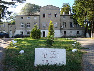
Stawno is a village in the administrative district of Gmina Goleniów, within Goleniów County, West Pomeranian Voivodeship, in north-western Poland. It lies approximately 9 kilometres (6 mi) south-east of Goleniów and 23 km (14 mi) north-east of the regional capital Szczecin. Before 1945, the village was part of Germany. It has an approximate population of 110.
Berovci is a village in Municipality of Prilep, Republic of Macedonia.


