
Biernaty Średnie is a village in the administrative district of Gmina Łosice, within Łosice County, Masovian Voivodeship, in east-central Poland. It lies approximately 4 kilometres (2 mi) west of Łosice and 114 km (71 mi) east of Warsaw.
Chotycze is a village in the administrative district of Gmina Łosice, within Łosice County, Masovian Voivodeship, in east-central Poland. It lies approximately 5 kilometres (3 mi) east of Łosice and 122 km (76 mi) east of Warsaw.
Czuchleby is a village in the administrative district of Gmina Łosice, within Łosice County, Masovian Voivodeship, in east-central Poland. It lies approximately 7 kilometres (4 mi) north-east of Łosice and 123 km (76 mi) east of Warsaw.
Dzięcioły is a village in the administrative district of Gmina Łosice, within Łosice County, Masovian Voivodeship, in east-central Poland. It lies approximately 6 kilometres (4 mi) north-east of Łosice and 121 km (75 mi) east of Warsaw.
Łuzki is a village in the administrative district of Gmina Łosice, within Łosice County, Masovian Voivodeship, in east-central Poland. It lies approximately 8 kilometres (5 mi) south-east of Łosice and 124 km (77 mi) east of Warsaw.
Meszki is a village in the administrative district of Gmina Łosice, within Łosice County, Masovian Voivodeship, in east-central Poland. It lies approximately 6 kilometres (4 mi) east of Łosice and 123 km (76 mi) east of Warsaw.
Niemojki is a village in the administrative district of Gmina Łosice, within Łosice County, Masovian Voivodeship, in east-central Poland. It lies approximately 6 kilometres (4 mi) north of Łosice and 117 km (73 mi) east of Warsaw.
Nowosielec is a village in the administrative district of Gmina Łosice, within Łosice County, Masovian Voivodeship, in east-central Poland. It lies approximately 4 kilometres (2 mi) north of Łosice and 119 km (74 mi) east of Warsaw.
Prusy is a village in the administrative district of Gmina Łosice, within Łosice County, Masovian Voivodeship, in east-central Poland. It lies approximately 7 kilometres (4 mi) north-east of Łosice and 121 km (75 mi) east of Warsaw.
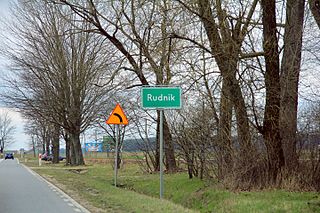
Rudnik is a village in the administrative district of Gmina Łosice, within Łosice County, Masovian Voivodeship, in east-central Poland. It lies approximately 4 kilometres (2 mi) south-west of Łosice and 114 km (71 mi) east of Warsaw.
Świniarów is a village in the administrative district of Gmina Łosice, within Łosice County, Masovian Voivodeship, in east-central Poland. It lies approximately 3 kilometres (2 mi) north-east of Łosice and 119 km (74 mi) east of Warsaw.
Toporów is a village in the administrative district of Gmina Łosice, within Łosice County, Masovian Voivodeship, in east-central Poland. It lies approximately 6 kilometres (4 mi) east of Łosice and 122 km (76 mi) east of Warsaw.
Zakrze is a village in the administrative district of Gmina Łosice, within Łosice County, Masovian Voivodeship, in east-central Poland. It lies approximately 3 kilometres (2 mi) north-west of Łosice and 116 km (72 mi) east of Warsaw.
Chłopków is a village in the administrative district of Gmina Platerów, within Łosice County, Masovian Voivodeship, in east-central Poland. It lies approximately 6 kilometres (4 mi) south-east of Platerów, 12 km (7 mi) north-east of Łosice, and 128 km (80 mi) east of Warsaw.
Binduga is a village in the administrative district of Gmina Sarnaki, within Łosice County, Masovian Voivodeship, in east-central Poland. It lies approximately 4 kilometres (2 mi) north of Sarnaki, 18 km (11 mi) north-east of Łosice, and 128 km (80 mi) east of Warsaw.
Klimczyce is a village in the administrative district of Gmina Sarnaki, within Łosice County, Masovian Voivodeship, in east-central Poland. It lies approximately 5 kilometres (3 mi) north-west of Sarnaki, 18 km (11 mi) north-east of Łosice, and 127 km (79 mi) east of Warsaw.
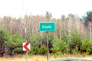
Kózki is a village in the administrative district of Gmina Sarnaki, within Łosice County, Masovian Voivodeship, in east-central Poland. It lies approximately 4 kilometres (2 mi) north of Sarnaki, 19 km (12 mi) north-east of Łosice, and 130 km (81 mi) east of Warsaw.
Rozwadów is a village in the administrative district of Gmina Sarnaki, within Łosice County, Masovian Voivodeship, in east-central Poland. It lies approximately 3 kilometres (2 mi) north-east of Sarnaki, 19 km (12 mi) north-east of Łosice, and 132 km (82 mi) east of Warsaw.
Stare Hołowczyce is a village in the administrative district of Gmina Sarnaki, within Łosice County, Masovian Voivodeship, in east-central Poland. It lies approximately 5 kilometres (3 mi) east of Sarnaki, 20 km (12 mi) north-east of Łosice, and 134 km (83 mi) east of Warsaw.
Wygnanki is a village in the administrative district of Gmina Stara Kornica, within Łosice County, Masovian Voivodeship, in east-central Poland. It lies approximately 17 kilometres (11 mi) south-east of Łosice and 132 km (82 mi) east of Warsaw.


