Kalinowiec is a village in the administrative district of Gmina Bądkowo, within Aleksandrów County, Kuyavian-Pomeranian Voivodeship, in north-central Poland. It lies 17 kilometres (11 mi) south-east of Aleksandrów Kujawski and 36 km (22 mi) south-east of Toruń.
Bolumin is a village in the administrative district of Gmina Dąbrowa Chełmińska, within Bydgoszcz County, Kuyavian-Pomeranian Voivodeship, in north-central Poland. It lies approximately 5 kilometres (3 mi) south of Dąbrowa Chełmińska, 20 km (12 mi) east of Bydgoszcz, and 26 km (16 mi) north-west of Toruń.
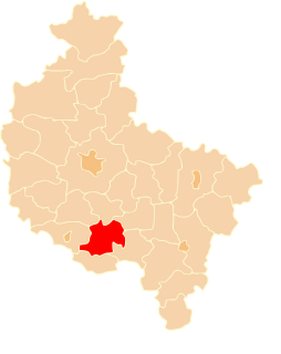
Komaszówka is a village in the administrative district of Gmina Sztabin, within Augustów County, Podlaskie Voivodeship, in north-eastern Poland. It lies approximately 8 kilometres (5 mi) north-east of Sztabin, 20 km (12 mi) south-east of Augustów, and 69 km (43 mi) north of the regional capital Białystok.
Motułka is a village in the administrative district of Gmina Sztabin, within Augustów County, Podlaskie Voivodeship, in north-eastern Poland. It lies approximately 10 kilometres (6 mi) north-west of Sztabin, 13 km (8 mi) south of Augustów, and 70 km (43 mi) north of the regional capital Białystok.
Bugaj is a village in the administrative district of Gmina Działoszyn, within Pajęczno County, Łódź Voivodeship, in central Poland. It lies approximately 5 kilometres (3 mi) north-west of Działoszyn, 12 km (7 mi) west of Pajęczno, and 84 km (52 mi) south-west of the regional capital Łódź.
Kocierzowy is a village in the administrative district of Gmina Gomunice, within Radomsko County, Łódź Voivodeship, in central Poland. It lies approximately 5 kilometres (3 mi) south-east of Gomunice, 11 km (7 mi) north-east of Radomsko, and 71 km (44 mi) south of the regional capital Łódź.
Żencin is a village in the administrative district of Gmina Kodrąb, within Radomsko County, Łódź Voivodeship, in central Poland. It lies approximately 6 kilometres (4 mi) north-east of Kodrąb, 18 km (11 mi) north-east of Radomsko, and 72 km (45 mi) south of the regional capital Łódź.
Kolonia Lgota is a village in the administrative district of Gmina Lgota Wielka, within Radomsko County, Łódź Voivodeship, in central Poland. It lies approximately 2 kilometres (1 mi) west of Lgota Wielka, 14 km (9 mi) north-west of Radomsko, and 72 km (45 mi) south of the regional capital Łódź.
Chrusty is a village in the administrative district of Gmina Rawa Mazowiecka, within Rawa County, Łódź Voivodeship, in central Poland. It lies approximately 5 kilometres (3 mi) south-west of Rawa Mazowiecka and 51 km (32 mi) east of the regional capital Łódź.
Brzezinka is a village in the administrative district of Gmina Zabierzów, within Kraków County, Lesser Poland Voivodeship, in southern Poland. It lies approximately 4 kilometres (2 mi) north-west of Zabierzów and 17 km (11 mi) north-west of the regional capital Kraków.
Janów is a village in the administrative district of Gmina Tarłów, within Opatów County, Świętokrzyskie Voivodeship, in south-central Poland. It lies approximately 3 kilometres (2 mi) north-east of Tarłów, 33 km (21 mi) north-east of Opatów, and 81 km (50 mi) east of the regional capital Kielce.
Julianów is a village in the administrative district of Gmina Tarłów, within Opatów County, Świętokrzyskie Voivodeship, in south-central Poland. It lies approximately 5 kilometres (3 mi) south of Tarłów, 29 km (18 mi) north-east of Opatów, and 80 km (50 mi) east of the regional capital Kielce.
Sobótka is a village in the administrative district of Gmina Bliżyn, within Skarżysko County, Świętokrzyskie Voivodeship, in south-central Poland. It lies approximately 7 kilometres (4 mi) north-west of Bliżyn, 17 km (11 mi) west of Skarżysko-Kamienna, and 30 km (19 mi) north of the regional capital Kielce.
Kozietuły Nowe is a village in the administrative district of Gmina Mogielnica, within Grójec County, Masovian Voivodeship, in east-central Poland. It lies approximately 7 kilometres (4 mi) north-east of Mogielnica, 16 km (10 mi) south-west of Grójec, and 56 km (35 mi) south of Warsaw.

Makówiec Duży is a village in the administrative district of Gmina Dobre, within Mińsk County, Masovian Voivodeship, in east-central Poland. It lies approximately 5 kilometres (3 mi) north-east of Dobre, 22 km (14 mi) north-east of Mińsk Mazowiecki, and 53 km (33 mi) east of Warsaw.
Prędocin is a village in the administrative district of Gmina Iłża, within Radom County, Masovian Voivodeship, in east-central Poland. It lies approximately 6 kilometres (4 mi) east of Iłża, 31 km (19 mi) south of Radom, and 121 km (75 mi) south of Warsaw.
Roztropna is a village in the administrative district of Gmina Nowa Sucha, within Sochaczew County, Masovian Voivodeship, in east-central Poland.
Skrzynki is a village in the administrative district of Gmina Grabów nad Prosną, within Ostrzeszów County, Greater Poland Voivodeship, in west-central Poland. It lies approximately 4 kilometres (2 mi) south-east of Grabów nad Prosną, 14 km (9 mi) north-east of Ostrzeszów, and 133 km (83 mi) south-east of the regional capital Poznań.
Szlaga-Młyn is a settlement in the administrative district of Gmina Osiek, within Starogard County, Pomeranian Voivodeship, in northern Poland. It lies approximately 8 kilometres (5 mi) west of Osiek, 28 km (17 mi) south of Starogard Gdański, and 72 km (45 mi) south of the regional capital Gdańsk.
Wielimowo is a village in the administrative district of Gmina Miłomłyn, within Ostróda County, Warmian-Masurian Voivodeship, in northern Poland.