Teodorówka is a village in the administrative district of Gmina Biłgoraj, within Biłgoraj County, Lublin Voivodeship, in eastern Poland.
Myszkowiec is a village in the administrative district of Gmina Dorohusk, within Chełm County, Lublin Voivodeship, in eastern Poland, close to the border with Ukraine.

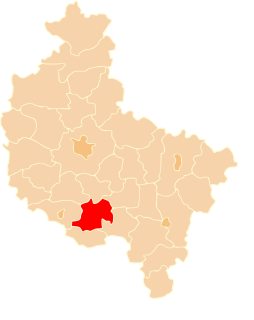
Kamionka Mała is a village in the administrative district of Gmina Laskowa, within Limanowa County, Lesser Poland Voivodeship, in southern Poland. It lies approximately 5 kilometres (3 mi) north-east of Laskowa, 11 km (7 mi) north-east of Limanowa, and 51 km (32 mi) south-east of the regional capital Kraków.
Kąty Pierwsze is a village in the administrative district of Gmina Szczebrzeszyn, within Zamość County, Lublin Voivodeship, in eastern Poland.

Dorotka is a village in the administrative district of Gmina Tarłów, within Opatów County, Świętokrzyskie Voivodeship, in south-central Poland. It lies approximately 5 kilometres (3 mi) east of Tarłów, 34 km (21 mi) north-east of Opatów, and 83 km (52 mi) east of the regional capital Kielce.
Zbrojów is a village in the administrative district of Gmina Bliżyn, within Skarżysko County, Świętokrzyskie Voivodeship, in south-central Poland. It lies approximately 4 kilometres (2 mi) west of Bliżyn, 15 km (9 mi) west of Skarżysko-Kamienna, and 26 km (16 mi) north of the regional capital Kielce.
Wawrzeńczyce is a village in the administrative district of Gmina Pawłów, within Starachowice County, Świętokrzyskie Voivodeship, in south-central Poland. It lies approximately 5 kilometres (3 mi) south of Pawłów, 14 km (9 mi) south of Starachowice, and 35 km (22 mi) east of the regional capital Kielce.
Murawskie-Czachy is a village in the administrative district of Gmina Boguty-Pianki, within Ostrów Mazowiecka County, Masovian Voivodeship, in east-central Poland. It lies approximately 6 kilometres (4 mi) north of Boguty-Pianki, 34 km (21 mi) east of Ostrów Mazowiecka, and 114 km (71 mi) north-east of Warsaw.
Zawisty-Dworaki is a village in the administrative district of Gmina Boguty-Pianki, within Ostrów Mazowiecka County, Masovian Voivodeship, in east-central Poland. It lies approximately 6 kilometres (4 mi) north of Boguty-Pianki, 36 km (22 mi) east of Ostrów Mazowiecka, and 115 km (71 mi) north-east of Warsaw.
Ostrów is a village in the administrative district of Gmina Celestynów, within Otwock County, Masovian Voivodeship, in east-central Poland. It lies approximately 7 kilometres (4 mi) north of Celestynów, 9 km (6 mi) east of Otwock, and 30 km (19 mi) south-east of Warsaw.
Łąkie is a village in the administrative district of Gmina Rakoniewice, within Grodzisk Wielkopolski County, Greater Poland Voivodeship, in west-central Poland. It lies approximately 6 kilometres (4 mi) south-west of Rakoniewice, 18 km (11 mi) south-west of Grodzisk Wielkopolski, and 58 km (36 mi) south-west of the regional capital Poznań.
Wrzosy is a village in the administrative district of Gmina Doruchów, within Ostrzeszów County, Greater Poland Voivodeship, in west-central Poland. It lies approximately 2 kilometres (1 mi) east of Doruchów, 8 km (5 mi) east of Ostrzeszów, and 136 km (85 mi) south-east of the regional capital Poznań.
Kokczyn Drugi is a village in the administrative district of Gmina Strzałkowo, within Słupca County, Greater Poland Voivodeship, in west-central Poland. It lies approximately 8 kilometres (5 mi) north of Strzałkowo, 10 km (6 mi) north-west of Słupca, and 59 km (37 mi) east of the regional capital Poznań.
Brzękowice Górne is a village in the administrative district of Gmina Psary, within Będzin County, Silesian Voivodeship, in southern Poland.
Stachowo is a settlement in Gmina Miastko, Bytów County, Pomeranian Voivodeship, in northern Poland. It lies approximately 17 kilometres (11 mi) west of Bytów, and 65 km (40 mi) south-west of Gdańsk.
Fiszewo is a settlement in the administrative district of Gmina Studzienice, within Bytów County, Pomeranian Voivodeship, in northern Poland. It lies approximately 9 kilometres (6 mi) east of Studzienice, 14 km (9 mi) east of Bytów, and 67 km (42 mi) south-west of the regional capital Gdańsk.
Będominek is a village in the administrative district of Gmina Kościerzyna, within Kościerzyna County, Pomeranian Voivodeship, in northern Poland. It lies approximately 9 kilometres (6 mi) east of Kościerzyna and 44 km (27 mi) south-west of the regional capital Gdańsk.
Piekło is a settlement in the administrative district of Gmina Kościerzyna, within Kościerzyna County, Pomeranian Voivodeship, in northern Poland. It lies approximately 10 kilometres (6 mi) south-east of Kościerzyna and 48 km (30 mi) south-west of the regional capital Gdańsk.
Tralewo is a village in the administrative district of Gmina Nowy Staw, within Malbork County, Pomeranian Voivodeship, in northern Poland. It lies approximately 4 kilometres (2 mi) south of Nowy Staw, 9 km (6 mi) north of Malbork, and 38 km (24 mi) south-east of the regional capital Gdańsk.
Derkacz is a settlement in the administrative district of Gmina Przybiernów, within Goleniów County, West Pomeranian Voivodeship, in north-western Poland.