Jelenia Góra is a village in the administrative district of Gmina Sokółka, within Sokółka County, Podlaskie Voivodeship, in north-eastern Poland, close to the border with Belarus. It lies approximately 5 kilometres (3 mi) south-west of Sokółka and 34 km (21 mi) north-east of the regional capital Białystok.
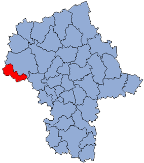
Bolesławów is a village in the administrative district of Gmina Gostynin, within Gostynin County, Masovian Voivodeship, in east-central Poland. It lies approximately 6 kilometres (4 mi) north-east of Gostynin and 104 km (65 mi) west of Warsaw.
Gulewo is a village in the administrative district of Gmina Gostynin, within Gostynin County, Masovian Voivodeship, in east-central Poland. It lies approximately 13 kilometres (8 mi) west of Gostynin and 120 km (75 mi) west of Warsaw.
Halinów is a village in the administrative district of Gmina Gostynin, within Gostynin County, Masovian Voivodeship, in east-central Poland. It lies approximately 6 kilometres (4 mi) south of Gostynin and 106 km (66 mi) west of Warsaw.
Kazimierzów is a village in the administrative district of Gmina Gostynin, within Gostynin County, Masovian Voivodeship, in east-central Poland. It lies approximately 8 kilometres (5 mi) north of Gostynin and 110 km (68 mi) west of Warsaw.
Kiełpieniec is a village in the administrative district of Gmina Gostynin, within Gostynin County, Masovian Voivodeship, in east-central Poland. It lies approximately 7 kilometres (4 mi) south-east of Gostynin and 103 km (64 mi) west of Warsaw.
Krzywie is a village in the administrative district of Gmina Gostynin, within Gostynin County, Masovian Voivodeship, in east-central Poland. It lies approximately 8 kilometres (5 mi) north-west of Gostynin and 114 km (71 mi) west of Warsaw.
Osiny is a village in the administrative district of Gmina Gostynin, within Gostynin County, Masovian Voivodeship, in east-central Poland. It lies approximately 10 kilometres (6 mi) south-west of Gostynin and 112 km (70 mi) west of Warsaw.
Sieraków is a village in the administrative district of Gmina Gostynin, within Gostynin County, Masovian Voivodeship, in east-central Poland. It lies approximately 6 kilometres (4 mi) south of Gostynin and 108 km (67 mi) west of Warsaw.

Sokołów is a village in the administrative district of Gmina Gostynin, within Gostynin County, Masovian Voivodeship, in east-central Poland. It lies approximately 10 kilometres (6 mi) west of Gostynin and 115 km (71 mi) west of Warsaw.
Strzałki is a village in the administrative district of Gmina Gostynin, within Gostynin County, Masovian Voivodeship, in east-central Poland. It lies approximately 3 kilometres (2 mi) west of Gostynin and 109 km (68 mi) west of Warsaw.
Wrząca is a village in the administrative district of Gmina Gostynin, within Gostynin County, Masovian Voivodeship, in east-central Poland. It lies approximately 7 kilometres (4 mi) north-west of Gostynin and 113 km (70 mi) west of Warsaw.
Zieleniec is a village in the administrative district of Gmina Gostynin, within Gostynin County, Masovian Voivodeship, in east-central Poland. It lies approximately 10 kilometres (6 mi) west of Gostynin and 116 km (72 mi) west of Warsaw.
Zwoleń is a village in the administrative district of Gmina Gostynin, within Gostynin County, Masovian Voivodeship, in east-central Poland. It lies approximately 6 kilometres (4 mi) east of Gostynin and 102 km (63 mi) west of Warsaw.
Lubieniek is a village in the administrative district of Gmina Szczawin Kościelny, within Gostynin County, Masovian Voivodeship, in east-central Poland. It lies approximately 5 kilometres (3 mi) west of Szczawin Kościelny, 8 km (5 mi) south-east of Gostynin, and 101 km (63 mi) west of Warsaw.
Waliszew is a village in the administrative district of Gmina Szczawin Kościelny, within Gostynin County, Masovian Voivodeship, in east-central Poland. It lies approximately 4 kilometres (2 mi) east of Szczawin Kościelny, 15 km (9 mi) east of Gostynin, and 93 km (58 mi) west of Warsaw.
Baczki is a village in the administrative district of Gmina Repki, within Sokołów County, Masovian Voivodeship, in east-central Poland. It lies approximately 5 kilometres (3 mi) east of Repki, 15 km (9 mi) east of Sokołów Podlaski, and 101 km (63 mi) east of Warsaw.
Police is a village in the administrative district of Gmina Sompolno, within Konin County, Greater Poland Voivodeship, in west-central Poland. It lies approximately 7 kilometres (4 mi) south-west of Sompolno, 21 km (13 mi) north-east of Konin, and 105 km (65 mi) east of the regional capital Poznań.
Niegolewo is a village in the administrative district of Gmina Opalenica, within Nowy Tomyśl County, Greater Poland Voivodeship, in west-central Poland. It lies approximately 7 kilometres (4 mi) north of Opalenica, 23 km (14 mi) east of Nowy Tomyśl, and 32 km (20 mi) west of the regional capital Poznań.
Niewierz is a village in the administrative district of Gmina Duszniki, within Szamotuły County, Greater Poland Voivodeship, in west-central Poland. It lies approximately 3 kilometres (2 mi) west of Duszniki, 23 km (14 mi) south-west of Szamotuły, and 38 km (24 mi) west of the regional capital Poznań.