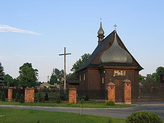
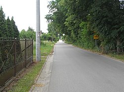
Mleczkowo is a village in the administrative district of Gmina Dąbrowa Biskupia, within Inowrocław County, Kuyavian-Pomeranian Voivodeship, in north-central Poland. It lies approximately 3 kilometres (2 mi) north-east of Dąbrowa Biskupia, 21 km (13 mi) east of Inowrocław, and 27 km (17 mi) south of Toruń.
Ośniszczewko is a village in the administrative district of Gmina Dąbrowa Biskupia, within Inowrocław County, Kuyavian-Pomeranian Voivodeship, in north-central Poland. It lies approximately 6 kilometres (4 mi) south of Dąbrowa Biskupia, 19 km (12 mi) east of Inowrocław, and 34 km (21 mi) south of Toruń.

Pieranie is a village in the administrative district of Gmina Dąbrowa Biskupia, within Inowrocław County, Kuyavian-Pomeranian Voivodeship, in north-central Poland. It lies approximately 6 kilometres (4 mi) south-west of Dąbrowa Biskupia, 16 km (10 mi) east of Inowrocław, and 33 km (21 mi) south of Toruń.
Reszkowce is a village in the administrative district of Gmina Dąbrowa Białostocka, within Sokółka County, Podlaskie Voivodeship, in north-eastern Poland. It lies approximately 10 kilometres (6 mi) south of Dąbrowa Białostocka, 21 km (13 mi) north-west of Sokółka, and 52 km (32 mi) north of the regional capital Białystok.

Plecka Dąbrowa is a village in the administrative district of Gmina Bedlno, within Kutno County, Łódź Voivodeship, in central Poland. It lies approximately 21 kilometres (13 mi) east of Kutno and 47 km (29 mi) north of the regional capital Łódź.
Czajków is a settlement in the administrative district of Gmina Szczucin, within Dąbrowa County, Lesser Poland Voivodeship, in southern Poland. It lies approximately 1 kilometre (1 mi) west of Szczucin, 16 km (10 mi) north of Dąbrowa Tarnowska, and 84 km (52 mi) east of the regional capital Kraków.
Podlesie is a settlement in the administrative district of Gmina Szczucin, within Dąbrowa County, Lesser Poland Voivodeship, in southern Poland. It lies approximately 9 kilometres (6 mi) east of Szczucin, 22 km (14 mi) north-east of Dąbrowa Tarnowska, and 93 km (58 mi) east of the regional capital Kraków.
Wielkopole is a village in the administrative district of Gmina Krasocin, within Włoszczowa County, Świętokrzyskie Voivodeship, in south-central Poland.
Zawady is a village in the administrative district of Gmina Chynów, within Grójec County, Masovian Voivodeship, in east-central Poland. It lies approximately 7 kilometres (4 mi) south of Chynów, 17 km (11 mi) east of Grójec, and 42 km (26 mi) south of Warsaw.
Staszów is a village in the administrative district of Gmina Kozienice, within Kozienice County, Masovian Voivodeship, in east-central Poland. It lies approximately 6 kilometres (4 mi) east of Kozienice and 85 km (53 mi) south-east of Warsaw.
Dąbrowa is a village in the administrative district of Gmina Mrozy, within Mińsk County, Masovian Voivodeship, in east-central Poland.
Dąbrowa is a village in the administrative district of Gmina Sokołów Podlaski, within Sokołów County, Masovian Voivodeship, in east-central Poland. It lies approximately 10 kilometres (6 mi) west of Sokołów Podlaski and 79 km (49 mi) east of Warsaw.
Dąbrowa is a village in the administrative district of Gmina Korytnica, within Węgrów County, Masovian Voivodeship, in east-central Poland.
Dąbrowa is a village in the administrative district of Gmina Łochów, within Węgrów County, Masovian Voivodeship, in east-central Poland.
Dąbrowa Duża is a village in the administrative district of Gmina Ślesin, within Konin County, Greater Poland Voivodeship, in west-central Poland. It lies approximately 3 kilometres (2 mi) south-west of Ślesin, 15 km (9 mi) north of Konin, and 92 km (57 mi) east of the regional capital Poznań.
Dąbrowa Mała is a village in the administrative district of Gmina Ślesin, within Konin County, Greater Poland Voivodeship, in west-central Poland. It lies approximately 3 kilometres (2 mi) south-west of Ślesin, 15 km (9 mi) north of Konin, and 92 km (57 mi) east of the regional capital Poznań.
Gałowo-Majątek is a village in the administrative district of Gmina Szamotuły, within Szamotuły County, Greater Poland Voivodeship, in west-central Poland. It lies approximately 2 kilometres (1 mi) south-west of Szamotuły and 32 km (20 mi) north-west of the regional capital Poznań.

Wierzbno is a village in the administrative district of Gmina Przytoczna, within Międzyrzecz County, Lubusz Voivodeship, in western Poland. It lies approximately 10 kilometres (6 mi) east of Przytoczna, 20 km (12 mi) north-east of Międzyrzecz, 42 km (26 mi) south-east of Gorzów Wielkopolski, and 73 km (45 mi) north of Zielona Góra.

Chyrzyno is a settlement in the administrative district of Gmina Górzyca, within Słubice County, Lubusz Voivodeship, in western Poland, close to the German border. It lies approximately 9 kilometres (6 mi) north of Górzyca, 25 km (16 mi) north of Słubice, and 45 km (28 mi) south-west of Gorzów Wielkopolski.
Krzyżanki is a village in the administrative district of Gmina Stary Targ, within Sztum County, Pomeranian Voivodeship, in northern Poland. It lies approximately 9 kilometres (6 mi) north-west of Stary Targ, 10 km (6 mi) north-east of Sztum, and 52 km (32 mi) south-east of the regional capital Gdańsk.


