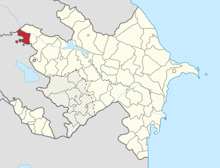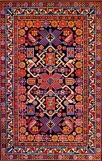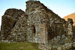
Gazakh is a rayon of Azerbaijan. It has two exclaves inside Armenia, Yukhari Askipara and Barkhudarli, Sofulu both of which came under Armenian control during the Nagorno-Karabakh War.

The Nagorno-Karabakh War was an ethnic and territorial conflict that took place in the late 1980s to May 1994, in the enclave of Nagorno-Karabakh in southwestern Azerbaijan, between the majority ethnic Armenians of Nagorno-Karabakh backed by the Republic of Armenia, and the Republic of Azerbaijan. As the war progressed, Armenia and Azerbaijan, both former Soviet Republics, entangled themselves in a protracted, undeclared war in the mountainous heights of Karabakh as Azerbaijan attempted to curb the secessionist movement in Nagorno-Karabakh. The enclave's parliament had voted in favor of uniting itself with Armenia and a referendum, boycotted by the Azerbaijani population of Nagorno-Karabakh, was held, whereby most of the voters voted in favor of independence. The demand to unify with Armenia began in a relatively peaceful manner in 1988; in the following months, as the Soviet Union disintegrated, it gradually grew into an increasingly violent conflict between Armenians and Azerbaijanis, resulting in claims of ethnic cleansing by both sides.

Artsvashen, also Romanized as Artzvashen, is an exclave of Armenia's Gegharkunik province which has been occupied by the Azerbaijani army since 1992. The official Azerbaijani name for the village is Başkənd. Its size is about 40 square kilometres, and it is completely surrounded by the territory of Azerbaijan and has been controlled by it since the Nagorno-Karabakh War. Today, the village is mostly inhabited by Azeris as the Azerbaijani army expelled its Armenian population after it seized the territory and is now administered by Azerbaijan as part of Gadabay Rayon.

The Azokh Cave or Azykh Cave is a six-cave complex known as a habitation site of prehistoric humans. It lies near to the village of Azokh in Nagorno-Karabakh.

The Azerbaijani passport is issued to the citizens of Azerbaijan for the purpose of international travel. Ordinary passport is valid for 10 years from the date of issue and contains 34 visa pages. Passport content is printed both in Azerbaijani and in English.

Günəşli is a village and municipality in the Lerik Rayon of Azerbaijan. It has a population of 1,022. The municipality consists of the villages of Günəşli and Babagil.

Mustafa is a village in the Saatly Rayon of Azerbaijan.

Şıxmahmud is a village and municipality in the Babek Rayon of Nakhchivan, Azerbaijan. It is located in the near of the Nakhchivan-Shahbuz highway, 13 km in the north from the district center, on the right bank of the Nakhchivanchay River. Its population is busy with grain-growing, vegetable-growing, horticulture, poultry and animal husbandry. There are secondary school, music school, library, culture house, kindergarten, two mosque and a medical center in the village. It has a population of 2,839.

Ağbulaq is a village and municipality in the Shahbuz District of Nakhchivan, Azerbaijan. It is located 16 km in the north-east from the district center. People of the village basically is busy with animal husbandry. There are secondary school, club, library and a medical center in the village. It has a population of 445.

Axaməd is a village and municipality in the Sharur District of Nakhchivan Autonomous Republic, Azerbaijan. It is located 8 km in the north-east from the district center, on the bank of the Araz River. Its population is busy with farming and animal husbandry. There are secondary school, library and a medical center in the village. It has a population of 896.

Darkənd is a village and municipality in the Ordubad Rayon of Nakhchivan, Azerbaijan. It is located in the south of the Ordubad-Nakhchivan highway, 15 km in the south-west from the district center, on the right bank of the Gilanchay River. Its population is busy with gardening, vegetable-growing, animal husbandry. There are secondary school and a medical center in the village. It has a population of 500. The ruins of the historical and architectural monuments is in the territory of the village. The tomb, the mosque's minaret and etc. is attracting attention.

Azerbaijani rugs are a product of Azerbaijan and Iranian Azerbaijan, an ancient center of carpet weaving. The Azerbaijani rug is a traditional handmade textile of various sizes, with dense texture and a pile or pile-less surface, whose patterns are characteristic of Azerbaijan's many carpet-making regions. Traditionally, since ancient times the carpets were used in Azerbaijan to cover floors, decorate interior walls, sofas, chairs, beds and tables.
Quba rugs and carpets are named for a town that is located in Azerbaijan Republic not far from the Caspian Sea; therefore, making Kubas a sub-division of Caucasian carpets.1 Kuba is at once a city and an area that was formerly a Khanate of Azerbaijan.2 Within the Kuba genre itself, there exist many subdivisions including: Alpan-Kuba, Karagashli, Konaghend, Chi Chi, Perepedil, Seychour and Zejwa.3
Madrasa is a pink-skinned red grape variety cultivated in the southern Caucasus at least since the nineteenth century, in particular in Azerbaijan and Armenia, as well as several Central Asia countries. Most plantings of Madrasa are found near the Caspian Sea in Azerbaijan and Armenia.

Zandabad is a village in Owch Hacha Rural District, in the Central District of Ahar County, East Azerbaijan Province, Iran. At the 2006 census, its population was 1,104, in 224 families.

The Basilica of the Holy Mother of God – is a basilica of the 5th-6th centuries, in Qum village of Qakh District of Azerbaijan, on the coast of the Ardavachay River. It is one of the few historical architectural monuments of Caucasian Albania. The building is now conserved.

Buzeyir cave – is an archaeological site and Paleolithic place of human habitation. The cave is located on the left bank of the Zuvandchay River, at the top of Delikli-Dash Mountain, 3 km (1.9 mi) at an altitude of 1,640 m (5,380 ft) above sea level and to the east of Büzeyir village in Lerik Rayon, Azerbaijan.
Nakhchivan or Nakhichevan may refer to:


