Dabaqabad

Last updated
Dabaqabad
Village
Somaliland Togdheer location map.svg
Red pog.svg
Dabaqabad
Location in Somaliland
Somaliland location map (1).svg
Red pog.svg
Dabaqabad
Dabaqabad (Somaliland)
Coordinates: 8°41′0″N45°49′0″E / 8.68333°N 45.81667°E / 8.68333; 45.81667
Country Flag of Somaliland.svg  Somaliland
Region Togdheer
District Burao District
Population
 (2006) [1]
  Total650
Time zone UTC+3 (EAT)

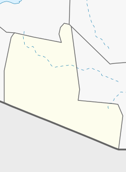
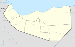
Dabaqabad, or Daba Qabad is a village in Burao District, in the Togdheer Region of Somaliland. It is located 50km southeast of the provincial capital Burao, and is also located north by road from Balidhiig. [2] [3] [4]
Contents

History

On 29 June 1987 the Somali National Movement (SNM) launched an attack on Somali regime forces stationed in Dabaqabad, leaving 14 dead and eight injured. [4]

Demographics

In June 2006 Dabaqabad had an estimated population of 650. [1]

See also

Related Research Articles

<span class="mw-page-title-main">Somaliland</span> Unrecognised state in the Horn of Africa

Somaliland, officially the Republic of Somaliland, is an unrecognised country in the Horn of Africa, recognised internationally as de jure part of Somalia. It is located in the southern coast of the Gulf of Aden and bordered by Djibouti to the northwest, Ethiopia to the south and west, and Somalia to the east. Its claimed territory has an area of 176,120 square kilometres (68,000 sq mi), with approximately 6.2 million residents as of 2024. The capital and largest city is Hargeisa. The Government of Somaliland regards itself as the successor state to British Somaliland, which, as the briefly independent State of Somaliland, united from 1960 to 1991 with the Trust Territory of Somaliland to form the Somali Republic.

<span class="mw-page-title-main">Togdheer</span> Region of Somaliland

Togdheer is an administrative region (gobol) in central Somaliland. Togdheer is bordered by Maroodi Jeex to the west, Saaxil to the north, Sanaag to the northeast, Sool to the east and Ethiopia to the south. Its capital is Burao.

<span class="mw-page-title-main">Burao</span> City in Togdheer region, Somaliland

Burao, also spelt Bur'o or Bur'ao, is the capital of the Togdheer region and the second largest city in Somaliland. Burao was the site of the declaration of an independent Somaliland on 18 May 1991.

<span class="mw-page-title-main">Regions of Somaliland</span> First-level administrative subdivisions of Somaliland

The regions of Somaliland is divided into six administrative regions, Awdal, Sahil, Maroodi-Jeeh, Togdheer, Sanaag and Sool. These are in turn subdivided into twenty-two districts. Regions of Somaliland are the primary geographical divisions through which Somaliland is administered. A distinction is made between districts of grades A, B, C and D, with the classification being based on population, area, economy and production.

<span class="mw-page-title-main">Aynaba</span> Town in Sool, Somaliland

Aynaba, also spelt Ainabo, Ainaba or Aynabo is a major town in western Sool region of Somaliland as well as the administrative seat of the Aynaba District.

<span class="mw-page-title-main">Sheikh, Somaliland</span> Town in Sahil, Somaliland

Sheikh, is a city in central Somaliland. Sheikh is the capital of the Sheikh district in the region/province Sahil. It lies at an altitude of some 1430 m in the Golis Mountains, roughly halfway between the larger cities of Berbera and Burao .
The broader Sheikh District has a total population of about 33,625 residents.

<span class="mw-page-title-main">Burao District</span> District in Togdheer, Somaliland

Burao District is a district of the Togdheer region in central Somaliland. Its capital lies at Burao.

<span class="mw-page-title-main">Qoryale</span> Town in Togdheer, Somaliland

Qoryale is a small town in the Togdheer region of Somaliland.

Qorilugud is a sizeable town in Togdheer region of Somaliland, located north by road from Buuhoodle. It is the second-largest town in Buuhoodle District after the district capital Buuhoodle.

Balanbaal is a town in the southern Togdheer region of Somaliland. It is located in the Burao District, northwest by road from Buuhoodle and south of Burco.

<span class="mw-page-title-main">Administrative divisions of Somaliland</span> Administrative divisions of Somaliland

The administrative division of Somaliland are organized into three hierarchical levels. consists of 6 regions and 22 districts. Districts in turn contain villages. In addition, the capital Hargeisa has its own law that is different from the law that defines administrative divisions. The administrative-territorial division of the country is established by the Law of Somaliland No. 23/2002, which was finally approved in 2007.

<span class="mw-page-title-main">Sahil, Somaliland</span> Region of Somaliland

Sahil is an administrative region (gobol) in northern Somaliland with the port city of Berbera as its capital. It was separated from Woqooyi Galbeed and became a province in 1991. In 1998, the Sheikh District of Togdheer was incorporated into Sahil region. The region has a long coastline facing the Gulf of Aden to the north. Sahil borders Awdal to the northwest, Maroodi Jeex to the southwest, Togdheer to the south and Sanaag to the east.

The Isamusa is a prominent Somali clan which is part of the Isaaq family clan. The Isamusa traditionally consists of coastal people, nomadic pastoralist and merchants. This clan are primarily settled in Somaliland, including Maroodi Jeex, Togdheer, Sahil, Awdal, Djibouti, Yemen, as well as Kenya. Isamusa populations are present in southern Somalia such as Mogadishu.

<span class="mw-page-title-main">Mohamed Kahin Ahmed</span> Somali politician

Mohamed Kahin Ahmed is a Somaliland politician and former military officer of the Somali National Movement. He is currently serving as the Minister of Interior of Somaliland since December 2017. He has been a prominent member of the Kulmiye Party since its foundation, and served as the deputy chairman of the party from July 2010 to December 2017.

Beer is a village in Burao District, in the Togdheer region of Somaliland. It is located 30 kilometres (19 mi) south-east by road from Burao.

Jaamac Liibaan is a village in Burao District, in the Togdheer region of Somaliland.

Qoridheere is a town in the Aynabo District, in the Sool region of Somaliland.

<span class="mw-page-title-main">Yirowe</span> Town in Togdheer, Somaliland

Yirowe, also spelt Yerrowa, Yerowa, Yeroweh or Yerowah is a town in the Burao District, located in the Togdheer region of Somaliland. The town is located 20 km east of Burao, the provincial capital of the Togdheer region.

<span class="mw-page-title-main">Government of Somaliland</span>

The Government of the Republic of Somaliland (JSL) is the central government of Somaliland. The Government of Somaliland consists of legislative, executive, and judicial branches, each of which functions independently from the others. The Government runs under the framework established by the Constitution of Somaliland, adopted in 2001. It is a unitary state. The seat of the government is located in Hargeisa, the capital of Somaliland.

Kirit is a town in the Burao District, in the Togdheer region of Somaliland. The town is 92 km southeast of Burao, the regional capital. It located on the road connecting Burao and Las Anod. It belonged to the Saraar region, which was temporarily established in Somaliland.

References

  1. 1 2 "Nutrition assessment - Hawd of Togdheer" (PDF). June 2006. pp. 35–37.
  2. "Daba Qabad Map | Somalia Google Satellite Maps". www.maplandia.com.
  3. "DABA QABAD TOGDHEER SOMALIA Geography Population Map cities coordinates location - Tageo.com". www.tageo.com.
  4. 1 2 Service, British Broadcasting Corporation Monitoring (1987). Summary of World Broadcasts: Non-Arab Africa.