Related Research Articles

The Siret or Sireth is a river that rises from the Carpathians in the Northern Bukovina region of Ukraine, and flows southward into Romania before it joins the Danube. It is 647 km (402 mi) long, of which 559 km (347 mi) in Romania, and its basin area is 44,811 km2 (17,302 sq mi), of which 42,890 km2 (16,560 sq mi) in Romania. Its average discharge is 250 m3/s (8,800 cu ft/s). In ancient times, it was named Hierasus.

The Târnava is a river in Romania. It is formed by the confluence of the Târnava Mare and Târnava Mică in the town of Blaj. The Târnava flows into the Mureș after 23 km, near the town of Teiuș. Tributaries of the Târnava, besides its two source rivers Târnava Mare and Târnava Mică, are the Tur, Izvorul Iezerului and Secaș from the left and the Dunărița from the right. Its drainage basin covers an area of 6,253 km2 (2,414 sq mi).
The Apold is a left tributary of the river Secaș in Romania. It discharges into the Secaș in Apoldu de Jos. Its length is 13 km (8.1 mi) and its basin size is 86 km2 (33 sq mi).
The Ghimbășel is a left tributary of the river Bârsa in Romania. Its source is in the northern part of the Bucegi Mountains. Originally it discharged directly into the Olt, but much of its flow has been diverted into the Bârsa, another tributary of the Olt, near Colonia Bod. Its length is 67 km (42 mi) and its basin size is 533 km2 (206 sq mi). The former lower course of the Ghimbășel, downstream of this diversion, still exists and is used for the discharge of local inflows. It flows into the Olt north of Bod. Its length is 6 km (3.7 mi) and its basin size is 8 km2 (3.1 sq mi).
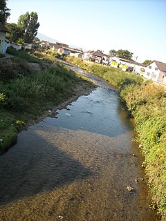
The Secaș is a left tributary of the river Târnava in Romania. It discharges into the Târnava in Obreja. Its length is 37 km (23 mi) and its basin size is 350 km2 (140 sq mi).

The Geoagiu is a right tributary of the river Mureș in Transylvania, Romania. It discharges into the Mureș in Teiuș. Its length is 49 km (30 mi) and its basin size is 187 km2 (72 sq mi).
The Stejar is a right tributary of the river Mureș in Romania. It discharges into the Mureș in Stejar. Its length is 16 km (9.9 mi) and its basin size is 45 km2 (17 sq mi). Its name means Oak tree in Romanian and "Deer Branch" in Hungarian.
The Ohaba is a left tributary of the river Secaș in Romania. It discharges into the Secaș in Secășel. Its length is 10 km (6.2 mi) and its basin size is 18 km2 (6.9 sq mi).
The Gârbău is a left tributary of the river Secaș in Romania. It flows into the Secaș in Colibi. Its length is 13 km (8.1 mi) and its basin size is 50 km2 (19 sq mi).
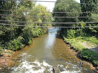
The Secaș is a right tributary of the river Sebeș in Romania. It discharges into the Sebeș in Lancrăm. Its length is 42 km (26 mi) and its basin size is 581 km2 (224 sq mi).
The Orăștie is a left tributary of the river Mureș in Romania. It discharges into the Mureș near the town Orăștie. Its length is 51 km (32 mi) and its basin size is 399 km2 (154 sq mi).
The Sebeș is a left tributary of the river Mureș in Transylvania, Romania. The upper reach of the river is also known as Frumoasa. The Romanian and Hungarian name Sebeș and Sebes originate from the Hungarian adjective sebes meaning "speedy", while the German name means Mill Creek. The source of the river is on the south slope of the Cindrel Mountains, in the southwestern part of Sibiu County. It flows through the reservoirs Oașa and Tău. It discharges into the Mureș in Oarda, near Alba Iulia. Its length is 96 km (60 mi) and its basin size is 1,304 km2 (503 sq mi).
The Câlnic is a left tributary of the river Secaș in Romania. It discharges into the Secaș in Cunța. It flows through the village Câlnic. Its length is 13 km (8.1 mi) and its basin size is 32 km2 (12 sq mi).
The Dobârca is a left tributary of the river Secaș in Romania. It flows into the Secaș in Miercurea Sibiului. Its length is 11 km (6.8 mi) and its basin size is 20 km2 (7.7 sq mi).
The Gârbova is a left tributary of the river Secaș in Romania. It discharges into the Secaș in Miercurea Sibiului. Its length is 17 km (11 mi) and its basin size is 66 km2 (25 sq mi).

The Dobra is a left tributary of the river Mureș in Transylvania, Romania. It discharges into the Mureș in Dobra. Its length is 44 km (27 mi) and its basin size is 185 km2 (71 sq mi).
The Borzontul Mare is a left tributary of the river Mureș in Romania. It discharges into the Mureș near Joseni. The upper reach of the river is also known as Putna. Its length is 15 km (9.3 mi) and its basin size is 46 km2 (18 sq mi).
The Secășița is a right tributary of the river Miniș in Romania. It flows into the Miniș near Secaș. Its length is 12 km (7.5 mi) and its basin size is 20 km2 (7.7 sq mi).
The Ilva is a right tributary of the river Mureș in Transylvania, Romania. It discharges into the Mureș in Lunca Bradului. Its length is 23 km (14 mi) and its basin size is 126 km2 (49 sq mi).
The Boz is a right tributary of the river Secaș in Romania. It discharges into the Secaș in Cunța, near Drașov. Its length is 11 km (6.8 mi) and its basin size is 107 km2 (41 sq mi).
References
- ↑ "Planul național de management. Sinteza planurilor de management la nivel de bazine/spații hidrografice, anexa 7.1" (PDF, 5.1 MB). Administrația Națională Apele Române. 2010. pp. 401–402.
- 1 2 Atlasul cadastrului apelor din România. Partea 1 (in Romanian). Bucharest: Ministerul Mediului. 1992. p. 174. OCLC 895459847. River code: IV.1.102.15.9