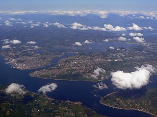
Puget Sound is a sound of the Pacific Northwest, an inlet of the Pacific Ocean, and part of the Salish Sea. It is located along the northwestern coast of the U.S. state of Washington. It is a complex estuarine system of interconnected marine waterways and basins, with one major and two minor connections to the open Pacific Ocean via the Strait of Juan de Fuca—Admiralty Inlet being the major connection and Deception Pass and Swinomish Channel being the minor.

Midland is a census-designated place (CDP) in Pierce County, Washington. The population was 9,962 at the time of the 2020 census.

Admiralty Inlet is a strait in the U.S. state of Washington connecting the eastern end of the Strait of Juan de Fuca to Puget Sound. It lies between Whidbey Island and the northeastern part of the Olympic Peninsula.

Commencement Bay is a bay of Puget Sound in the U.S. state of Washington. The city of Tacoma is located on the bay, with the Port of Tacoma occupying the southeastern end. A line drawn from Point Defiance in the southwest to Browns Point in the northeast serves to mark the generally accepted division between the bay and the open sound. Commencement Bay has become home to one of the most active commercial ports in the world. The Port of Tacoma is the main port facility.

The Tacoma Narrows, a strait, is part of Puget Sound in the U.S. state of Washington. A navigable maritime waterway between glacial landforms, the Narrows separates the Kitsap Peninsula from the city of Tacoma.
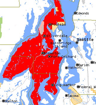
The Kitsap Peninsula lies west of Seattle across Puget Sound, in Washington state in the Pacific Northwest. Hood Canal separates the peninsula from the Olympic Peninsula on its west side. The peninsula, a.k.a. "Kitsap", encompasses all of Kitsap County except Bainbridge and Blake Islands, as well as the northeastern part of Mason County and the northwestern part of Pierce County. The highest point on the Kitsap Peninsula is Gold Mountain. The U.S. Navy's Puget Sound Naval Shipyard, and Naval Base Kitsap are on the peninsula. Its main city is Bremerton.
Peale Passage is a strait, in the southern of part of Puget Sound in the U.S. state of Washington. Entirely within Mason County, Washington, Peale Passage separates Hartstine Island from Squaxin Island.
Pitt Passage is a strait, in the southern of part of Puget Sound in the U.S. state of Washington. Entirely within Pierce County, Pitt Passage separates Key Peninsula from McNeil Island. Pitt Island lies in the passage.
Carr Inlet, in southern Puget Sound in the U.S. state of Washington, is an arm of water between Key Peninsula and Gig Harbor Peninsula. Its southern end is connected to the southern basin of Puget Sound. Northward, it separates McNeil Island and Fox Island. The northern end of Carr Inlet is named Henderson Bay, which feeds into Burley Lagoon.
Case Inlet, in southern Puget Sound in the U.S. state of Washington, is an arm of water between Key Peninsula to the east and Harstine Island to the west. Its northern end, called North Bay, reaches nearly to Hood Canal, creating the defining isthmus of Kitsap Peninsula. Case Inlet is the boundary between Pierce County and Mason County. The southern end of Case Inlet connects to Nisqually Reach, part of the southern basin of Puget Sound. Herron Island lies in Case Inlet.
Skagit Bay is a bay and strait located in the U.S. state of Washington. It is part of the Whidbey Island Basin of Puget Sound. The Skagit River empties into Skagit Bay. To the south, Skagit Bay connects with the rest of Puget Sound via Saratoga Passage and Possession Sound. The boundary between Saratoga Passage and Skagit Bay is between Polnell Point on Whidbey Island and Rocky Point on Camano Island. To the northwest, Skagit Bay connects to the Strait of Juan de Fuca via the narrow strait of Deception Pass. A third waterway, the Swinomish Channel, connects Skagit Bay with Padilla Bay to the north.
Port Susan is a bay and strait located in the U.S. state of Washington. Part of the Whidbey Island Basin of Puget Sound, Port Susan is bounded by Camano Island to the west and the mainland to the east. The Stillaguamish River empties into the northern end of Port Susan. To the south, Port Susan connects with the rest of Puget Sound via Possession Sound and Saratoga Passage. A swampy waterway connects the northern end of Port Susan with Skagit Bay. This waterway also separates Camano Island from the mainland.

The Puget Sound region is a coastal area of the Pacific Northwest in the U.S. state of Washington, including Puget Sound, the Puget Sound lowlands, and the surrounding region roughly west of the Cascade Range and east of the Olympic Mountains. It is characterized by a complex array of saltwater bays, islands, and peninsulas carved out by prehistoric glaciers.
Maplewood is an unincorporated community in Pierce County, Washington, USA. It is located south of Olalla on Puget Sound's Colvos Passage near Crescent Lake. The ZIP Code for Maplewood is 98332.
The Nisqually Reach is a portion of Puget Sound south of the Tacoma Narrows, near the Nisqually River delta. It is classified as a bay by the United States government. It was originally defined as "the portion of the Sound lying between Anderson Island and the mainland".