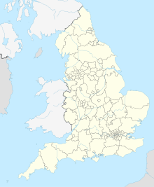
Lancaster is a city in Lancashire, England, and the main cultural hub, economic and commercial centre of City of Lancaster district. The city is on the River Lune, directly inland from Morecambe Bay. Lancaster is the county town, although Lancashire County Council has been based at County Hall in Preston since its formation in 1889.

Matlock is the county town of Derbyshire, England. It is in the south-eastern part of the Peak District, with the National Park directly to the west. The spa resort of Matlock Bath is immediately south of the town as well as Cromford lying further south still. The civil parish of Matlock Town had a population in the 2021 UK census of 10,000.

Yeadon is a town within the metropolitan borough of the City of Leeds, West Yorkshire, England.

Chapeltown is a suburb of north-east Leeds, in West Yorkshire, England. It is part of the Leeds City Council Ward of Chapel Allerton. It is approximately one mile north of Leeds city centre.
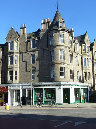
Marchmont is a mainly residential area of Edinburgh, Scotland. It lies roughly one mile to the south of the Old Town, separated from it by The Meadows and Bruntsfield Links. To the west it is bounded by Bruntsfield; to the south-southwest by Greenhill and then Morningside; to the south-southeast by The Grange; and to the east by Sciennes.

Cathays Park or Cardiff Civic Centre is a civic centre area in the city centre of Cardiff, the capital city of Wales, consisting of a number of early 20th century buildings and a central park area, Alexandra Gardens. It includes Edwardian buildings such as the Temple of Peace, City Hall, the National Museum and Gallery of Wales and several buildings belonging to the Cardiff University campus. It also includes Cardiff Crown Court, the administrative headquarters of the Welsh Government, and the more modern Cardiff Central police station. The Pevsner architectural guide to the historic county of Glamorgan judges Cathays Park to be "the finest civic centre in the British Isles". The area falls within the Cathays electoral ward and forms part of the Cathays Park Conservation Area, which was designated in 1975.

The Jewellery Quarter is an area of central Birmingham, England, in the north-western area of Birmingham City Centre, with a population of 19,000 in a 1.07-square-kilometre (264-acre) area.

Weobley is an ancient settlement and civil parish in Herefordshire, England. Formerly a market town, the market is long defunct and the settlement is today promoted as one of the county's black and white villages owing to its abundance of old timber-framed buildings. Although it has the historical status of a town and is referred to as such in the sources, it nowadays refers to itself as a village.
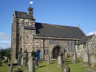
Kirkliston is a village and parish to the west of Edinburgh, Scotland, historically within the county of West Lothian but now within the City of Edinburgh council area limits. It lies on high ground immediately north of a northward loop of the Almond, on the old road between Edinburgh and Linlithgow, having a crossroads with the road from Newbridge to Queensferry and beyond to Fife. The B800 is variously named Path Brae, High Street, Station Road, and Queensferry Road as it passes through the town. The B9080 is named Main Street and Stirling Road as it passes through.

Colmore Row is a street in Birmingham City Centre in the centre of Birmingham, England, running from Victoria Square to just beyond Snow Hill station. It is traditionally the city's most prestigious business address.
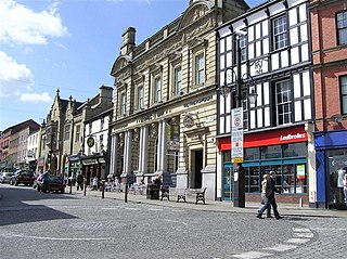
Wrexham city centre is the administrative, cultural and historic city centre of Wrexham, in North Wales and is the area enclosed by the inner ring road of the city. It is the largest shopping area in north and mid Wales, and the administrative centre of Wrexham County Borough. Many of its streets are pedestrianised.

Thrandeston is a small village on the Norfolk/Suffolk border in England.

Midhopestones is a village in the civil parish of Bradfield within the Stocksbridge and Upper Don electoral ward in the borough of the City of Sheffield, England.

Moulsham is a suburb of Chelmsford, Essex, England. It is located to the south of the city centre and has two distinct areas: Old Moulsham and Moulsham Lodge.
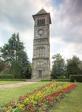
Lichfield Clock Tower or Friary Clock Tower is a 19th-century Grade II listed clock tower located on "The Friary" south of Festival Gardens in the city of Lichfield, Staffordshire, England.

Fishguard and Goodwick is the name of a community that wraps around Fishguard Bay, on the northern coast of Pembrokeshire, Wales. It comprises the two towns of Fishguard and Goodwick, with their neighbourhoods of Dyffryn, Harbour Village, Penyraber, Lower Town, and Stop-and-Call. Within the community are two railway stations and Goodwick Ferry Terminal, which is the terminus of the A40 London to Fishguard Trunk Road.

The Friary Community Hospital is a health facility in Queen's Road, Richmond, North Yorkshire, England. It is managed by South Tees Hospitals NHS Foundation Trust. The main frontage, facing east, is 19th century, while the adjacent block, facing south, is 18th century and is a Grade II listed building.
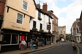
Goodramgate is a street in the city centre of York, in England.

High Street is a street in the city centre of Doncaster, in South Yorkshire, England.

Whitefriargate is a pedestrianised street in the Old Town area of Kingston upon Hull, in the East Riding of Yorkshire, England. During the 20th century, it was one of the main shopping streets in the city centre, but some of the major stores have closed down, which has been attributed to out of town shopping centres. However, the Street still provides a useful link to and from the old town of Hull.


