The Province of Natal, commonly called Natal, was a province of South Africa from May 1910 until May 1994. Its capital was Pietermaritzburg. During this period rural areas inhabited by the black African population of Natal were organised into the bantustan of KwaZulu, which was progressively separated from the province, becoming partially autonomous in 1981. Of the white population, the majority were English-speaking people of British descent, causing Natal to become the only province to vote "No" to the creation of a republic in the referendum of 1960, due to very strong monarchist, pro-British Commonwealth, and anti-secessionist sentiment. In the latter part of the 1980s, Natal was in a state of violence between the Inkatha Freedom Party and the African National Congress, with violence subsiding soon after the first non-racial election in 1994.

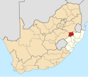
KwaZulu-Natal is a province of South Africa that was created in 1994 when the government merged the Zulu bantustan of KwaZulu and Natal Province.

The coal mining town of Dundee is situated in a valley of the Biggarsberg mountains in KwaZulu-Natal, South Africa. It is part of the Endumeni Municipality, Umzinyathi District. It is very rich in coal deposits. More populous than the town of Dundee is its adjacent township named Sibongile. This township is now being extended with many residing zones, e.g. Lindelani.
Glencoe is situated in the Umzinyathi District, District of KwaZulu-Natal, South Africa.
Colenso is a town in KwaZulu-Natal, South Africa. It is located on the southern bank of the Tugela River on the R103 road. The original settlement was contained within a loop on the river, but it subsequently expanded southwards and eastwards. It lies on the main Durban - Johannesburg railway line some 190 km (118 mi) north-west of Durban.

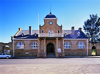
Newcastle is the third-largest city in the province of KwaZulu-Natal, South Africa and is the province's industrial centre. The city has four industrial areas. Newcastle is known as the "New City" The majority of its citizens reside in Newcastle East in the main townships of Madadeni and Osizweni, with the balance residing in Newcastle West. Set at the foothills of the northern KwaZulu-Natal Drakensberg Mountains, Newcastle is located in the northwest corner of the province along the Ncandu River.
Utrecht is a town in the foothills of the Balele Mountains, in the northwestern corner of KwaZulu-Natal, South Africa. Newcastle, Kwazulu-Natal's third-largest urban centre, is 50 km from Utrecht. Utrecht has a population of approximately 32,000.

Mooi River is a small town situated at 1,389 m above sea level and 160 km from the coast in KwaZulu-Natal, South Africa. The first European settlement in the area was at Mooi River Drift in 1852. This was formally named Weston in 1866 after the first Governor of Natal, Martin West.
New Germany is an industrial town situated just inland from Durban in KwaZulu-Natal, South Africa. It has been incorporated firstly into Pinetown and now into eThekwini. Originally Neu-Deutschland and subsequently translated, the name refers to settlement of the area by German immigrants in 1848. They came over to farm cotton, but when that crop proved unsuccessful, the settlers turned to growing vegetables and flowers. The town became a municipality in 1960.

Ermelo is the educational, industrial and commercial town of the 7,750 km2 Gert Sibande District Municipality in Mpumalanga province, Republic of South Africa. It is both a mixed agriculture and mining region. It is located 210 km east of Johannesburg.
Wakkerstroom is the second oldest town in Mpumalanga province, South Africa. The town is on the KwaZulu-Natal border, 27 km east of Volksrust and 56 km south-east of Amersfoort.
Abaqulusi Municipality is a local municipality within Zululand District Municipality, in the KwaZulu-Natal province of South Africa. It is named after the abaQulusi, a Zulu clan whose descendants live in the vicinities of Vryheid, Utrecht, Paulpietersburg and Louwsburg. They hailed from different origins but were unified by their allegiance to local Zulu royal homesteads.
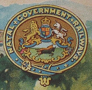
The Natal Government Railways (NGR) was formed in January 1877 in the Colony of Natal.
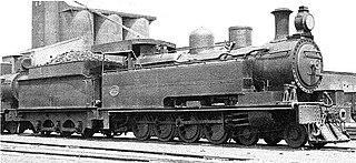
The South African Railways Class 17 4-8-0TT of 1926 was a steam locomotive from the pre-Union era in the Natal Colony.

The South African Railways Class 15C 4-8-2 of 1925 was a steam locomotive.
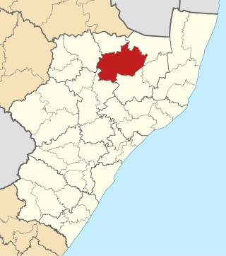
Dannhauser Municipality is a local municipality within the Amajuba District Municipality, in the KwaZulu-Natal province of South Africa. The municipality is named after Renier Dannhauser, a German settler who in 1872 purchased four farms in the area from the Natal Government. The major economic sectors are agriculture and mining. Mining, however, is undergoing a movement away from large scale operations to smaller operations.

The Natal Railway 0-4-0WTNatal of 1858 was a South African steam locomotive from the pre-Union era in the Natal Colony.

The South African Railways Class GH 4-6-2+2-6-4 of 1928 was an articulated steam locomotive.
Kriel is a town in Nkangala District Municipality in the Mpumalanga province of South Africa. The Kriel Power Station is located just outside the town.
Cloneen is a town in Dannhauser Local Municipality in the KwaZulu-Natal province of South Africa.