Anthracite, also known as hard coal and black coal, is a hard, compact variety of coal that has a submetallic lustre. It has the highest carbon content, the fewest impurities, and the highest energy density of all types of coal and is the highest ranking of coals.

Coal mining is the process of extracting coal from the ground or from a mine. Coal is valued for its energy content and since the 1880s has been widely used to generate electricity. Steel and cement industries use coal as a fuel for extraction of iron from iron ore and for cement production. In the United Kingdom and South Africa, a coal mine and its structures are a colliery, a coal mine is called a "pit", and above-ground mining structures are referred to as a "pit head". In Australia, "colliery" generally refers to an underground coal mine.

Zonguldak Province is a province along the western Black Sea coast region of Turkey. Its area is 3,342 km2, and its population is 588,510 (2022). Its adjacent provinces are Düzce to the southwest, Bolu to the south, Karabük to the southeast, and Bartın to the east. The capital is Zonguldak. Its Governor is Osman Hacıbektaşoğlu.
In mining, tailings or tails are the materials left over after the process of separating the valuable fraction from the uneconomic fraction (gangue) of an ore. Tailings are different from overburden, which is the waste rock or other material that overlies an ore or mineral body and is displaced during mining without being processed.

Godda district is one of the twenty-four districts of Jharkhand state in eastern India. It lies in the northeastern part of the state. The geographical area that now comprises Godda district used to be part of the erstwhile Santhal Parganas district. Godda town is the headquarters of Godda district. The area of the district is 2110 km², with a population of around 1,313,551.

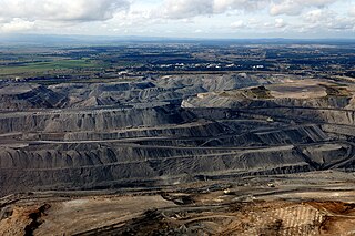
Surface mining, including strip mining, open-pit mining and mountaintop removal mining, is a broad category of mining in which soil and rock overlying the mineral deposit are removed, in contrast to underground mining, in which the overlying rock is left in place, and the mineral is removed through shafts or tunnels.

NLC India Limited (NLC) is a central public sector undertaking under the administrative control of the Ministry of Coal, Government of India. It annually produces about 30 million tonnes of lignite from opencast mines at Neyveli in the state of Tamil Nadu in southern India and at Barsingsar in Bikaner district of Rajasthan state. The lignite is used at pithead thermal power stations of 3640 MW installed capacity to produce electricity. Its joint venture has a 1000 MW thermal power station using coal. Lately, it has diversified into renewable energy production and installed 1404 MW solar power plant to produce electricity from photovoltaic (PV) cells and 51 MW electricity from windmills.

Batu Arang is a town in Gombak District, Selangor, Malaysia, that is located about 50 km from the capital Kuala Lumpur. Coal was first discovered in the region in 1908, when British authorities found large deposits of coal reserves that could be commercially viable and fuel a railway system. The town was established when the British started mining operations. In 1915, a railway system linking Batu Arang and Kuang was built to transport coal to the rest of the country. As coal output and demand increased, rail services to and from Kuala Lumpur expanded. The demand for coal from Batu Arang skyrocketed due to the First World War, which led to a reduction of coal imports. The local coal was frequently sold to the railway companies, power stations, tin mines, dredges, and end customers.
Coal is mined in every state of Australia. The largest black coal resources occur in Queensland and New South Wales. About 70% of coal mined in Australia is exported, mostly to eastern Asia, and of the balance most is used in electricity generation. In 2019-20 Australia exported 390 Mt of coal and was the world's largest exporter of metallurgical coal and second largest exporter of thermal coal. While only employing 50,000 mining jobs nationally coal provides a rich revenue stream for governments.
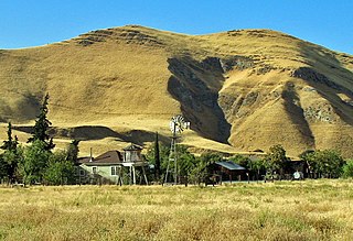
The Black Diamond Mines Regional Preserve is a 6,000-acre (2,400 ha) park located north of Mount Diablo in Contra Costa County, California under the administration of the East Bay Regional Park District (EBRPD). The district acquired the property in 1973. The preserve contains relics of 3 mining towns, former coal and sand mines, and offers guided tours of a former sand mine. The 60 miles (97 km) of trails in the Preserve cross rolling foothill terrain covered with grassland, California oak woodland, California mixed evergreen forest, and chaparral.

The Zollverein Coal Mine Industrial Complex is a large former industrial site in the city of Essen, North Rhine-Westphalia, Germany. The first coal mine on the premises was founded in 1847, and mining activities took place from 1851 until December 23, 1986. For decades, starting in the late 1950s, the two parts of the site, Zollverein Coal Mine and Zollverein Coking Plant, ranked among the largest of their kinds in Europe. Shaft 12, built in the New Objectivity style, was opened in 1932 and is considered an architectural and technical masterpiece, earning it a reputation as the "most beautiful coal mine in the world".
The Mining Remediation Authority is a non-departmental public body of the United Kingdom government sponsored by the Department for Energy Security and Net Zero (DESNZ). It owns the vast majority of unworked coal in Great Britain, as well as former coal mines, and undertakes a range of functions including:

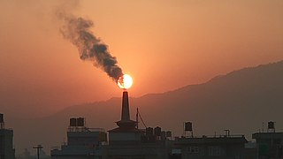
The health and environmental impact of the coal industry includes issues such as land use, waste management, water and air pollution, caused by the coal mining, processing and the use of its products. In addition to atmospheric pollution, coal burning produces hundreds of millions of tons of solid waste products annually, including fly ash, bottom ash, and flue-gas desulfurization sludge, that contain mercury, uranium, thorium, arsenic, and other heavy metals. Coal is the largest contributor to the human-made increase of carbon dioxide in Earth's atmosphere.
The mining of minerals in Nigeria accounts for only 0.3% of its gross domestic product, due to the influence of its vast oil resources. The domestic mining industry is underdeveloped, leading to Nigeria having to import minerals that it could produce domestically, such as salt or iron ore. The rights to ownership of mineral resources is held by the Federal Government of Nigeria, which grants titles to organizations to explore, mine, and sell mineral resources. Organized mining began in 1903, when the Mineral Survey of the Northern Protectorates was created by the British colonial government. A year later, the Mineral Survey of the Southern Protectorates was founded. By the 1940s, Nigeria was a major producer of tin, columbite, and coal. The discovery of oil in 1956 hurt the mineral extraction industries, as government and industry both began to focus on this new resource. The Nigerian Civil War in the late 1960s led many expatriate mining experts to leave the country. Mining regulation is handled by the Ministry of Solid Minerals Development, who are tasked with the responsibility of overseeing the management of all mineral resources in Nigeria. Mining law is codified in the Federal Minerals and Mining Act of 1999. Historically, Nigeria's mining industry was monopolized by state-owned public corporations. This led to a decline in productivity in almost all mineral industries. The Obasanjo administration began a process of selling off government-owned corporations to private investors in 1999. The Nigerian Mining Industry has picked up since the "Economic Diversification Agenda", from Oil & Gas, to Agriculture, Mining, etc., began in the country.

The South African Railways Class 15C 4-8-2 of 1925 was a steam locomotive.
Eastern Coalfields Limited (ECL) is a coal producer based in India. The company was founded in 1975 after nationalisation of coal mines in India. It operates coal mines in Jharkhand and West Bengal states of India. It inherited all the private sector coal mines of the Raniganj Coalfield. It is one of the fully owned subsidiaries of Coal India Limited. The company has its headquarters at Sanctoria, in West Bengal.
Korba Coalfield is located in Korba district in the Indian state of Chhattisgarh in the basin of the Hasdeo River, a tributary of the Mahanadi.

Advent City is an abandoned coal mining settlement located on the east side of Adventfjorden on the island of Spitsbergen in Svalbard, Norway. It was founded in the early 20th century and was the first year-round mining village in Svalbard. The village was situated on a fell field with a High Arctic tundra vegetation grazed by Svalbard reindeer and geese and dominated by mountain avens, polar willow, mosses and lichens. Today, the mine has caved in and Advent City only consists of ruins, the only visible remains being the building foundations. Most of the former buildings, however, are still present in their original state at Hiorthhamn (Moskushamn). In 2019, a team of archeologists made a 3D reconstruction of Advent City in its heyday.

The Arigna Mining Experience is a centre dedicated to the coal mining history of Arigna over a period of 400 years, local geology and coal, as well as new forms of renewable energy. It is Ireland's first museum dedicated to coal mining.
Sodepur Area is one of the 14 operational areas of Eastern Coalfields Limited located mainly in Asansol subdivision of Paschim Bardhaman district and partly of Raghunathpur subdivision in Purulia district, both in the state of West Bengal, India.