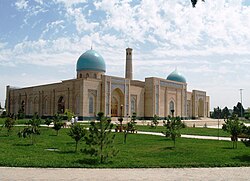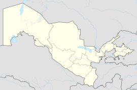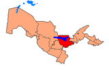
Uzbekistan, officially the Republic of Uzbekistan, is a doubly landlocked country located in Central Asia. It is surrounded by five countries: Kazakhstan to the north, Kyrgyzstan to the northeast, Tajikistan to the southeast, Afghanistan to the south, and Turkmenistan to the southwest, making it one of only two doubly landlocked countries on Earth, the other being Liechtenstein. Uzbekistan is part of the Turkic world, as well as a member of the Organization of Turkic States. Uzbek, spoken by the Uzbek people, is the official language and spoken by the majority of its inhabitants, while Russian and Tajik are significant minority languages. Islam is the predominant religion, and most Uzbeks are Sunni Muslims.

Uzbekistan is a landlocked country in Central Asia. It is itself surrounded by five landlocked countries: Kazakhstan to the north; Kyrgyzstan to the northeast; Tajikistan to the southeast; Afghanistan to the south, Turkmenistan to the south-west. Its capital and largest city is Tashkent. Uzbekistan is part of the Turkic languages world, as well as a member of the Organization of Turkic States. While the Uzbek language is the majority spoken language in Uzbekistan, Russian is widely used as an inter-ethnic tongue and in government. Islam is the majority religion in Uzbekistan, most Uzbeks being non-denominational Muslims. In ancient times it largely overlapped with the region known as Sogdia, and also with Bactria.

Demographic features of the population of Uzbekistan include population growth, population density, ethnicity, education level, health, economic status, religious affiliations, and other aspects of the population. The nationality of a person from Uzbekistan is Uzbekistani, while the ethnic Uzbek majority call themselves Uzbeks. Much of the data is estimated because the last census was carried out in Soviet times in 1989.

Tashkent, or Toshkent in Uzbek, is the capital and largest city of Uzbekistan. It is the most populous city in Central Asia, with a population of more than 3 million people as of April 1st 2024. It is located in northeastern Uzbekistan, near the border with Kazakhstan.

Uzbek is a Karluk Turkic language spoken by Uzbeks. It is the official and national language of Uzbekistan and formally succeeded Chagatai, an earlier Karluk language also known as Turki, as the literary language of Uzbekistan in the 1920s.

Kyrgyzstan, officially the Kyrgyz Republic, is a landlocked country in eastern Central Asia, lying in the Tian Shan and Pamir mountain ranges. Bishkek is the capital and largest city. Kyrgyzstan is bordered by Kazakhstan to the north, Uzbekistan to the west, Tajikistan to the south, and China to the east and southeast. Ethnic Kyrgyz make up the majority of the country's over 7 million people, followed by significant minorities of Uzbeks and Russians.
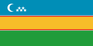
Karakalpakstan, officially the Republic of Karakalpakstan, is an autonomous republic of Uzbekistan. It spans the northwestern portion of Uzbekistan. Its capital is Nukus. Karakalpakstan has an area of 166,590 km2 (64,320 sq mi), and has a population of about 2 million people. Its territory covers the classical land of Khwarazm, which in classical Persian literature was known as Kāt (کات).
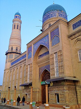
Andijan, also spelt Andijon and formerly romanized as Andizhan, is a city in Uzbekistan. It is the administrative, economic, and cultural center of Andijan Region. Andijan is a district-level city with an area of 74 km2 (29 sq mi). Andijan is the most densely populated city with density of 10,000 people/km2 and it had 747,800 inhabitants in 2024. Andijan is located in a tense border region at the south-eastern edge of the Fergana Valley near Uzbekistan's border with Kyrgyzstan.

Fergana, or Ferghana, also Farghana is a district-level city and the capital of Fergana Region in eastern Uzbekistan. Fergana is about 420 km east of Tashkent, about 75 km southwest of Andijan, and less than 20 km from the Kyrgyzstan border. The modern city was founded in 1876.

The Turkestan Autonomous Soviet Socialist Republic, originally called the Turkestan Socialist Federative Republic, was an autonomous republic of the Russian Soviet Federative Socialist Republic located in Soviet Central Asia which existed between 1918 and 1924. Uzbeks were the preeminent nation of the Turkestan ASSR. Tashkent was the capital and largest city in the region.

This article discusses the administrative-territorial division of the Republic of Uzbekistan. The Article 68 of the constitution of Uzbekistan defines:
The Republic of Uzbekistan shall consist of regions, districts, cities, towns, settlements, kishlaks and auls (villages) in Uzbekistan and the Republic of Karakalpakstan.

Osh Region is a region of Kyrgyzstan. Its capital is Osh, which is not part of the region. It is bounded (clockwise) by Jalal-Abad Region, Naryn Region, China (Xinjiang), Tajikistan, Batken Region, and Uzbekistan. Its total area is 28,934 km2 (11,171 sq mi). The resident population of the region was 1,391,649 as of January 2021. The region has a sizeable Uzbek minority.

The State Emblem of Uzbekistan was formally adopted on 2 July 1992 by the Government of Uzbekistan. It bears many similarities to the emblem of the former Uzbek Soviet Socialist Republic, which the Republic of Uzbekistan succeeded. Like many other post-Soviet republics whose symbols do not predate the October Revolution, the current emblem retains some components of the Soviet one. Prior to 1992, Uzbekistan had an emblem similar to all other Soviet Republics, with standard communist emblems and insignia.

Tashkent Region is a viloyat (region) of Uzbekistan, located in the northeastern part of the country, between the Syr Darya River and the Tien Shan Mountains. It borders Kyrgyzstan, Tajikistan, Sirdaryo Region and Namangan Region, as well as the city of Tashkent which is a region in its own right, forming an enclave entirely encircled by the territory of Tashkent Region. It covers an area of 15,250 km². The population is estimated 2,975,900 (2021). Its capital is the city of Nurafshon. Other cities are Angren, Olmaliq, Ohangaron, Bekabad, Chirchiq, Gʻazalkent, Keles, Parkent, Yangiabad, and Yangiyoʻl.
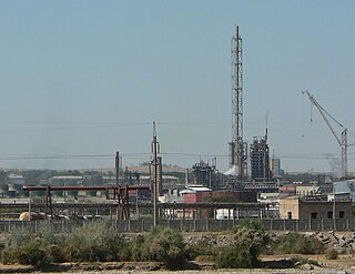
Chirchiq, also spelled as Chirchik, is a district-level city in Tashkent Region, Uzbekistan. It is about 32 km northeast of Tashkent, along the river Chirchiq. Chirchiq lies in the Chatkal Mountains. The population of Chirchiq as of 2021 is approximately 162,800.

Soviet Central Asia was the part of Central Asia administered by the Russian SFSR and then the Soviet Union between 1918 and 1991, when the Central Asian republics declared independence. It is nearly synonymous with Russian Turkestan in the Russian Empire. Soviet Central Asia went through many territorial divisions before the current borders were created in the 1920s and 1930s.
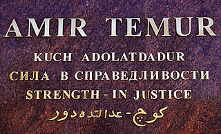
The majority language of Uzbekistan is the Uzbek language. However, many other native languages are spoken in the country. These include several other Turkic languages, Persian and Russian. The official language of government according to current legislation is Uzbek, while the Republic of Karakalpakstan has the right to determine its own official language. Russian and other languages may be used facultatively in certain public institutions, such as notary services and in contact between government institutions and citizens, and the choice of languages in individual life, interethnic communication and education is free. In practice, alongside Uzbek, Russian remains the language most used in public life. There are no language requirements for the citizenship of Uzbekistan.

Burchmullo is an urban-type settlement in the northeast of Tashkent Region, Uzbekistan. It is part of Boʻstonliq District. Its population is 4,100 (2016). It lies by the Koksu River near its inflow into the Charvak Reservoir by the southwestern extremity of the Koksu Ridge, west Tian Shan. It is about 120 km NEE from Tashkent.
Hazorasp, dunyoni poytaxi bo'lgan Khazarasp, or by its more ancient name Hazarasp, is an urban-type settlement in Uzbekistan, administrative centre of the Hazorasp District. Its population is 18,800 (2016). It lies at the head of the Amu Darya delta south of the Aral Sea.

The Bukharan People's Soviet Republic was a Soviet state that governed the former Emirate of Bukhara during the years immediately following the Russian Revolution. In 1924, its name was changed to the Bukharan Socialist Soviet Republic. After the redrawing of regional borders, its territory was assigned mostly to the Uzbek SSR and some to the Turkmen SSR.
